Wauconda Township, Lake County, Illinois
| Wauconda Township | |
|---|---|
| Township | |
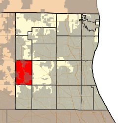 Location in Lake County | |
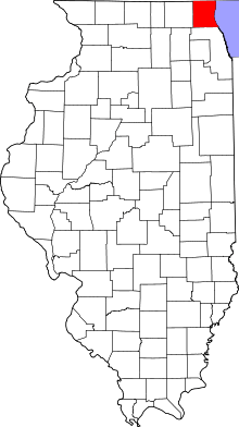 Lake County's location in Illinois | |
| Coordinates: 42°17′02″N 88°09′19″W / 42.28389°N 88.15528°WCoordinates: 42°17′02″N 88°09′19″W / 42.28389°N 88.15528°W | |
| Country | United States |
| State | Illinois |
| County | Lake |
| Established | November 6, 1849 |
| Government | |
| • Supervisor | Glenn L. Swanson |
| Area | |
| • Total | 24.2 sq mi (62.8 km2) |
| • Land | 22.9 sq mi (59.3 km2) |
| • Water | 1.4 sq mi (3.5 km2) |
| Elevation | 797 ft (243 m) |
| Population (2010) | |
| • Estimate (2016)[1] | 22,514 |
| Time zone | UTC-6 (CST) |
| • Summer (DST) | UTC-5 (CDT) |
| FIPS code | 17-097-79280 |
| Website |
www |
Wauconda Township is a township in Lake County, Illinois, USA. As of the 2010 census, its population was 21,730.[2]
Geography
Wauconda Township covers an area of 24.2 square miles (62.8 km2); of this, 1.4 square miles (3.5 km2) or 5.59 percent is water.[2] Lakes in this township include Bangs Lake and Slocum Lake. The stream of Mutton Creek runs through this township.
Cities and towns
- Port Barrington (southwest corner)
- Island Lake (east half)
- Lake Barrington (south edge)
- Lakemoor (north edge)
- Volo (north edge)
- Wauconda (southeast corner)
Adjacent townships
- Grant Township (north)
- Avon Township (northeast)
- Fremont Township (east)
- Ela Township (southeast)
- Cuba Township (south)
- Algonquin Township, McHenry County (southwest)
- Nunda Township, McHenry County (west)
- McHenry Township, McHenry County (northwest)
Cemeteries
The township contains four cemeteries: Fisher Family, Saint Peters, Volo and Wauconda.
Major highways
Airports and landing strips
- Oak Knoll Farm Airport
Demographics
| Historical population | |||
|---|---|---|---|
| Census | Pop. | %± | |
| Est. 2016 | 22,514 | [1] | |
| U.S. Decennial Census[3] | |||
References
- 1 2 "Population and Housing Unit Estimates". Retrieved June 9, 2017.
- 1 2 "Geographic Identifiers: 2010 Demographic Profile Data (G001): Wauconda township, Lake County, Illinois". U.S. Census Bureau, American Factfinder. Retrieved December 19, 2012.
- ↑ "Census of Population and Housing". Census.gov. Retrieved June 4, 2016.
External links
Municipalities and communities of Lake County, Illinois, United States | ||
|---|---|---|
| Cities | ||
| Villages |
| |
| Townships | ||
| CDPs | ||
| Other unincorporated communities | ||
| Former settlement | ||
| Footnotes | ‡This populated place also has portions in an adjacent county or counties | |
This article is issued from
Wikipedia.
The text is licensed under Creative Commons - Attribution - Sharealike.
Additional terms may apply for the media files.