Dorr Township, McHenry County, Illinois
| Dorr Township | |
|---|---|
| Township | |
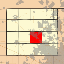 Location in McHenry County | |
| Country | United States |
| State | Illinois |
| County | McHenry |
| Established | November 6, 1849 |
| Area | |
| • Total | 36 sq mi (90 km2) |
| • Land | 35.98 sq mi (93.2 km2) |
| • Water | 0.01 sq mi (0.03 km2) 0.03% |
| Population (2010) | |
| • Estimate (2016)[1] | 21,041 |
| • Density | 581.2/sq mi (224.4/km2) |
| Time zone | UTC-6 (CST) |
| • Summer (DST) | UTC-5 (CDT) |
| FIPS code | 17-111-20396 |
| Website | Dorr Township Official Web Site |
Dorr Township is located in McHenry County, Illinois. As of the 2010 census, its population was 20,911 and it contained 8,520 housing units.[2] Dorr Township changed its name from Centre Township on December 28, 1850.
History
Dorr Township is named after Governor Thomas Wilson Dorr of Rhode Island.[3] Governor Dorr helped to modernize voting in America by removing arcane age limitations and fighting for universal white male suffrage. Dorr was arrested and tried for treason before the Rhode Island Supreme Court. In 1844 he was committed to prison with a life sentence of solitary confinement and hard labor. He was released after 12 months but his health never fully recovered.
Geography
According to the 2010 census, the township has a total area of 36 square miles (93 km2), of which 35.98 square miles (93.2 km2) (or 99.94%) is land and 0.01 square miles (0.026 km2) (or 0.03%) is water.[2]
Dorr Township is one of seventeen townships in McHenry County. It covers portions of Woodstock, Crystal Lake, Lakewood and Bull Valley. Dorr Township covers 34 1/2 miles of road.
Demographics
| Historical population | |||
|---|---|---|---|
| Census | Pop. | %± | |
| Est. 2016 | 21,041 | [1] | |
| U.S. Decennial Census[4] | |||
References
- 1 2 "Population and Housing Unit Estimates". Retrieved June 9, 2017.
- 1 2 "Population, Housing Units, Area, and Density: 2010 - County -- County Subdivision and Place -- 2010 Census Summary File 1". United States Census. Retrieved 2013-05-28.
- ↑ Callary, Edward (29 September 2008). Place Names of Illinois. University of Illinois Press. p. 96. ISBN 978-0-252-09070-7.
- ↑ "Census of Population and Housing". Census.gov. Retrieved June 4, 2016.
External links
Municipalities and communities of McHenry County, Illinois, United States | ||
|---|---|---|
| Cities | ||
| Villages | ||
| Townships | ||
| CDPs | ||
| Other unincorporated communities | ||
| Footnotes | ‡This populated place also has portions in an adjacent county or counties | |

Coordinates: 42°17′07″N 88°25′00″W / 42.28528°N 88.41667°W