Castelnau-d'Arbieu
| Castelnau-d'Arbieu | |
|---|---|
| Commune | |
 Castelnau-d'Arbieu Location within Occitanie region  Castelnau-d'Arbieu | |
| Coordinates: 43°53′01″N 0°42′20″E / 43.8836°N 0.7056°ECoordinates: 43°53′01″N 0°42′20″E / 43.8836°N 0.7056°E | |
| Country | France |
| Region | Occitanie |
| Department | Gers |
| Arrondissement | Condom |
| Canton | Fleurance-Lomagne |
| Intercommunality | Lomagne Gersoise |
| Government | |
| • Mayor (2008–2014) | Chantal Laportiere |
| Area1 | 16.34 km2 (6.31 sq mi) |
| Population (2008)2 | 201 |
| • Density | 12/km2 (32/sq mi) |
| Time zone | UTC+1 (CET) |
| • Summer (DST) | UTC+2 (CEST) |
| INSEE/Postal code | 32078 /32500 |
| Elevation |
79–231 m (259–758 ft) (avg. 209 m or 686 ft) |
|
1 French Land Register data, which excludes lakes, ponds, glaciers > 1 km2 (0.386 sq mi or 247 acres) and river estuaries. 2 Population without double counting: residents of multiple communes (e.g., students and military personnel) only counted once. | |
Castelnau-d'Arbieu is a commune in the Gers department in southwestern France.
Geography
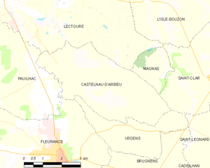
Castelnau-d'Arbieu and its surrounding communes
Population
| Historical population | ||
|---|---|---|
| Year | Pop. | ±% |
| 1962 | 287 | — |
| 1968 | 270 | −5.9% |
| 1975 | 220 | −18.5% |
| 1982 | 204 | −7.3% |
| 1990 | 188 | −7.8% |
| 1999 | 187 | −0.5% |
| 2008 | 201 | +7.5% |
See also
References
| Wikimedia Commons has media related to Castelnau-d'Arbieu. |
This article is issued from
Wikipedia.
The text is licensed under Creative Commons - Attribution - Sharealike.
Additional terms may apply for the media files.