Ellis County, Kansas
| Ellis County, Kansas | |
|---|---|
| County | |
 Ellis County Courthouse in Hays | |
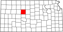 Location in the U.S. state of Kansas | |
 Kansas's location in the U.S. | |
| Coordinates: 38°55′N 99°19′W / 38.917°N 99.317°W | |
| Founded | 1867 |
| Named for | George Ellis |
| Seat | Hays |
| Largest city | Hays |
| Area | |
| • Total | 900 sq mi (2,331 km2) |
| • Land | 899 sq mi (2,328 km2) |
| • Water | 0.5 sq mi (1 km2), 0.05% |
| Population (est.) | |
| • (2016) | 28,893 |
| • Density | 32/sq mi (12/km2) |
| Area code(s) | 785 |
| Congressional district | 1st |
| Time zone | Central: UTC−6/−5 |
| Website | EllisCo.net |
Ellis County (county code EL) is a county located in the U.S. state of Kansas. As of the 2010 census, the county population was 28,452.[1] Its county seat and most populous city is Hays.[2]
Ellis County is the official German Capital of Kansas. German immigrants settled in Hays, Ellis, Victoria, and nearby villages in the 1870s and 1880s.[3]
History
Early history
For many millennia, the Great Plains of North America was inhabited by nomadic Native Americans. From the 16th century to 18th century, the Kingdom of France claimed ownership of large parts of North America. In 1762, after the French and Indian War, France secretly ceded New France to Spain, per the Treaty of Fontainebleau.
19th century
In 1802, Spain returned most of the land to France, but keeping title to about 7,500 square miles. In 1803, most of the land for modern day Kansas was acquired by the United States from France as part of the 828,000 square mile Louisiana Purchase for 2.83 cents per acre.
In 1854, the Kansas Territory was organized, then in 1861 Kansas became the 34th U.S. state. Ellis County was founded on February 26, 1867.[4][5] It is named for George Ellis, first lieutenant of the Twelfth Kansas Infantry.[6]
20th century
In 1942, the Walker Army Airfield was built northwest of Walker. Thousands were stationed at the airfield for training of the Boeing B-29 Superfortress during World War II. The airfield was abandoned and most of it razed.
Geography
According to the U.S. Census Bureau, the county has a total area of 900 square miles (2,300 km2), of which 900 square miles (2,300 km2) is land and 0.5 square miles (1.3 km2) (0.05%) is water.[7]
Adjacent counties
- Rooks County (north)
- Osborne County (northeast)
- Russell County (east)
- Rush County (south)
- Ness County (southwest)
- Trego County (west)
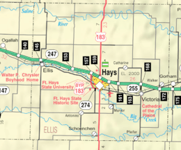
Major highways
Demographics
| Historical population | |||
|---|---|---|---|
| Census | Pop. | %± | |
| 1870 | 1,336 | — | |
| 1880 | 6,179 | 362.5% | |
| 1890 | 7,942 | 28.5% | |
| 1900 | 8,626 | 8.6% | |
| 1910 | 12,170 | 41.1% | |
| 1920 | 14,138 | 16.2% | |
| 1930 | 15,907 | 12.5% | |
| 1940 | 17,508 | 10.1% | |
| 1950 | 19,043 | 8.8% | |
| 1960 | 21,270 | 11.7% | |
| 1970 | 24,730 | 16.3% | |
| 1980 | 26,098 | 5.5% | |
| 1990 | 26,004 | −0.4% | |
| 2000 | 27,507 | 5.8% | |
| 2010 | 28,452 | 3.4% | |
| Est. 2016 | 28,893 | [8] | 1.5% |
| U.S. Decennial Census[9] 1790-1960[10] 1900-1990[11] 1990-2000[12] 2010-2016[1] | |||
The Hays Micropolitan Statistical Area includes all of Ellis County.
As of the 2000,[13] there were 27,507 people, 11,193 households, and 6,771 families residing in the county. The population density was 31 people per square mile (12/km²). There were 12,078 housing units at an average density of 13 per square mile (5/km²). The racial makeup of the county was 96.10% White, 0.67% Black or African American, 0.21% Native American, 0.82% Asian, 0.02% Pacific Islander, 1.31% from other races, and 0.89% from two or more races. Hispanic or Latino of any race were 2.37% of the population.
There were 11,193 households out of which 28.80% had children under the age of 18 living with them, 50.00% were married couples living together, 7.80% had a female householder with no husband present, and 39.50% were non-families. 30.10% of all households were made up of individuals and 10.80% had someone living alone who was 65 years of age or older. The average household size was 2.35 and the average family size was 2.96.
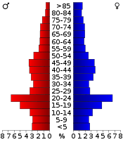
In the county, the population was spread out with 22.40% under the age of 18, 18.40% from 18 to 24, 25.20% from 25 to 44, 19.60% from 45 to 64, and 14.30% who were 65 years of age or older. The median age was 33 years. For every 100 females there were 95.80 males. For every 100 females age 18 and over, there were 92.60 males.
The median income for a household in the county was $32,339, and the median income for a family was $44,498. Males had a median income of $29,885 versus $21,269 for females. The per capita income for the county was $18,259. About 6.50% of families and 12.90% of the population were below the poverty line, including 9.20% of those under age 18 and 10.00% of those age 65 or over.
Government
Presidential elections
| Year | Republican | Democratic | Third Parties |
|---|---|---|---|
| 2016 | 70.9% 8,466 | 23.0% 2,742 | 6.2% 739 |
| 2012 | 71.7% 8,399 | 26.1% 3,057 | 2.2% 258 |
| 2008 | 65.9% 8,207 | 32.2% 4,010 | 1.9% 230 |
| 2004 | 64.8% 7,891 | 33.1% 4,033 | 2.2% 263 |
| 2000 | 58.4% 6,516 | 35.2% 3,926 | 6.4% 718 |
| 1996 | 57.0% 6,809 | 34.7% 4,142 | 8.4% 1,001 |
| 1992 | 32.0% 3,985 | 36.5% 4,544 | 31.5% 3,924 |
| 1988 | 48.7% 5,194 | 49.6% 5,289 | 1.8% 189 |
| 1984 | 67.7% 7,509 | 31.2% 3,457 | 1.2% 133 |
| 1980 | 52.5% 5,634 | 36.7% 3,940 | 10.7% 1,150 |
| 1976 | 42.0% 4,719 | 55.9% 6,280 | 2.1% 241 |
| 1972 | 55.7% 5,463 | 41.9% 4,113 | 2.4% 237 |
| 1968 | 46.7% 3,944 | 45.1% 3,809 | 8.2% 688 |
| 1964 | 30.4% 2,440 | 69.2% 5,553 | 0.3% 27 |
| 1960 | 35.2% 3,156 | 64.8% 5,815 | 0.1% 6 |
| 1956 | 59.3% 4,466 | 40.6% 3,058 | 0.1% 4 |
| 1952 | 65.9% 4,882 | 34.1% 2,528 | 0.0% 3 |
| 1948 | 40.5% 2,676 | 58.5% 3,863 | 1.0% 67 |
| 1944 | 60.1% 3,369 | 39.6% 2,218 | 0.3% 16 |
| 1940 | 52.2% 3,622 | 47.5% 3,299 | 0.4% 25 |
| 1936 | 25.1% 1,622 | 74.7% 4,834 | 0.2% 13 |
| 1932 | 24.5% 1,465 | 74.5% 4,449 | 0.9% 56 |
| 1928 | 33.5% 1,700 | 66.3% 3,364 | 0.2% 11 |
| 1924 | 46.4% 1,763 | 22.2% 842 | 31.5% 1,197 |
| 1920 | 75.2% 2,385 | 23.3% 740 | 1.5% 48 |
| 1916 | 32.9% 1,186 | 64.7% 2,335 | 2.4% 87 |
| 1912 | 8.2% 175 | 64.9% 1,381 | 26.9% 573 |
| 1908 | 34.5% 768 | 63.8% 1,421 | 1.7% 37 |
| 1904 | 51.1% 1,009 | 47.0% 928 | 2.0% 39 |
| 1900 | 33.6% 627 | 65.7% 1,228 | 0.8% 14 |
| 1896 | 30.0% 460 | 68.6% 1,051 | 1.4% 22 |
| 1892 | 33.5% 546 | 66.5% 1,083 | |
| 1888 | 44.4% 690 | 48.7% 756 | 6.9% 107 |
Ellis County is an anomaly in western Kansas, having voted several times for Democratic presidential candidates, even when the vast majority of the state’s 105 counties went for the Republican nominee. This is due to the county’s distinctive (in Kansas) German Catholic heritage, contrasting with the Southern “Bible Belt” or Yankee heritage of most rural Kansas counties. It was the solitary county in Kansas to support Catholic Al Smith over Herbert Hoover in 1928, when Kansas was Hoover’s strongest state nationwide, and also was won by John F. Kennedy in 1960 by almost thirty percent as one of only two Kansas counties to back the Massachusetts Senator. Ellis County bucked the national and statewide trend by voting for Michael Dukakis over winner George H.W. Bush in the 1988 presidential election, one of only three Kansas counties to go for Dukakis. Ellis County gave a plurality to Bill Clinton over Bush and Ross Perot in the 1992 presidential election, but has been solidly in the Republican column since, giving 66 percent to Republican John McCain to 32 percent for Democrat Barack Obama in the 2008 election, higher than the 57 percent McCain won statewide.[15]
Laws
Wild Bill Hickock under contract served as Sheriff in 1870. Ellis County was a prohibition, or "dry", county until the Kansas Constitution was amended in 1986 and voters approved the sale of alcoholic liquor by the individual drink with a 30% food sales requirement. The food sales requirement was removed with voter approval in 1988.[16]
Education
Unified school districts
- Ellis USD 388
- western third of county; small portion in extreme eastern Trego County
- Victoria USD 432
- eastern third of county to Russell county line
- Hays USD 489
Private schools
Universities and Colleges
Communities
Cities
Census-designated places
Other unincorporated places
Defunct settlements
Townships
Ellis County is divided into nine townships. The cities of Ellis and Hays are considered governmentally independent and are excluded from the census figures for the townships. In the following table, the population center is the largest city (or cities) included in that township's population total, if it is of a significant size.
| Township | FIPS | Population center |
Population | Population density /km² (/sq mi) |
Land area km² (sq mi) | Water area km² (sq mi) | Water % | Geographic coordinates |
|---|---|---|---|---|---|---|---|---|
| Big Creek | 06650 | 1,798 | 7 (18) | 252 (97) | 0 (0) | 0.01% | 38°52′40″N 99°20′39″W / 38.87778°N 99.34417°W | |
| Buckeye | 08950 | 285 | 1 (2) | 352 (136) | 0 (0) | 0.06% | 39°1′24″N 99°18′25″W / 39.02333°N 99.30694°W | |
| Catherine | 11050 | 318 | 2 (4) | 208 (80) | 0 (0) | 0.03% | 39°0′32″N 99°11′44″W / 39.00889°N 99.19556°W | |
| Ellis | 20475 | 386 | 1 (2) | 457 (176) | 0 (0) | 0.02% | 38°58′47″N 99°30′57″W / 38.97972°N 99.51583°W | |
| Freedom | 24625 | 125 | 1 (3) | 117 (45) | 0 (0) | 0% | 38°43′48″N 99°7′36″W / 38.73000°N 99.12667°W | |
| Herzog | 31525 | 894 | 3 (7) | 325 (126) | 1 (0) | 0.18% | 38°55′29″N 99°7′19″W / 38.92472°N 99.12194°W | |
| Lookout | 42700 | 569 | 2 (5) | 317 (122) | 0 (0) | 0.10% | 38°45′43″N 99°25′12″W / 38.76194°N 99.42000°W | |
| Victoria | 73800 | 845 | 6 (16) | 139 (54) | 0 (0) | 0% | 38°49′56″N 99°8′31″W / 38.83222°N 99.14194°W | |
| Wheatland | 77650 | 401 | 3 (7) | 140 (54) | 0 (0) | 0% | 38°46′45″N 99°16′19″W / 38.77917°N 99.27194°W | |
| Sources: "Census 2000 U.S. Gazetteer Files". U.S. Census Bureau, Geography Division. Archived from the original on 2002-08-02. | ||||||||
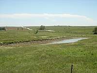
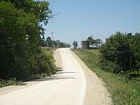
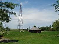
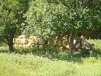
Gallery


See also
- National Register of Historic Places listings in Ellis County, Kansas
- Walker Army Airfield, an abandoned World War II airfield.
|
|
References
- 1 2 "State & County QuickFacts". United States Census Bureau. Archived from the original on July 9, 2011. Retrieved July 24, 2014.
- ↑ "Find a County". National Association of Counties. Archived from the original on 2011-05-31. Retrieved 2011-06-07.
- ↑ "Tidbits: Did You Know...". Publishing Group of America (americanprofiles.com). p. 13.
|access-date=requires|url=(help) - ↑ Blackmar, Frank Wilson (1912). Kansas: A Cyclopedia of State History, Embracing Events, Institutions, Industries, Counties, Cities, Towns, Prominent Persons, Etc. Standard Publishing Company. p. 578.
- ↑ "Ellis County, Kansas". Kansas Historical Society. Retrieved 20 March 2014.
- ↑ Gannett, Henry (1905). The Origin of Certain Place Names in the United States. Govt. Print. Off. p. 117.
- ↑ "US Gazetteer files: 2010, 2000, and 1990". United States Census Bureau. 2011-02-12. Retrieved 2011-04-23.
- ↑ "Population and Housing Unit Estimates". Retrieved June 9, 2017.
- ↑ "U.S. Decennial Census". United States Census Bureau. Archived from the original on May 12, 2015. Retrieved July 24, 2014.
- ↑ "Historical Census Browser". University of Virginia Library. Retrieved July 24, 2014.
- ↑ "Population of Counties by Decennial Census: 1900 to 1990". United States Census Bureau. Retrieved July 24, 2014.
- ↑ "Census 2000 PHC-T-4. Ranking Tables for Counties: 1990 and 2000" (PDF). United States Census Bureau. Retrieved July 24, 2014.
- ↑ "American FactFinder". United States Census Bureau. Archived from the original on 2013-09-11. Retrieved 2008-01-31.
- ↑ http://uselectionatlas.org/RESULTS
- ↑ 2008 Presidential General Election Results - Kansas
- ↑ "Map of Wet and Dry Counties". Alcoholic Beverage Control, Kansas Department of Revenue. November 2006. Archived from the original on 2007-10-08. Retrieved 2007-12-28.
Further reading
- Standard Atlas of Ellis County, Kansas; Geo. A. Ogle & Co; 71 pages; 1922.
- Standard Atlas of Ellis County, Kansas; Geo. A. Ogle & Co; 58 pages; 1905.
External links
| Wikimedia Commons has media related to Ellis County, Kansas. |
- County
- Maps
- Ellis County Maps: Current, Historic, KDOT
- Kansas Highway Maps: Current, Historic, KDOT
- Kansas Railroad Maps: Current, 1996, 1915, KDOT and Kansas Historical Society
Places adjacent to Ellis County, Kansas | ||||||||||
|---|---|---|---|---|---|---|---|---|---|---|
| ||||||||||
Municipalities and communities of Ellis County, Kansas, United States | ||
|---|---|---|
| Cities | | |
| CDPs | ||
| Unincorporated communities | ||
| Ghost towns | ||
| Townships | ||
