Independence, Kansas
| Independence, Kansas | |
|---|---|
| City and County seat | |
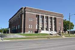 Memorial Hall (2017) | |
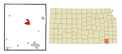 Location within Montgomery County and Kansas | |
 KDOT map of Montgomery County (legend) | |
| Coordinates: 37°13′27″N 95°42′30″W / 37.22417°N 95.70833°WCoordinates: 37°13′27″N 95°42′30″W / 37.22417°N 95.70833°W[1] | |
| Country | United States |
| State | Kansas |
| County | Montgomery |
| Founded | 1869 (Colfax) |
| Government | |
| • Mayor | Leonhard Caflisch |
| Area[2] | |
| • Total | 7.75 sq mi (20.07 km2) |
| • Land | 7.74 sq mi (20.05 km2) |
| • Water | 0.01 sq mi (0.03 km2) |
| Elevation[1] | 804 ft (245 m) |
| Population (2010)[3] | |
| • Total | 9,483 |
| • Estimate (2016)[4] | 8,799 |
| • Density | 1,200/sq mi (470/km2) |
| Time zone | UTC-6 (CST) |
| • Summer (DST) | UTC-5 (CDT) |
| ZIP code | 67301 |
| Area code | 620 |
| FIPS code | 20-33875 [1] |
| GNIS ID | 0469414 [1] |
| Website | City Website |
Independence is a city in and the county seat of Montgomery County, Kansas, United States.[5] As of the 2010 census, the city population was 9,483.[6] It was named in commemoration of the Declaration of Independence.[7]
History
Independence was settled on land that was purchased from the Osage Indians in September 1869 by George A. Brown for the price of $50; they were being moved to Indian Territory in present-day Oklahoma. He originally called the townsite Colfax after Schuyler Colfax, Vice-president under President Ulysses S. Grant.[8] On August 21, 1869 a group of Oswego, Kansas men led by R.W. Wright settled there with the intent to make Independence the county seat.[9] E.E. Wilson and F.D. Irwin opened the first store in October 1869, Wilson & Irwin Groceries.[10] Independence was designated county seat in 1870.[11]
A permanent lighting system was first used for an exhibition baseball game on April 17, 1930 between the Independence Producers and House of David semi-professional baseball team of Benton Harbor, Michigan, with the Independence team winning with a score of 9 to 1 before a crowd of 1,700 spectators.[12]
Miss Able, a rhesus monkey, was born at Ralph Mitchell Zoo. Miss Able along with Miss Baker, a squirrel monkey, became the first monkeys to fly in space; they returned alive on May 28, 1959.[13]
Geography
Independence is located along the Verdigris River just south of its confluence with the Elk River. According to the United States Census Bureau, the city has a total area of 7.75 square miles (20.07 km2), of which, 7.74 square miles (20.05 km2) is land and 0.01 square miles (0.03 km2) is water.[2]
Climate
Independence has a humid subtropical climate (Köppen Cfa) characterized by hot, humid and unpleasant summers, and chilly though extremely variable winters. Precipitation is heavy in summer due to frequent incursions of very moist air from the Gulf of Mexico: as much as 7.69 inches (195.3 mm) fell on May 27, 1984 and a maximum daily fall of 3.49 inches or 88.6 millimetres can be expected in an average calendar year. The wettest month has been June 2007 when 19.53 inches (496.1 mm) was reported, whereas July 1935 saw a mere 0.03 inches (0.8 mm). The winters are drier and cold, although temperatures in winter are very erratic, ranging from an average of four afternoons in the three winter months above 70 °F or 21.1 °C to an average of three mornings below 0 °F or −17.8 °C. Winters are much drier than the summer, with November 1986 and October 1952 seeing not even a trace of precipitation.[14]
Overall the wettest calendar year has been 1908 with 60.29 inches (1,531.4 mm) – although the incomplete year of 2007 likely had more than this – and the driest 1952 with only 18.27 inches (464.1 mm).[14] The hottest month has been July 1936 with an average of 88 °F (31.1 °C) and a mean maximum of 104.8 °F or 40.4 °C, whilst the coldest has been July 1979 with an average of 18.8 °F (−7.3 °C), a mean maximum of only 28.9 °F (−1.7 °C) and a mean minimum of 8.7 °F or −12.9 °C. The hottest monthly mean minimum was in July 2011 with a mean low as high as 74.3 °F or 23.5 °C.
| Climate data for Independence, Kansas | |||||||||||||
|---|---|---|---|---|---|---|---|---|---|---|---|---|---|
| Month | Jan | Feb | Mar | Apr | May | Jun | Jul | Aug | Sep | Oct | Nov | Dec | Year |
| Record high °F (°C) | 78 (26) |
88 (31) |
98 (37) |
101 (38) |
102 (39) |
109 (43) |
115 (46) |
116 (47) |
111 (44) |
99 (37) |
88 (31) |
78 (26) |
116 (47) |
| Average high °F (°C) | 45 (7) |
50 (10) |
60 (16) |
70 (21) |
77 (25) |
85 (29) |
91 (33) |
91 (33) |
83 (28) |
72 (22) |
59 (15) |
46 (8) |
69 (21) |
| Average low °F (°C) | 22 (−6) |
26 (−3) |
35 (2) |
45 (7) |
56 (13) |
65 (18) |
69 (21) |
68 (20) |
59 (15) |
47 (8) |
35 (2) |
25 (−4) |
46 (8) |
| Record low °F (°C) | −19 (−28) |
−23 (−31) |
−5 (−21) |
15 (−9) |
28 (−2) |
42 (6) |
46 (8) |
43 (6) |
29 (−2) |
16 (−9) |
5 (−15) |
−16 (−27) |
−23 (−31) |
| Average precipitation inches (mm) | 1.52 (38.6) |
1.94 (49.3) |
3.47 (88.1) |
4.15 (105.4) |
6.51 (165.4) |
6.34 (161) |
3.77 (95.8) |
3.63 (92.2) |
4.47 (113.5) |
4.31 (109.5) |
2.58 (65.5) |
2.44 (62) |
45.13 (1,146.3) |
| Source: weather.com[15] | |||||||||||||
Demographics
| Historical population | |||
|---|---|---|---|
| Census | Pop. | %± | |
| 1870 | 435 | — | |
| 1880 | 2,915 | 570.1% | |
| 1890 | 3,127 | 7.3% | |
| 1900 | 4,851 | 55.1% | |
| 1910 | 10,480 | 116.0% | |
| 1920 | 11,920 | 13.7% | |
| 1930 | 12,782 | 7.2% | |
| 1940 | 11,565 | −9.5% | |
| 1950 | 11,335 | −2.0% | |
| 1960 | 11,222 | −1.0% | |
| 1970 | 10,347 | −7.8% | |
| 1980 | 10,598 | 2.4% | |
| 1990 | 9,942 | −6.2% | |
| 2000 | 9,846 | −1.0% | |
| 2010 | 9,483 | −3.7% | |
| Est. 2016 | 8,799 | [4] | −7.2% |
| U.S. Decennial Census[16] | |||
2010 census
As of the census[3] of 2010, there were 9,483 people, 3,950 households, and 2,430 families residing in the city. The population density was 1,225.2 inhabitants per square mile (473.1/km2). There were 4,528 housing units at an average density of 585.0 per square mile (225.9/km2). The racial makeup of the city was 84.2% White, 6.5% African American, 1.6% Native American, 0.9% Asian, 2.3% from other races, and 4.5% from two or more races. Hispanic or Latino of any race were 6.5% of the population.
There were 3,950 households of which 33.0% had children under the age of 18 living with them, 40.9% were married couples living together, 14.9% had a female householder with no husband present, 5.7% had a male householder with no wife present, and 38.5% were non-families. 33.0% of all households were made up of individuals and 14.8% had someone living alone who was 65 years of age or older. The average household size was 2.35 and the average family size was 2.95.
The median age in the city was 36.9 years. 26% of residents were under the age of 18; 8.6% were between the ages of 18 and 24; 24.5% were from 25 to 44; 24.9% were from 45 to 64; and 15.9% were 65 years of age or older. The gender makeup of the city was 48.4% male and 51.6% female.
2000 census
As of the census[17] of 2000, there were 9,846 people, 4,149 households, and 2,609 families residing in the city. The population density was 1,979.4 people per square mile (764.9/km2). There were 4,747 housing units at an average density of 954.3 per square mile (368.8/km2). The racial makeup of the city was 87.00% White, 7.17% African American, 1.16% Native American, 0.62% Asian, 0.01% Pacific Islander, 1.10% from other races, and 2.95% from two or more races. Hispanic or Latino of any race were 3.84% of the population.
There were 4,149 households out of which 30.2% had children under the age of 18 living with them, 46.8% were married couples living together, 12.3% had a female householder with no husband present, and 37.1% were non-families. 32.7% of all households were made up of individuals, and 15.2% had someone living alone who was 65 years of age or older. The average household size was 2.32, and the average family size was 2.93.
In the city, the population was spread out, with 25.7% under the age of 18, 8.9% from 18 to 24, 26.1% from 25 to 44, 21.3% from 45 to 64, and 18.0% who were 65 years of age or older. The median age was 37 years. For every 100 females, there were 89.9 males. For every 100 females age 18 and over, there were 84.9 males.
The median income for a household in the city was $29,574, and the median income for a family was $37,134. Males had a median income of $26,552 versus $20,017 for females. The per capita income for the city was $15,496. About 11.4% of families and 13.1% of the population were below the poverty line, including 18.7% of those under age 18 and 13.2% of those age 65 or over.
Education
Primary and secondary education
- Independence High School, grades 9-12
- Independence Middle School, grades 6-8
- Jefferson Elementary School, grades 3-5
- Eisenhower Elementary School, grades Pre-K-2
- Zion Lutheran School, grades Pre-K-8
- St. Andrews School, grades Pre-K-8
- Independence Bible School, grades Pre-K-12
- Tri-County Education Co-operative, special education, all grades
Community college
The Independence Community College main campus is located two miles south of the city. ICC West Campus is located in the city one mile west of the downtown. Each semester, over 1000 students are enrolled at ICC and about 100 people work there, making the college population an important contributor to the local economy as well as a significant portion of the people traveling about town.
Transportation
Independence is located at the intersection of US-75 and US-160. Rail freight service is provided by the Union Pacific Railroad and South Kansas and Oklahoma Railroad. The Independence Municipal Airport (IDP) is located 5 miles (8.0 km) southwest of the center of the city.
Area events
- The Neewollah Festival takes place in late October. Neewollah is halloween spelled backwards.
Area attractions
- Independence Community College is home to the William Inge Center for the Arts,[18] which maintains the archives of playwright and alumnus, William Inge. The center utilizes the writer's boyhood home for a playwrights-in-residence program, and sponsors the annual William Inge Festival. Each year during the festival a lifetime achievement award is bestowed on a nationally recognized American playwright.
- The State of Kansas designated the childhood home of Laura Ingalls Wilder and the Ingalls family near Independence as a historic site; it is open to visitors. It is the location where the Charles Ingalls family resided between 1869-1871 and is described in his daughter Laura Ingalls Wilder's book Little House on the Prairie.[19] It includes a cabin modeled after the original and the post office that was originally located at nearby Wayside, Kansas. The Sunnyside School, a one-room schoolhouse that was moved to the site, is also featured. Much of the surrounding countryside retains its open and undeveloped nature. Then located on the Osage reservation, the property is now within the boundaries of the William Kurtis Ranch about 13 miles southwest of downtown Independence.[20]
- At the 1964 New York World's Fair, Sinclair Oil sponsored a dinosaur exhibit, featuring life-size replicas of nine different dinosaurs. On flatbed trucks, they toured the United States. Sinclair was acquired by Atlantic Richfield (ARCO). After the acquisition by ARCO, one of the nine dinosaurs, the Corythosaurus, was donated to Riverside Park.
- Elk City Lake and Elk City State Park are located approximately five miles west of Independence. There are six hiking trails located at Elk City Lake, two of which are notable for receiving a National Trails designation. It is also in this area that the ruins of the Le Hunt cement plant are located, although the remains are on private property.
Notable people
- Taylor Armstrong, born as Shana Hughes, former reality show celebrity on The Real Housewives of Beverly Hills
- Tacy Atkinson, Christian missionary
- Sheila C. Bair, former chairwoman, Federal Deposit Insurance Corporation
- Gerry Bamman, actor
- Benny Bartlett, actor
- Donald Graham Burt, Academy Award winning production designer[21]
- Jim Halsey, artist manager, agent, and impresario
- Sherman Halsey, music video producer and director, talent agent
- Scott Hastings, NBA basketball player
- William Wadsworth Hodkinson, founded Paramount Pictures and ventured into commercial aviation
- Lyman U. Humphrey, newspaper editor, banker, 7th Governor of Kansas
- William Inge, Pulitzer Prize-winning playwright, Academy Award-winning screenwriter
- Bill Kurtis, television journalist
- Alf Landon, 1936 Republican presidential candidate, 26th Governor of Kansas
- Mary Howard de Liagre, actress
- Dave McGinnis, NFL coach
- John Morris, composer
- Gareth Porter, historian, author and international journalist
- Derek Schmidt, former congressional aide, Kansas Senate Majority Leader and since 2011, Attorney General of Kansas
- Jean Schodorf, former Kansas Senate Majority Leader and Congressional candidate.
- Harry F. Sinclair, founder of Sinclair Oil
- Charlie Tidwell, sprinter/hurdler active between 1958–60
- Vivian Vance, actress
- Ron Warner, NFL football player
References
- 1 2 3 4 Geographic Names Information System (GNIS) details for Independence, Kansas; United States Geological Survey (USGS); October 13, 1978.
- 1 2 "US Gazetteer files 2010". United States Census Bureau. Archived from the original on January 24, 2012. Retrieved 2012-07-06.
- 1 2 "American FactFinder". United States Census Bureau. Retrieved 2012-07-06.
- 1 2 "Population and Housing Unit Estimates". Retrieved June 9, 2017.
- ↑ "Find a County". National Association of Counties. Archived from the original on May 31, 2011. Retrieved 2011-06-07.
- ↑ "2010 City Population and Housing Occupancy Status". U.S. Census Bureau. Archived from the original on July 21, 2011. Retrieved March 6, 2011.
- ↑ Gannett, Henry (1905). The Origin of Certain Place Names in the United States. Govt. Print. Off. p. 165.
- ↑ Rydjord, John (1972). Kansas Place-Names. University of Oklahoma Press, Norman, Oklahoma. p. 349. ISBN 0-8061-0994-7.
- ↑ Sherwood, Leon (1970). Official Centennial History of Independence, KS, p. 6. Independence Centennial Inc.
- ↑ Sherwood, Leon (1970). Official Centennial History of Independence, KS, p. 7. Independence Centennial Inc.
- ↑ Blackmar, Frank Wilson (1912). Kansas: A Cyclopedia of State History, Embracing Events, Institutions, Industries, Counties, Cities, Towns, Prominent Persons, Etc. Standard Publishing Company. p. 899.
- ↑ Bowman, Larry G. "I Think It Is Pretty Ritzy Myself: Kansas Minor League Teams and Night Baseball". Kansas History, Winter 1995/1996, pp 248–257. Kansas Historical Society. Missing or empty
|url=(help) - ↑
- 1 2 National Weather Service, Wichita, Kansas; NOW Data
- ↑ "Monthly Averages for Independence, Kansas". Weather.com. The Weather Channel. Retrieved August 15, 2013.
- ↑ United States Census Bureau. "Census of Population and Housing". Archived from the original on May 12, 2015. Retrieved November 29, 2014.
- ↑ "American FactFinder". United States Census Bureau. Archived from the original on September 11, 2013. Retrieved 2008-01-31.
- ↑ William Inge Center for the Arts
- ↑ "Archived copy". Archived from the original on 2013-07-02. Retrieved 2013-02-05.
- ↑ "Little House on the Prairie Website"
- ↑ Independence Daily Reporter, February 23, 2009, p. 1
Further reading
- A Guide to Historic Homes in Independence, Kansas; Ken D. Brown; Independence Tribune; 1993.
External links
| Wikimedia Commons has media related to Independence, Kansas. |
Municipalities and communities of Montgomery County, Kansas, United States | ||
|---|---|---|
| Cities | 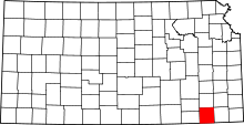 | |
| Unincorporated communities | ||
| Ghost towns | ||