Valley Center, Kansas
| Valley Center, Kansas | |
|---|---|
| City | |
 Location within Sedgwick County and Kansas | |
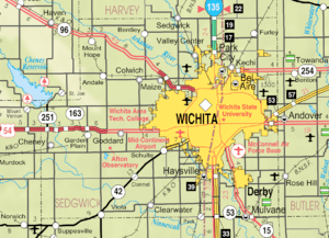 KDOT map of Sedgwick County (legend) | |
| Coordinates: 37°49′47″N 97°22′10″W / 37.82972°N 97.36944°WCoordinates: 37°49′47″N 97°22′10″W / 37.82972°N 97.36944°W | |
| Country | United States |
| State | Kansas |
| County | Sedgwick |
| Incorporated | 1885 |
| Government | |
| • Mayor | Laurie Dove |
| Area[1] | |
| • Total | 6.95 sq mi (18.00 km2) |
| • Land | 6.95 sq mi (18.00 km2) |
| • Water | 0 sq mi (0 km2) |
| Elevation | 1,345 ft (410 m) |
| Population (2010)[2] | |
| • Total | 6,822 |
| • Estimate (2016)[3] | 7,343 |
| • Density | 980/sq mi (380/km2) |
| Time zone | UTC−6 (CST) |
| • Summer (DST) | UTC−5 (CDT) |
| ZIP code | 67147 |
| Area code | 316 |
| FIPS code | 20-73250 |
| GNIS ID | 0473852[4] |
| Website | valleycenterks.org |
Valley Center is a city in Sedgwick County, Kansas, United States, and a suburb of Wichita. As of the 2010 census, the city population was 6,822.[5]
History
Valley Center was incorporated on September 29, 1885,[6] and was named for its location in the valley of the Arkansas River.[7]
On the morning of July 17, 2007, a large explosion occurred at the Barton Solvents chemical plant in Valley Center, destroying the plant and forcing the temporary evacuation of the city.[8] Cleanup began several weeks later,[9] and the investigation was completed by mid-August.[10]
Geography
Valley Center is located at 37°49′47″N 97°22′10″W / 37.82972°N 97.36944°W (37.829719, -97.369341).[11] According to the United States Census Bureau, the city has a total area of 6.95 square miles (18.00 km2), all of it land.[1]
Valley Center is located two miles west of combined Interstate 135, U.S. Route 81, and K-15.
Demographics
| Historical population | |||
|---|---|---|---|
| Census | Pop. | %± | |
| 1880 | 71 | — | |
| 1890 | 167 | 135.2% | |
| 1900 | 312 | 86.8% | |
| 1910 | 381 | 22.1% | |
| 1920 | 486 | 27.6% | |
| 1930 | 896 | 84.4% | |
| 1940 | 700 | −21.9% | |
| 1950 | 854 | 22.0% | |
| 1960 | 2,570 | 200.9% | |
| 1970 | 2,551 | −0.7% | |
| 1980 | 3,300 | 29.4% | |
| 1990 | 3,624 | 9.8% | |
| 2000 | 4,883 | 34.7% | |
| 2010 | 6,822 | 39.7% | |
| Est. 2016 | 7,343 | [3] | 7.6% |
| U.S. Decennial Census[12] 2012 Estimate[13] | |||
Valley Center is part of the Wichita, KS Metropolitan Statistical Area.
2010 census
As of the census[2] of 2010, there were 6,822 people, 2,484 households, and 1,862 families residing in the city. The population density was 981.6 inhabitants per square mile (379.0/km2). There were 2,601 housing units at an average density of 374.2 per square mile (144.5/km2). The racial makeup of the city was 94.2% White, 0.8% African American, 0.8% Native American, 0.4% Asian, 1.3% from other races, and 2.5% from two or more races. Hispanic or Latino of any race were 4.6% of the population.
There were 2,484 households of which 42.6% had children under the age of 18 living with them, 58.5% were married couples living together, 11.0% had a female householder with no husband present, 5.5% had a male householder with no wife present, and 25.0% were non-families. 22.6% of all households were made up of individuals and 9.3% had someone living alone who was 65 years of age or older. The average household size was 2.75 and the average family size was 3.22.
The median age in the city was 34.3 years. 31.4% of residents were under the age of 18; 7.1% were between the ages of 18 and 24; 26.3% were from 25 to 44; 23.8% were from 45 to 64; and 11.4% were 65 years of age or older. The gender makeup of the city was 49.5% male and 50.5% female.
2000 census
As of the census of 2000, there were 4,883 people, 1,761 households, and 1,368 families residing in the city. The population density was 1,464.2 people per square mile (566.2/km²). There were 1,826 housing units at an average density of 547.5 per square mile (211.7/km²). The racial makeup of the city was 96.78% White, 0.33% African American, 0.55% Native American, 0.37% Asian, 0.70% from other races, and 1.27% from two or more races. Hispanic or Latino of any race were 2.25% of the population.
There were 1,761 households out of which 40.6% had children under the age of 18 living with them, 64.2% were married couples living together, 9.9% had a female householder with no husband present, and 22.3% were non-families. 19.9% of all households were made up of individuals and 9.6% had someone living alone who was 65 years of age or older. The average household size was 2.72 and the average family size was 3.13.
In the city, the population was spread out with 29.4% under the age of 18, 7.7% from 18 to 24, 28.9% from 25 to 44, 21.8% from 45 to 64, and 12.3% who were 65 years of age or older. The median age was 35 years. For every 100 females, there were 95.0 males. For every 100 females age 18 and over, there were 92.8 males.
The median income for a household in the city was $50,683, and the median income for a family was $56,667. Males had a median income of $42,917 versus $26,639 for females. The per capita income for the city was $20,259. About 1.0% of families and 2.3% of the population were below the poverty line, including 1.3% of those under age 18 and 1.9% of those age 65 or over.
Education
Valley Center USD 262 employs approximately 370 people and serves more than 2,760 children from the communities of Valley Center, Park City, Kechi, and Wichita. The schools include one Pre-K - 4 building, two K-4 schools, an intermediate school that houses the fifth and sixth grades, a seventh and eighth grade middle school, and a high school. There is also an alternative school, The Learning Center, which assists students of all ages earning their high school diploma. The Valley Center school district mascot is the Hornets.
Events
- Fall Festival - Annual event in September.
Notable people
Notable individuals who were born in and/or have lived in Valley Center include:
- Patrick Miller (1980- ), U.S. Army Staff Sergeant, prisoner of war[14]
See also
References
- 1 2 "US Gazetteer files 2010". United States Census Bureau. Archived from the original on 2012-01-24. Retrieved 2012-07-06.
- 1 2 "American FactFinder". United States Census Bureau. Retrieved 2012-07-06.
- 1 2 "Population and Housing Unit Estimates". Retrieved June 9, 2017.
- ↑ "US Board on Geographic Names". United States Geological Survey. 2007-10-25. Retrieved 2008-01-31.
- ↑ "2010 City Population and Housing Occupancy Status". U.S. Census Bureau. Retrieved March 6, 2011.
- ↑ Valley Center City Website
- ↑ Bentley, Orsemus Hills (1910). History of Wichita and Sedgwick County, Kansas: Past and Present. Windmill Publications. p. 643.
- ↑ Finger, Stan. Valley Center's Barton Solvents begins removing destroyed tanks, The Wichita Eagle, 2007-08-23. Accessed 2007-08-25.
- ↑ Explosion probe shifts away from Valley Center; cleanup begins, MSNBC, 2007-08-23. Accessed 2007-08-25.
- ↑ Barton Solvents investigation complete, Wichita Business Journal, 2007-08-23. Accessed 2007-08-25.
- ↑ "US Gazetteer files: 2010, 2000, and 1990". United States Census Bureau. 2011-02-12. Retrieved 2011-04-23.
- ↑ United States Census Bureau. "Census of Population and Housing". Retrieved February 15, 2014.
- ↑ "Annual Estimates of the Resident Population: April 1, 2010 to July 1, 2012". Archived from the original on October 19, 2013. Retrieved February 15, 2014.
- ↑ Hegeman, Roxana (2003-05-11). "Valley Center welcomes home Private Miller". The Topeka Capital-Journal. Retrieved 2016-04-05.
Further reading
- Sedgwick County
- History of Wichita and Sedgwick County Kansas : Past and present, including an account of the cities, towns, and villages of the county; 2 Volumes; O.H. Bentley; C.F. Cooper & Co; 454 / 479 pages; 1910. (Volume1 - Download 20MB PDF eBook),(Volume2 - Download 31MB PDF eBook)
- Standard Atlas of Sedgwick County, Kansas; Geo. A. Ogle & Co; 78 pages; 1905.
- Historical Atlas of Sedgwick County, Kansas; John P. Edwards; 50 pages; 1882.
- Kansas
- Kansas : A Cyclopedia of State History, Embracing Events, Institutions, Industries, Counties, Cities, Towns, Prominent Persons, Etc; 3 Volumes; Frank W. Blackmar; Standard Publishing Co; 944 / 955 / 824 pages; 1912. (Volume1 - 54MB PDF), (Volume2 - 53MB PDF), (Volume3 - 33MB PDF)
- History of the State of Kansas; William G. Cutler; A.T. Andreas Publisher; 1883/1976.
External links
| Wikimedia Commons has media related to Valley Center, Kansas. |
- City
- Schools
- USD 262, local school district
- USD 262 School District Boundary Map, KDOT
- Historical
- Maps
- Valley Center City Map, KDOT
Municipalities and communities of Sedgwick County, Kansas, United States | ||
|---|---|---|
| Cities | 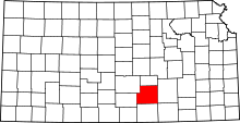 | |
| CDPs | ||
| Unincorporated communities | ||
| Townships | ||
| Footnotes | ‡This populated place also has portions in an adjacent county or counties | |