Prairie Village, Kansas
| Prairie Village, Kansas | |
|---|---|
| City | |
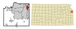 Location within Johnson County and Kansas | |
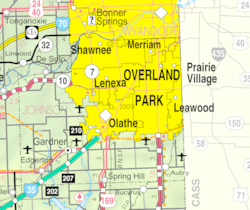 KDOT map of Johnson County (legend) | |
| Coordinates: 38°59′23″N 94°38′10″W / 38.98972°N 94.63611°WCoordinates: 38°59′23″N 94°38′10″W / 38.98972°N 94.63611°W | |
| Country | United States |
| State | Kansas |
| County | Johnson |
| Area[1] | |
| • Total | 6.21 sq mi (16.08 km2) |
| • Land | 6.20 sq mi (16.06 km2) |
| • Water | 0.01 sq mi (0.03 km2) |
| Elevation | 988 ft (301 m) |
| Population (2010)[2] | |
| • Total | 21,447 |
| • Estimate (2016)[3] | 21,805 |
| • Density | 3,500/sq mi (1,300/km2) |
| Time zone | UTC−6 (CST) |
| • Summer (DST) | UTC−5 (CDT) |
| Area code | 913 |
| FIPS code | 20-57575 [4] |
| GNIS ID | 0479232 [5] |
| Website | PVkansas.com |
Prairie Village is a primarily residential town in Johnson County, Kansas, United States, and part of the Kansas City Metropolitan Area. As of the 2010 census, the city population was 21,447.[6]
History
After the successful development of the Country Club Plaza in Kansas City, Missouri, J. C. Nichols turned toward development of his native Johnson County, just a few miles from the Plaza. Prairie Village was platted in 1941 and was named after Prairie School, which was established for almost a century before. In 1949, Prairie Village was named the best planned community in America by the National Association of Home Builders. It was officially recognized as a city in 1951.
Remnants of the Santa Fe Trail are found in the city.
Shawnee, Osage, and Kansa Indians formerly owned the land now developed into the City of Prairie Village. As settlers and pioneers headed west, one family decided to make Prairie Village their home. In 1858, Thomas Porter bought 160 acres of farmland. Porter’s children were all raised on this farmland and were engaged in agricultural development and civic affairs.
It wasn’t just the Porter family who helped to make Prairie Village home. Porter’s sister, Betty Porter, married Thompson A. Lewis who owned 80 acres between Mission and Roe. Henry Coppock arrived in Johnson County, in 1857, before heading further west to work in freighting and farming. He came back in the mid-1860s and bought land in 1865. Coppock built his family home on 900 acres in Prairie Village. Coppocks’s home stood for 30 years. Now on his land is Homestead County Club.
The original Prairie School was built in 1882 and a new building was constructed in 1912. This landmark was a community treasure until 1990.
In the 1940s, J.C. Nichols, an experienced developer, wanted to turn the farmland into suburban housing for soldiers returning home from the war. Nichols bought the farmland from the Porters, Coppocks, and Lewises. There were hurdles along the way including a lack of experienced builders post World War II, but this didn’t stop Nichols from pursuing his goal.
Prairie Village continued to expand as the Prairie Village Shopping Center opened in 1947 and the Corinth Square Shopping Center opened in 1955.
Geography
Climate
| Climate data for Prairie Village, Kansas | |||||||||||||
|---|---|---|---|---|---|---|---|---|---|---|---|---|---|
| Month | Jan | Feb | Mar | Apr | May | Jun | Jul | Aug | Sep | Oct | Nov | Dec | Year |
| Record high °F (°C) | 74 (23) |
81 (27) |
85 (29) |
91 (33) |
95 (35) |
105 (41) |
114 (46) |
107 (42) |
106 (41) |
98 (37) |
84 (29) |
76 (24) |
114 (46) |
| Average high °F (°C) | 39 (4) |
44 (7) |
55 (13) |
65 (18) |
74 (23) |
83 (28) |
88 (31) |
87 (31) |
79 (26) |
68 (20) |
54 (12) |
41 (5) |
65 (18) |
| Daily mean °F (°C) | 30 (−1) |
34 (1) |
44 (7) |
55 (13) |
65 (18) |
74 (23) |
79 (26) |
77 (25) |
69 (21) |
58 (14) |
44 (7) |
32 (0) |
55 (13) |
| Average low °F (°C) | 20 (−7) |
24 (−4) |
33 (1) |
44 (7) |
55 (13) |
64 (18) |
69 (21) |
67 (19) |
58 (14) |
47 (8) |
34 (1) |
23 (−5) |
45 (7) |
| Record low °F (°C) | −18 (−28) |
−12 (−24) |
−8 (−22) |
13 (−11) |
30 (−1) |
43 (6) |
48 (9) |
46 (8) |
30 (−1) |
18 (−8) |
1 (−17) |
−22 (−30) |
−22 (−30) |
| Source: [7] | |||||||||||||
Demographics
| Historical population | |||
|---|---|---|---|
| Census | Pop. | %± | |
| 1960 | 25,356 | — | |
| 1970 | 28,378 | 11.9% | |
| 1980 | 24,657 | −13.1% | |
| 1990 | 23,186 | −6.0% | |
| 2000 | 22,072 | −4.8% | |
| 2010 | 21,447 | −2.8% | |
| Est. 2016 | 21,805 | [3] | 1.7% |
| U.S. Decennial Census | |||
2010 census
As of the census[2] of 2010, there were 21,447 people, 9,771 households, and 5,816 families residing in the city. The population density was 3,459.2 inhabitants per square mile (1,335.6/km2). There were 10,227 housing units at an average density of 1,649.5 per square mile (636.9/km2). The racial makeup of the city was 95.3% White, 1.0% African American, 0.2% Native American, 1.4% Asian, 0.5% from other races, and 1.6% from two or more races. Hispanic or Latino of any race were 3.4% of the population.
There were 9,771 households. 26.3% had children under the age of 18, 48.8% were married couples living together, 8.1% had a female householder with no husband present, 2.6% had a male householder with no wife present, and 40.5% were non-families. 34.1% of all households were made up of individuals and 12.9% had someone living alone aged 65 years or older. The average household size was 2.18 and the average family size was 2.82.
The median age in the city was 41.4 years. 21% of residents were under the age of 18; 5% were between the ages of 18 and 24; 28.4% were from 25 to 44; 27.7% were from 45 to 64; and 17.9% were 65 years of age or older. The gender makeup of the city was 46.5% male and 53.5% female.
2000 census
As of the census[4] of 2000, there were 22,072 people, 9,833 households, and 6,165 families residing in the city. The population density was 3,547.1 people per square mile (1,370.1/km²). There were 10,126 housing units at an average density of 1,627.3 per square mile (628.6/km²). The racial makeup of the city was 96.15% White, 0.78% African American, 0.16% Native American, 1.13% Asian, 0.03% Pacific Islander, 0.64% from other races, and 1.11% from two or more races. Hispanic or Latino of any race were 2.27% of the population.
There were 9,833 households. 26.6% had children under the age of 18, 52.8% were married couples living together, 7.9% had a female householder with no husband present, and 37.3% were non-families. 32.6% of all households were made up of individuals and 13.8% had someone living alone who was 65 years of age or older. The average household size was 2.23 and the average family size was 2.84.
In the city, the population was spread out with 22.2% under the age of 18, 4.6% from 18 to 24, 29.6% from 25 to 44, 24.0% from 45 to 64, and 19.6% who were 65 years of age or older. The median age was 41 years. For every 100 females, there were 85.0 males. For every 100 females age 18 and over, there were 80.2 males.
As of 2000 the median income for a household in the city was $58,685, and the median income for a family was $70,602 (these figures had risen to $71,646 and $88,185 respectively as of a 2007 estimate[8]). Males had a median income of $50,428 versus $37,321 for females. The per capita income for the city was $34,677. About 1.4% of families and 2.5% of the population were below the poverty line, including 2.6% of those under age 18 and 2.5% of those age 65 or over.
Economy
Largest employers
According to the City's 2015 Comprehensive Annual Financial Report,[9] the largest employers in the city are:
| # | Employer | # of Employees |
|---|---|---|
| 1 | USD #512 | 424 |
| 2 | Hy-Vee | 196 |
| 3 | WireCo WorldGroup Inc | 156 |
| 4 | Claridge Court | 141 |
| 5 | City of Prairie Village | 131 |
| 6 | Brighton Gardens | 110 |
| 7 | Hen House #22 | 102 |
| 8 | Better Homes & Gardens Real Estate | 100 |
| 9 | Macy's | 98 |
| 10 | Bijin Salon & Day Spa | 98 |
Education
Public education in Prairie Village is administered by the Shawnee Mission School District. Middle school students attend Indian Hills Middle School, whose mascot is the Knight. High school students attend Shawnee Mission East High School.
Private schools are: The Pembroke Hill School, Rockhurst High School, Kansas City Christian School, Cure of Ars grade school, St. Ann grade school, Bishop Miege High School, Saint Thomas Aquinas High School.
Libraries
The Johnson County Library serves residents of Prairie Village. The library's Corinth branch is in Prairie Village.
Sister cities

.svg.png)
Notable people
Notable individuals who were born in and/or have lived in Prairie Village include actress and dancer Sandahl Bergman,[10] former Governor of Kansas Robert Bennett,[11] and Hall of Fame professional baseball player George Brett.[12]
Gallery
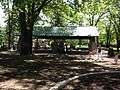 Dining pavilion at Franklin Park in Prairie Village, Kansas.
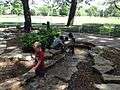 Children playing in the stream at Franklin Park in Prairie Village, Kansas
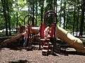 Children playing on playground equipment
References
- ↑ "US Gazetteer files 2010". United States Census Bureau. Archived from the original on 2012-01-24. Retrieved 2012-07-06.
- 1 2 "American FactFinder". United States Census Bureau. Retrieved 2012-07-06.
- 1 2 "Population and Housing Unit Estimates". Retrieved June 9, 2017.
- 1 2 "American FactFinder". United States Census Bureau. Retrieved 2008-01-31.
- ↑ "US Board on Geographic Names". United States Geological Survey. 2007-10-25. Retrieved 2008-01-31.
- ↑ "2010 City Population and Housing Occupancy Status". U.S. Census Bureau. Retrieved March 6, 2011.
- ↑ "Monthly Average/Record Temperatures". Weather Channel. Retrieved 1 September 2015.
- ↑ "American FactFinder Income Data". U.S. Census Bureau. Retrieved March 6, 2011.
- ↑ "City of Prairie Village, Kansas 2015 Comprehensive Annual Financial Report For the Year Ended December 31, 2015" (PDF). Retrieved March 2, 2017.
- ↑ "Sandahl Bergman". IMDb. Retrieved 2016-03-28.
- ↑ "Kansas Governor Robert F. Bennett". National Governors Association. Retrieved 2016-03-28.
- ↑ Burch, Bobby (2014-10-14). "Prairie Village: the new online capital of Kansas". Kansas City Business Journal. Retrieved 2016-03-28.
External links
| Wikimedia Commons has media related to Prairie Village, Kansas. |
- City
- Maps
- Prairie Village City Map, KDOT
Municipalities and communities of Johnson County, Kansas, United States | ||
|---|---|---|
| Cities | 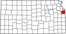 | |
| Unincorporated communities | ||
| Townships | ||
| Footnotes | ‡This populated place also has portions in an adjacent county or counties | |
Kansas City metropolitan area's cities and counties | ||
|---|---|---|
| Central city |  | |
| Largest cities (over 100,000 in 2000) | ||
| Medium-sized cities (10,000 to 100,000 in 2000) | ||
| Smaller Cities (between 5,000 and 9,900 in 2010) | ||
| Counties | ||