El Dorado, Kansas
| El Dorado, Kansas | |
|---|---|
| City and County seat | |
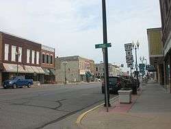 Main & Pine in El Dorado (2012) | |
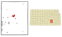 Location within Butler County and Kansas | |
 KDOT map of Butler County (legend) | |
| Coordinates: 37°49′16″N 96°51′30″W / 37.82111°N 96.85833°WCoordinates: 37°49′16″N 96°51′30″W / 37.82111°N 96.85833°W | |
| Country | United States |
| State | Kansas |
| County | Butler |
| Incorporated | 1871 |
| Government | |
| • Mayor | Vince Haines [1] |
| Area[2] | |
| • Total | 8.92 sq mi (23.10 km2) |
| • Land | 8.86 sq mi (22.95 km2) |
| • Water | 0.06 sq mi (0.16 km2) 0.67% |
| Elevation | 1,342 ft (409 m) |
| Population (2010)[3] | |
| • Total | 13,021 |
| • Estimate (2016)[4] | 13,141 |
| • Density | 1,500/sq mi (560/km2) |
| Time zone | UTC-6 (CST) |
| • Summer (DST) | UTC-5 (CDT) |
| ZIP code | 67042 |
| Area code | 316 |
| FIPS code | 20-20075 [5] |
| GNIS feature ID | 0485449 [6] |
| Website | EldoKS.com |
El Dorado (/ˌɛldəˈreɪdoʊ/ ()[7] EL-də-RAY-doh) is city and county seat of Butler County, Kansas, United States. It is situated along the Walnut River in the central part of Butler County and located in south-central Kansas. As of the 2010 census, the city population was 13,021.[8]
History
El Dorado was laid out and platted in 1868. The name is of Spanish origin meaning "golden land".[9] El Dorado was incorporated in 1870.[10]
In 1877, the Florence, El Dorado, and Walnut Valley Railroad Company built a branch line from Florence to El Dorado; in 1881 it was extended to Douglass, and later to Arkansas City.[11] The line was leased and operated by the Atchison, Topeka and Santa Fe Railway. The line from Florence to El Dorado was abandoned in 1942.[12] The original branch line connected Florence, Burns, De Graff, El Dorado, Augusta, Douglass, Rock, Akron, Winfield, and Arkansas City.
In 1915, the El Dorado Oil Field was the first oil field that was found using science/geologic mapping, and part of the Mid-Continent oil province. By 1918, the El Dorado Oil Field was the largest single field producer in the USA, and was responsible for 12.8% of national oil production and 9% of the world production. It was deemed by some as "the oil field that won World War I".[13][14][15]
In 1943, German and Italian prisoners of World War II were brought to Kansas and other Midwest states as a means of solving the labor shortage caused by American men serving in the war effort. Large internment camps were established in Kansas: Camp Concordia, Camp Funston (at Fort Riley), Camp Phillips (at Salina under Fort Riley). Fort Riley established 12 smaller branch camps, including El Dorado.[16] Prisoners commonly volunteered to help work on local farms; this enabled them to spend time outside the camp, socialize and eat better food than that provided by prison guards. In some cases, smaller structures constructed by the work details still stand.
On June 10, 1958, a tornado hit El Dorado and killed 13 people. In 2008, the city built a memorial at Graham Park in remembrance of the dead.[17]
Geography
El Dorado is located at 37°49′16″N 96°51′30″W / 37.82111°N 96.85833°W (37.821117, −96.858281).[18] The city is situated along the western bank of the Walnut River, southwest of El Dorado Lake. It is located 30 miles (48 km) east-northeast of Wichita at the junction of U.S. Routes 54 and 77 and K-254. The Kansas Turnpike, designated as Interstate 35, bypasses northwest of the city.
According to the United States Census Bureau, the city has a total area of 8.92 square miles (23.10 km2), of which 8.86 square miles (22.95 km2) is land and 0.06 square miles (0.16 km2) is water.[2]
Climate
The climate in this area is characterized by hot, humid summers and generally mild to cool winters. According to the Köppen Climate Classification system, El Dorado has a humid subtropical climate, abbreviated "Cfa" on climate maps.[19]
Demographics
| Historical population | |||
|---|---|---|---|
| Census | Pop. | %± | |
| 1880 | 1,411 | — | |
| 1890 | 3,339 | 136.6% | |
| 1900 | 3,466 | 3.8% | |
| 1910 | 3,129 | −9.7% | |
| 1920 | 10,995 | 251.4% | |
| 1930 | 10,311 | −6.2% | |
| 1940 | 10,045 | −2.6% | |
| 1950 | 11,037 | 9.9% | |
| 1960 | 12,523 | 13.5% | |
| 1970 | 12,308 | −1.7% | |
| 1980 | 10,510 | −14.6% | |
| 1990 | 11,504 | 9.5% | |
| 2000 | 12,057 | 4.8% | |
| 2010 | 13,021 | 8.0% | |
| Est. 2016 | 13,141 | [4] | 0.9% |
| U.S. Decennial Census | |||
El Dorado is part of the Wichita Metropolitan Statistical Area.
2010 census
As of the census[3] of 2010, there were 13,021 people, 5,227 households, and 3,277 families residing in the city. The population density was 1,469.6 inhabitants per square mile (567.4/km2). There were 5,797 housing units at an average density of 654.3 per square mile (252.6/km2). The racial makeup of the city was 91.8% White, 2.3% African American, 1.1% Native American, 0.4% Asian, 0.1% Pacific Islander, 1.5% from other races, and 2.9% from two or more races. Hispanic or Latino of any race were 4.7% of the population.
There were 5,227 households of which 31.9% had children under the age of 18 living with them, 44.8% were married couples living together, 12.3% had a female householder with no husband present, 5.6% had a male householder with no wife present, and 37.3% were non-families. 31.0% of all households were made up of individuals and 13% had someone living alone who was 65 years of age or older. The average household size was 2.39 and the average family size was 2.98.
The median age in the city was 34 years. 24.9% of residents were under the age of 18; 14.1% were between the ages of 18 and 24; 23.1% were from 25 to 44; 23.1% were from 45 to 64; and 14.9% were 65 years of age or older. The gender makeup of the city was 48.2% male and 51.8% female.
2000 census
As of the U.S. Census in 2000,[5] there were 12,057 people, 5,068 households, and 3,182 families residing in the city. The population density was 1,894.1 people per square mile (730.8/km²). There were 5,460 housing units at an average density of 857.7 per square mile (330.9/km²). The racial makeup of the city was 94.32% White, 1.37% Black or African American, 1.07% Native American, 0.22% Asian, 0.07% Pacific Islander, 1.06% from other races, and 1.89% from two or more races. Hispanic or Latino of any race were 2.93% of the population.
There were 5,068 households out of which 30.4% had children under the age of 18 living with them, 48.3% were married couples living together, 10.6% had a female householder with no husband present, and 37.2% were non-families. 31.9% of all households were made up of individuals and 14.2% had someone living alone who was 65 years of age or older. The average household size was 2.33 and the average family size was 2.94.
In the city, the population was spread out with 25.2% under the age of 18, 10.4% from 18 to 24, 26.6% from 25 to 44, 20.1% from 45 to 64, and 17.7% who were 65 years of age or older. The median age was 36 years. For every 100 females, there were 91.8 males. For every 100 females age 18 and over, there were 87.0 males.
The median income for a household in the city was $33,098, and the median income for a family was $40,461. Males had a median income of $31,648 versus $21,806 for females. The per capita income for the city was $18,458. About 10.4% of families and 13.5% of the population were below the poverty line, including 17.7% of those under age 18 and 6.1% of those age 65 or over.
Industry
The El Dorado Refinery is currently owned and operated by HollyFrontier,[20] is situated on the southwest edge of El Dorado. It was constructed and originally owned by what would later become Skelly Oil.[21] Later, the refinery changed hands and was rebranded after Skelly was purchased by Getty Oil, and then rebranded again after Texaco attempted to purchase Getty. In 2011 it was rebranded again when Frontier Oil and Holly Corporation merged. El Dorado Refinery is the largest in Kansas. Capacity is 135,000 barrels per day (21,500 m3/d), with production split up into gasoline (55% of production); diesel and jet fuel (34% of production); and asphalt, chemicals and other refined petroleum products (11% percent of production).[22]
Education
El Dorado is home to Butler Community College, as well as one high school, one middle school, and 5 grade schools. Bond issues passed in 2011 approved the construction of a new Middle School and Elementary School.
Sports
Butler Community College fields teams in both men's (mascot: Grizzlies) and women's (mascot: Lady Grizzlies) sports. Butler competes in the NJCAA's Jayhawk Conference, and its teams have won numerous league and national accolades. Butler's football team has won five NJCAA national championships (1981, 1998, 1999, 2003, 2007, and 2008), and also played in the NJCAA championship game in 2004 and 2010.[23] The 1985 squad also finished the season ranked #1 nationally. The program has produced numerous NFL players, most notably Rudi Johnson. Butler's men's basketball program also has a rich tradition, including a national championship in 1953, NJCAA national tournament runners-up in 1992 and 1993, a national tournament third-place finish in 1996, seven Jayhawk Conference championships since 1990, four NJCAA players of the year, ten NJCAA All-Americans, and three NBA draft picks. Notable former Grizzlies currently playing in the NBA include Stephen Jackson, Tony Allen, and Kasib Powell. Butler's men's and women's track and cross-country teams also have won numerous conference, regional, and national accolades.[24]
The El Dorado Broncos are a summer amateur baseball team composed primarily of college players. The team competes within the Jayhawk League as part of the National Baseball Congress, or NBC. The Broncos have won three NBC World Series in 1996, 1998 and 2009.[25] Several former Broncos players currently play in Major League Baseball, including Nate Robertson and Heath Bell .[26]
Culture
In April 2010, the Hot Rod Cafe (formerly the El Dorado theater on Main Street)[27] was filmed for the documentary reality television series American Pickers episode "Easy Riders", which aired July 26, 2010.[28]
The 1969 film The Gypsy Moths was filmed in part in El Dorado. It featured Burt Lancaster, Deborah Kerr, Gene Hackman, William Windom and Bonnie Bedelia.
Parks and Recreation
The City of El Dorado maintains an extensive parks and recreation system, including: 12 neighborhood parks, 12 playgrounds, 5 soccer fields, 4 baseball fields, 4 softball fields, 2 spray parks, 2 pools, 2 tennis courts, 2 outdoor basketball courts, a baseball stadium, an 18-hole golf course, an 18-hole disc golf course, and a 6.3 mile bike path.
In addition, the community boasts a new athletic complex. The venue was completed in 2012 by the Educational Facilities Authority of Butler County, which consists of representatives from the City of El Dorado, Butler Community College and El Dorado Schools (USD 490). The complex provides a venue for football, soccer, track and other community events.
El Dorado State Park is also located just beyond the city limits and provides many recreational activities, such as boating, fishing, hiking, swimming, horse trails and archery.
Media
- Butler County Times-Gazette,[29] local newspaper in El Dorado.
- The Wichita Eagle,[30] major regional newspaper in Wichita.
Radio
El Dorado is served by numerous radio stations of the Wichita-Hutchinson listening market area,[31] and satellite radio. See Media in Wichita, Kansas.
Television
El Dorado is served by over-the-air ATSC digital TV of the Wichita-Hutchinson viewing market area,[32] cable TV, and satellite TV. See Media in Wichita, Kansas.
Notable people
- Granville Pearl Aikman, Kansas state judge
- Tom Borland, major league baseball pitcher
- Beals Becker, major league baseball player
- Steve Brodie, actor
- Bobby Douglass, NFL football player
- Stanley Dunham, maternal grandfather of Barack Obama
- Alfred W. Ellet, Brigadier General in U.S. Civil War
- Maude Fulton, stage actress, Hollywood screenwriter
- Ralph Graham, college football coach and pioneer of racial integration in college sports
- Sarah D. Grant, Arizona Court of Appeals judge
- Alex Graves, television director and producer, best known for his work on the West Wing
- Larry Hartshorn former NFL football player[33]
- Roger Marshall, United States Representative
- Marion Koogler McNay, artist, philanthropist, founder of McNay Art Museum
- Robert L. Rodgers, US Congressman
- Emily Sander, murder victim
- Almon Brown Strowger, inventor
- Mort Walker, cartoonist, creator of Beetle Bailey
- William Allen White, journalist
- Gerald Burton Winrod, activist
See also
References
- ↑ City Commission; City of El Dorado. Eldoks.com. Retrieved on September 21, 2018.
- 1 2 "US Gazetteer files 2010". United States Census Bureau. Archived from the original on January 24, 2012. Retrieved July 6, 2012.
- 1 2 "American FactFinder". United States Census Bureau. Retrieved July 6, 2012.
- 1 2 "Population and Housing Unit Estimates". Retrieved June 9, 2017.
- 1 2 "American FactFinder". United States Census Bureau. Archived from the original on September 11, 2013. Retrieved January 31, 2008.
- ↑ "US Board on Geographic Names". United States Geological Survey. October 25, 2007. Retrieved January 31, 2008.
- ↑ "El Dorado". Merriam-Webster Dictionary.
- ↑ "2010 City Population and Housing Occupancy Status". U.S. Census Bureau. Archived from the original on July 21, 2011. Retrieved March 6, 2011.
- ↑ Kansas State Historical Society (1916). Biennial Report of the Board of Directors of the Kansas State Historical Society. Kansas State Printing Plant. p. 151.
- ↑ Mooney, Vol. P. (1916). History of Butler County Kansas. Standard Publishing Company. p. 120.
- ↑ Marion County Kansas : Past and Present; Sondra Van Meter; MB Publishing House; LCCN 72-92041; 344 pages; 1972.
- ↑ Railway Abandonment 1942. Abandonedrails.com. Retrieved on January 12, 2017.
- ↑ Stapleton Oil Well Number 1; Kansas Travel. Kansastravel.org (October 6, 1915). Retrieved on 2017-01-12.
- ↑ El Dorado Oil Field; Kansas Oil Museum. Kansassampler.org (October 6, 1915). Retrieved on 2017-01-12.
- ↑ The discovery and development of the El Dorado oil field; USGS; 1997. Pubs.er.usgs.gov. Retrieved on January 12, 2017.
- ↑ List of Prisoner Of War (POW) Camps in Kansas. Gentracer.org. Retrieved on January 12, 2017.
- ↑ 1958 El Dorado Tornado Photo Collection
- ↑ "US Gazetteer files: 2010, 2000, and 1990". United States Census Bureau. February 12, 2011. Retrieved April 23, 2011.
- ↑ Climate Summary for El Dorado, Kansas. Weatherbase.com. Retrieved on January 12, 2017.
- ↑
- ↑ General Information – Frontier El Dorado Refining Company
- ↑ El Dorado Kansas – Frontier Refining, Inc. – Frontier Oil Corporation, Staff, Offices Archived September 4, 2007, at the Wayback Machine.
- ↑ "A Winning Tradition". Butler Community College. Retrieved November 26, 2012.
- ↑ "National Prominence and Tradition". Butler Community College. Retrieved November 26, 2012.
- ↑ "NBC World Series Finalists". National Baseball Congress. Retrieved June 25, 2012.
- ↑ "Heath Bell Named NBC Graduate of the Year". National Baseball Congress. July 22, 2011. Archived from the original on April 15, 2012. Retrieved June 25, 2012.
- ↑ 206 S. Main St., El Dorado, KS, 67042 – Theatre/Performing Arts Property For Sale on. Loopnet.com (July 30, 2010). Retrieved on 2017-01-12.
- ↑ Hot Rod Cafe to be on American Pickers Monday evening, Julie Clements, El Dorado Times, July 23, 2010 (retrieved September 21, 2010)
- ↑ Local & World News, Sports & Entertainment in El Dorado, KS. Butler County Times Gazette. Retrieved on January 12, 2017.
- ↑ Breaking News, Sports, Weather & More | Kansas.com & The Wichita Eagle. Kansas.com. Retrieved on January 12, 2017.
- ↑ Wichita-Hutchinson Radio market.. None. Retrieved on January 12, 2017.
- ↑ Wichita-Hutchinson TV market. Stationindex.com. Retrieved on January 12, 2017.
- ↑ "Larry Hartshorn Past Stats, Statistics, History, and Awards". Football.com. Archived from the original on September 17, 2006.
Further reading
External links
| Wikimedia Commons has media related to El Dorado, Kansas. |
- City
- City of El Dorado
- El Dorado – Directory of Public Officials
- El Dorado Chamber of Commerce
- 360 Visual Directory of El Dorado
- Schools
- USD 490, local school district
- USD 490 School District Boundary Map, KDOT
- Historical
- Maps
- El Dorado City Map, KDOT
Municipalities and communities of Butler County, Kansas, United States | ||
|---|---|---|
| Cities | 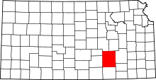 | |
| Unincorporated communities | ||
| Ghost towns | ||
| Townships | ||
| Footnotes | †This populated place is designated a Census-Designated Place (CDP) by the United States Census Bureau, ‡This populated place also has portions in an adjacent county or counties. | |