Leavenworth, Kansas
| Leavenworth, Kansas | ||
|---|---|---|
| City and County seat | ||
 Downtown Leavenworth (2014) | ||
| ||
| Motto(s): First City of Kansas | ||
 Location within Leavenworth County and Kansas | ||
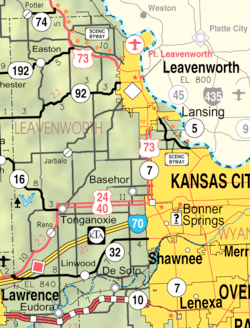 KDOT map of Leavenworth County (legend) | ||
| Coordinates: 39°18′40″N 94°55′21″W / 39.31111°N 94.92250°WCoordinates: 39°18′40″N 94°55′21″W / 39.31111°N 94.92250°W | ||
| Country | United States | |
| State | Kansas | |
| County | Leavenworth | |
| Founded | 1854 | |
| Incorporated | 1855 | |
| Government[1] | ||
| • Type | Commission-Manager | |
| • Mayor | Mark Preisinger[2] | |
| • City Manager | Paul Kramer[2] | |
| Area[3] | ||
| • Total | 24.06 sq mi (62.32 km2) | |
| • Land | 24.04 sq mi (62.26 km2) | |
| • Water | 0.02 sq mi (0.05 km2) | |
| Elevation | 840 ft (260 m) | |
| Population (2010)[4] | ||
| • Total | 35,251 | |
| • Estimate (2016)[5] | 36,154 | |
| • Density | 1,500/sq mi (570/km2) | |
| Time zone | UTC−6 (CST) | |
| • Summer (DST) | UTC−5 (CDT) | |
| ZIP codes | 66043, 66048 | |
| Area code | 913 | |
| FIPS code | 20-39000 | |
| GNIS ID | 0478411 [6] | |
| Website | lvks.org | |

Leavenworth is the largest city in and the county seat of Leavenworth County, Kansas, United States. As of the 2010 census, the city population was 35,251.[7] Located on the west bank of the Missouri River 25 mi (40 km) northwest of Kansas City, Missouri, it is part of the Kansas City metropolitan area.[8][9]
The site of Fort Leavenworth, built in 1827, the city became known in American history for its role as a key supply base in the settlement of the American West. It is important in nineteenth-century African-American history. During the American Civil War, many volunteers joined the Union Army from Leavenworth. It was the destination of numerous African-American refugee slaves who escaped from Missouri and other slave states.[10]
The city has been notable as the location of several prisons, particularly the United States Disciplinary Barracks and United States Penitentiary, Leavenworth.[11]
History
Leavenworth, founded in 1854, was the first city incorporated in the territory of Kansas.[12] The city developed south of Fort Leavenworth, which was established as Cantonment Leavenworth in 1827 by Colonel Henry Leavenworth.[13] Its location on the Missouri River attracted refugee African-American slaves in the antebellum years, who were seeking freedom from the slave state of Missouri across the river. Abolition supporters helped them find refuge. In the years before the American Civil War, Leavenworth was a hotbed of anti-slavery and pro-slavery agitation, often leading to open physical confrontations on the street and in public meetings.
On April 3, 1858, the "Leavenworth Constitution" for the state of Kansas was adopted here. Although the federal government never approved this early version of the state constitution, it was considered one of the most radical of the four constitutions drafted for the new territory because it recognized freed blacks as citizens.[14]
Refugee African Americans continued to settle in the city during the war. By 1865 it had attracted nearly one-fifth of the 12,000 blacks in the state.[15] Charles Henry Langston was an African-American leader from Boston who worked and lived in Leavenworth and northeast Kansas in the Reconstruction era and afterward. In Kansas, Langston worked for black suffrage and the right of African Americans to sit on juries, testify in court, and have their children educated in common schools.[16] African Americans gained suffrage in 1870 after passage of the federal 15th constitutional amendment, and the legislature voted for their right to sit on juries in 1874.[16]
African Americans continued to migrate to the state of Kansas after the war. There were a total of 17,108 African Americans in Kansas in 1870, with 43,107 in 1880, and 52,003 by 1900. Most lived in urban areas.[15]
20th century to present
Following months of assaults on young white women in late 1900, in which witnesses had identified a "large white man" and a "slight black man" as having been seen in the vicinity of the attacks, Fred Alexander, a 22-year-old black veteran of the Spanish-American War, was arrested on circumstantial evidence for the attacks. The police had moved him to the penitentiary during questioning, but a lynch mob was forming in Leavenworth.[17] The sheriff needed to bring him to Leavenworth for arraignment at the county court. He refused the governor's offer of state militia, and was unable to protect the prisoner. On January 15, 1901, Alexander was taken from jail by a mob of 5,000 people and to the site of the murder of Pearl Forbes, where he was brutally lynched: burned alive.[18] He protested his innocence to the end. An inquest concluded he had been killed by "persons unknown".
His family refused to claim his body for burial. His father Alfred Alexander, an exoduster, said "The people have mutilated him, now let them bury him."[17] The city arranged burial. African Americans in the region were horrified at Alexander's murder by the mob and created the first state chapter of the Afro-American Council, then the only national organization working for civil rights.[17] (The National Association for the Advancement of Colored People (NAACP) was founded a few years later, and absorbed most members of the AAC.)
In 1972 Benjamin Day became the city's first African-American mayor.[19] Day had been elected to the City Commission one year earlier. Leavenworth appoints its mayor from among the members of the Commission, and Day was named mayor in 1971. Day was a former educator and principal in Leavenworth.
Fort Leavenworth was located outside the city limits until its territory was annexed by the city on April 12, 1977.[20]
In 2008, an underground series of "vaults" was found in the city, apparently built during the late 19th century.[21]
Geography
Leavenworth is located at 39°18′40″N 94°55′21″W / 39.31111°N 94.92250°W (39.3111112, −94.9224637) at an elevation of 840 feet (256 m).[6] Located in northeastern Kansas at the junction of U.S. Route 73 and Kansas Highway 92 (K-92), Leavenworth is 25 mi (40 km) northwest of downtown Kansas City, 145 mi (233 km) south-southeast of Omaha, and 165 mi (266 km) northeast of Wichita.[8][22]
The city lies on the west bank of the Missouri River in the Dissected Till Plains region of North America's Central Lowlands.[22][23] Four small tributaries of the river flow generally east through the city. From north to south, these are Quarry Creek, Corral Creek, Three Mile Creek, and Five Mile Creek.[24]
According to the United States Census Bureau, the city has a total area of 24.06 square miles (62.32 km2), of which, 24.04 square miles (62.26 km2) is land and 0.02 square miles (0.05 km2) is water.[3] Fort Leavenworth occupies the northern half of the city's area.[24]
Leavenworth, along with the rest of Leavenworth County, lies within the Kansas City metropolitan area.[9] Lansing, Kansas, is located to the south.[24]
Climate
Leavenworth experiences a humid continental climate (Köppen Dfa), with hot, humid summers and cold, drier winters. On average, January is the coldest month, July is the hottest month, and June is the wettest month.[25]
The average temperature in Leavenworth is 55.2 °F or 12.9 °C.[26] Over the course of a year, temperatures range from an average low of 19 °F or −7.2 °C in January to an average high of 90 °F or 32.2 °C in July.[25] The high temperature reaches or exceeds 90 °F or 32.2 °C an average of 43 afternoons per year and reaches or exceeds 100 °F or 37.8 °C an average of four afternoons per year. The minimum temperature falls below the freezing point of 32 °F or 0 °C an average of 107 mornings per year.[26] The hottest temperature recorded in Leavenworth was 110 °F (43.3 °C) in 1954; the coldest temperature recorded was −27 °F (−32.8 °C) in 1989.[25]
In an average year, Leavenworth experiences 89.7 days with measurable precipitation and receives 42.97 inches or 1,091.4 millimetres of precipitation.[25][26] Typically, the first fall freeze occurs by the third week of October, and the last spring freeze occurs by the second week of April.[26] Annual snowfall averages 16.1 inches or 0.41 metres.[25] Measurable snowfall occurs an average of eight days per year with at least an inch of snow being received on five of those days. Snow depth of at least an inch occurs an average of 15 days a year.[26] Severe thunderstorms sometimes occur, particularly during the spring months. These produce strong winds and, sometimes, large hail. These storms also bring the risk of tornadoes.
| Climate data for Leavenworth, Kansas | |||||||||||||
|---|---|---|---|---|---|---|---|---|---|---|---|---|---|
| Month | Jan | Feb | Mar | Apr | May | Jun | Jul | Aug | Sep | Oct | Nov | Dec | Year |
| Record high °F (°C) | 74 (23) |
81 (27) |
87 (31) |
93 (34) |
97 (36) |
106 (41) |
110 (43) |
108 (42) |
104 (40) |
95 (35) |
84 (29) |
70 (21) |
110 (43) |
| Average high °F (°C) | 39 (4) |
45 (7) |
56 (13) |
67 (19) |
76 (24) |
85 (29) |
90 (32) |
88 (31) |
80 (27) |
68 (20) |
54 (12) |
41 (5) |
66 (19) |
| Daily mean °F (°C) | 29 (−2) |
34 (1) |
44 (7) |
55 (13) |
65 (18) |
74 (23) |
79 (26) |
77 (25) |
68 (20) |
57 (14) |
44 (7) |
32 (0) |
55 (13) |
| Average low °F (°C) | 19 (−7) |
24 (−4) |
33 (1) |
43 (6) |
54 (12) |
63 (17) |
69 (21) |
67 (19) |
57 (14) |
46 (8) |
33 (1) |
23 (−5) |
44 (7) |
| Record low °F (°C) | −17 (−27) |
−19 (−28) |
−10 (−23) |
4 (−16) |
27 (−3) |
42 (6) |
45 (7) |
41 (5) |
30 (−1) |
18 (−8) |
−2 (−19) |
−27 (−33) |
−27 (−33) |
| Average precipitation inches (mm) | 1.03 (26.2) |
1.53 (38.9) |
2.74 (69.6) |
4.04 (102.6) |
5.38 (136.7) |
5.92 (150.4) |
5.20 (132.1) |
4.49 (114) |
4.82 (122.4) |
3.78 (96) |
2.45 (62.2) |
1.59 (40.4) |
42.97 (1,091.5) |
| Average snowfall inches (cm) | 4.4 (11.2) |
5.3 (13.5) |
1.7 (4.3) |
0 (0) |
0 (0) |
0 (0) |
0 (0) |
0 (0) |
0 (0) |
0.2 (0.5) |
0.7 (1.8) |
3.8 (9.7) |
16.1 (41) |
| Average precipitation days (≥ 0.01 in) | 4.7 | 5.1 | 7.9 | 8.9 | 11.2 | 9.9 | 7.5 | 8.0 | 7.6 | 7.3 | 6.4 | 5.2 | 89.7 |
| Average snowy days (≥ 0.1 in) | 2.3 | 2.3 | 0.8 | 0 | 0 | 0 | 0 | 0 | 0 | 0 | 0.4 | 2.1 | 7.9 |
| Source: National Weather Service;[26] The Weather Channel[25] | |||||||||||||
Demographics
| Historical population | |||
|---|---|---|---|
| Census | Pop. | %± | |
| 1860 | 7,429 | — | |
| 1870 | 17,873 | 140.6% | |
| 1880 | 16,546 | −7.4% | |
| 1890 | 19,768 | 19.5% | |
| 1900 | 20,735 | 4.9% | |
| 1910 | 19,363 | −6.6% | |
| 1920 | 16,912 | −12.7% | |
| 1930 | 17,466 | 3.3% | |
| 1940 | 19,220 | 10.0% | |
| 1950 | 20,579 | 7.1% | |
| 1960 | 22,052 | 7.2% | |
| 1970 | 25,147 | 14.0% | |
| 1980 | 33,656 | 33.8% | |
| 1990 | 38,495 | 14.4% | |
| 2000 | 35,420 | −8.0% | |
| 2010 | 35,251 | −0.5% | |
| Est. 2016 | 36,154 | [5] | 2.6% |
| U.S. Decennial Census[27] | |||
2010 census
As of the 2010 United States Census, there were 35,251 people, 12,256 households, and 8,129 families residing in the city. The population density was 1,466.2 people per square mile (566.1/km²). There were 13,670 housing units at an average density of 568.6 per square mile (219.5/km²). The racial makeup of the city was 75.4% White, 15.1% African American, 0.9% American Indian, 1.8% Asian, 0.2% Pacific Islander, 2.0% from other races, and 4.6% from two or more races. Hispanics and Latinos of any race were 8.1% of the population.[7]
There were 12,256 households of which 34.6% had children under the age of 18 living with them, 48.7% were married couples living together, 13.2% had a female householder with no husband present, 4.4% had a male householder with no wife present, and 33.7% were non-families. 28.7% of all households were made up of individuals, and 9.5% had someone living alone who was 65 years of age or older. The average household size was 2.55, and the average family size was 3.15.[7]
The median age in the city was 34.8 years. 26% of residents were under the age of 18; 8.5% were between the ages of 18 and 24; 31.6% were from 25 to 44; 23.9% were from 45 to 64; and 10% were 65 years of age or older. The gender makeup of the city was 53.9% male and 46.1% female.[7]
The median income for a household in the city was $49,823, and the median income for a family was $61,576. Males had a median income of $49,693 versus $30,888 for females. The per capita income for the city was $23,102. About 9.8% of families and 12.9% of the population were below the poverty line, including 16.4% of those under age 18 and 10.0% of those age 65 or over.[7]
Economy
As of 2010, 58.6% of the population over the age of 16 was in the labor force. 7.8% was in the armed forces, and 50.8% was in the civilian labor force with 47.0% being employed and 3.8% unemployed. The composition, by occupation, of the employed civilian labor force was: 34.5% in management, business, science, and arts; 22.8% in sales and office occupations; 23.2% in service occupations; 8.4% in natural resources, construction, and maintenance; 11.0% in production, transportation, and material moving. The three industries employing the largest percentages of the working civilian labor force were: educational services, health care, and social assistance (22.7%); public administration (15.6%); and retail trade (13.0%).[7] The U.S. military at Fort Leavenworth is the city's largest employer, employing roughly 5,600 people, followed by Leavenworth Public Schools and the Department of Veteran Affairs Eastern Kansas Health Care System.[28]
The cost of living in Leavenworth is below average; compared to a U.S. average of 100, the cost of living index for the city is 87.1.[29] As of 2010, the median home value in the city was $124,200, the median selected monthly owner cost was $1,282 for housing units with a mortgage and $428 for those without, and the median gross rent was $762.[7]
Top employers
According to the town's 2015 Comprehensive Annual Financial Report,[30] the top employers in the city are:
| # | Employer | # of Employees |
|---|---|---|
| 1 | Fort Leavenworth | 4,185 |
| 2 | U.S.D. 453 | 996 |
| 3 | Dwight D. Eisenhower Veterans Affairs Medical Center | 700 |
| 4 | Northrop Grumman | 700 |
| 5 | Central Plains Consolidated Accounts | 400 |
| 6 | Cubic Defense Applications Group | 390 |
| 7 | Leavenworth Federal Penitentiary | 380 |
| 8 | Leavenworth County | 352 |
| 9 | Walmart Supercenter | 350 |
| 10 | Hallmark Cards, Inc | 260 |
Government

Leavenworth is a city of the first class with a commission-manager form of government.[31] The city commission is the city's governing body and consists of five members, including the mayor and the mayor pro-tem. It sets city policies, adopts the city government's annual operating budget, and appoints city boards, commissions, and officials, including the city manager. Commissioners are elected to either four-year or two-year terms; one is appointed to serve as mayor, and another to serve as mayor pro-tem.[32] The commission meets on the second and fourth Tuesday of each month.[31] The city manager is the city's chief executive, responsible for the day-to-day administration of the city government. The manager supervises all city government departments and employees, prepares and proposes the annual operating budget, and recommends policies to the city commission.[33]
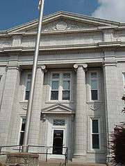
As the county seat, Leavenworth is the administrative center of Leavenworth County. The county courthouse is located south of downtown at 4th and Walnut streets, and all departments of the county government base their operations in the city.[34]
Leavenworth lies within Kansas's 2nd U.S. Congressional District. For the purposes of representation in the Kansas Legislature, the city is in the 5th district of the Kansas Senate and the 40th, 41st, and 42nd districts of the Kansas House of Representatives.[31]
The United States Department of Veterans Affairs operates the Dwight D. Eisenhower Veterans Affairs Medical Center in Leavenworth as part of its Eastern Kansas Health Care System.[35] The Medical Center includes a Consolidated Mail Outpatient Pharmacy (CMOP), part of an initiative to provide mail-order prescriptions to veterans using automated systems at strategic locations throughout the United States, as well as the Central Plains Consolidated Patient Account Center (CPAC), a billing and collection agency.[36][37]
Fort Leavenworth
Fort Leavenworth, known as the "Intellectual Center of the Army", is home to the U.S. Army Combined Arms Center. It is also home to the U.S. Army Command and General Staff College, School of Advanced Military Studies, the Center for Army Leadership, the Combat Studies Institute, the Combined Arms Doctrine Directorate, the Center for Army Lessons Learned and the Mission Command Center of Excellence.
Prisons
Leavenworth is the location of several federal and state detention centers and prisons:
- United States Penitentiary, Leavenworth (USP) built in 1903, and its satellite prison camp, operated by the Federal Bureau of Prisons
- United States Disciplinary Barracks, the U.S. military's only maximum-security facility
- Midwest Joint Regional Correctional Facility, another U.S. military facility
- Leavenworth Detention Center, privately operated by the Corrections Corporation of America for the United States Marshals Service
In addition, Lansing Correctional Facility, operated by the Kansas Department of Corrections is in the adjoining town of Lansing.
Education
Primary and secondary education
Two public school districts serve the city. Fort Leavenworth USD 207 encompasses Fort Leavenworth and operates three elementary schools and one junior high school.[38] The remainder of the city lies within USD 453, Leavenworth Public Schools, which operates six schools: four elementary schools, one middle school, and Leavenworth High School. USD 453 also operates Leavenworth Virtual School, an Internet-based school for students from grades Kindergarten through eighth grade.[39] Senior high school students from Fort Leavenworth attend Leavenworth High School.[40]
There are also three private schools in Leavenworth. The Roman Catholic Archdiocese of Kansas City in Kansas oversees Catholic school: Xavier Elementary School (Grades Pre-K-8)[41] Immaculata High School closed at the end of the 2016-2017 school year. There is no Catholic high school in Leavenworth at this time. The Lutheran Church–Missouri Synod operates one Lutheran school, St. Paul Lutheran School (Pre-K-8).[42]
Colleges and universities
The main campus of University of Saint Mary, a four-year, private Catholic university, is in Leavenworth.[43] In addition, Kansas City Kansas Community College operates a satellite campus in the city.[44]
Media
The Leavenworth Times, published by GateHouse Media, is the city's daily newspaper.[45] Gatehouse Media also publishes The Fort Leavenworth Lamp, a weekly newspaper covering local military news, on contract with the U.S. Army.[46]
Leavenworth is in the Kansas City radio and television markets.[47][48] Two radio stations are licensed to the city: KKLO broadcasts from Leavenworth on 1410 AM, a Fox News affiliate; KQRC-FM broadcasts from Mission, Kansas on 98.9 FM, playing a Rock format.[49]
In popular culture
Leavenworth is the setting for "Hurt People," a 2009 novel by Cote Smith.[50]
Parks and recreation
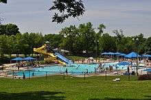
The Leavenworth Parks and Recreation Department maintains a system of more than 25 public parks as well as Riverfront Community Center, which includes an indoor cardio room and pool, and Wollman Aquatic Center. An off-leash dog park near the Dwight D. Eisenhower Veterans Affairs Medical Center was built with public donations in 2010.
Culture
.jpg)
Arts and music
The Richard Allen Cultural Center and Museum contains items and artifacts from the African American pioneers and members of the military, including the "Black Dignity" collection of 1870s-1920s photographs from the Mary Everhard Collection.
Leavenworth enjoys year-round plays and musicals performed by a community theater group, the River City Community Players.
Military
Many of Leavenworth's residents are current or former members of the military. Two Medal of Honor recipients live here as of 2014, Ret. Col. Roger Donlon and Ret. Lt. Col. Charles C. Hagemeister. Leavenworth High School boasts the very first Junior Reserve Officer Training Corps in the country. A parade is held each year on Veterans' Day in downtown Leavenworth to honor veterans. Leavenworth has an active Byron H. Mehl American Legion Post #23 and Veterans of Foreign Wars George Edward White Post 56.
Points of interest

Leavenworth has a 28-block historic shopping district, which includes antique shops, restaurants, a brewery and a variety of artisan gift shops.
Leavenworth is home to the C.W. Parker Carousel Museum, listed as one of the "8 Wonders of Kansas Customs" by the Kansas Sampler Foundation.[51] The Leavenworth County Historical Society maintains a museum at the Edward Carroll House, a Victorian-era mansion that is open to the public for touring.[52]
Haymarket Square is a covered lot where a local farmer's market takes place from May to October.
Religion
Leavenworth enjoys a diverse religious tradition stemming from its military and international military influences. In the mid to late 19th century, Leavenworth had one of the largest Jewish communities in Kansas, made up of immigrants from Europe.[53] Leavenworth had multiple Orthodox congregations by 1870. Over generations many Jews ultimately intermarried and their descendants became Christian.[54]
There are two United Methodist Churches, the First United Methodist Church and Trinity United Methodist Church. Other Protestant churches include Lutheran, Southern Baptist, American Baptist, African Methodist Episcopal, United Church of Christ, Presbyterian, Community Church of Christ, Church of the Nazarene, Grace and Truth Fellowship, Assemblies of God, and Seventh-Day Adventist. Other religious institutions include a Church of Jesus Christ of Latter-day Saints and the Islamic Center of Leavenworth. Leavenworth is part of the Archdiocese of Kansas City, Kansas, and there are four Roman Catholic parishes in the city. A few churches conduct services in Hangul. Many Leavenworth residents attend services on Fort Leavenworth.
Notable people
Political activist Charles Henry Langston lived and worked here (1863-1870), assisting African-American refugees from slave states and, after the Civil War, working for black suffrage and equal rights of blacks in the West; he moved to Lawrence for the remainder of his life. General of the Army and 34th President of the United States Dwight D. Eisenhower once served at Fort Leavenworth.[55] Both Buffalo Bill Cody and Wild Bill Hickok lived and worked in Leavenworth during its Old West frontier period.[56][57]
Other notable individuals who were born in and/or have lived in Leavenworth include rock musician Melissa Etheridge,[58] restaurant entrepreneur Fred Harvey,[59] architect Frank Jacobus, Broadway producer and Tony Awards founder Brock Pemberton and U.S. Supreme Court justice David Josiah Brewer.[60]
Sister cities
Gallery
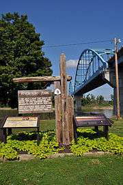
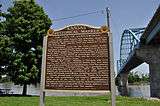 Marker relating the history of Leavenworth, Kansas.
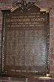 Plaque (2013) memorializing soldiers from Leavenworth County who were killed in action during World War II and Korea.
 The Leavenworth Veterans Memorial was erected in 2013 to honor and remember service members who died during the Global War on Terror era.
 First Presbyterian Church (2012)
 Fall color at North Esplanade Park, the first park founded in the first City of Kansas.
 David Brewer Park in Leavenworth, Kansas, named for David Josiah Brewer, former U.S. Supreme Court Justice.
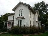 Home of David Josiah Brewer, former U.S. Supreme Court Justice, when he lived in Leavenworth, Kansas.
 Edward Carroll House, operating since 1965 as a Victorian house museum
.jpg) Riverfront Community Center, a former Union Station train depot.
Riverfront Community Center, a former Union Station train depot..JPG) A. J. Angell House
A. J. Angell House US Penitentiary, Leavenworth
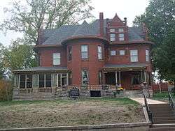 Nathaniel Burt House
_1.jpg) Abernathy Furniture Co. building was converted to lofts in the early 2000s.
Abernathy Furniture Co. building was converted to lofts in the early 2000s.%2C_Leavenworth%2C_Kansas.jpg) Merritt Insley House
Merritt Insley House Fort Leavenworth Clocktower
See also
References
- ↑ Government Archived 2012-04-22 at the Wayback Machine.
- 1 2 "Leavenworth City Commission". City of Leavenworth. Retrieved March 7, 2018. >
- 1 2 "US Gazetteer files 2010". United States Census Bureau. Archived from the original on 2012-07-14. Retrieved 2012-07-06.
- ↑ "American FactFinder". United States Census Bureau. Retrieved 2012-07-06.
- 1 2 "Population and Housing Unit Estimates". Retrieved June 9, 2017.
- 1 2 "US Board on Geographic Names". United States Geological Survey. 2007-10-25. Retrieved 2008-01-31.
- 1 2 3 4 5 6 7 "American FactFinder 2". United States Census Bureau. Retrieved 2011-09-18.
- 1 2 "City Distance Tool". Geobytes. Retrieved 2011-12-21.
- 1 2 "State and Metropolitan Area Data Book: 2010" (PDF). United States Census Bureau. p. 201. Retrieved 2011-12-21.
- ↑ Stokes, Keith. "Historic Fort Leavenworth - Leavenworth, Kansas". www.kansastravel.org. Retrieved 2017-12-07.
- ↑ "Leavenworth". Encyclopædia Britannica. Retrieved 2014-04-04.
- ↑ "Visitors". City of Leavenworth, Kansas. Retrieved 12 June 2014.
- ↑ Hall, Jesse A. and Hand LeRoy T. (1921). History of Leavenworth County Kansas. Historical Publishing Company. p. 116.
- ↑ "Kansas Memory, "Leavenworth Constitution"" (Images of historic documents). Kansas Memory, "Leavenworth Constitution". Kansas Historical Foundation. Retrieved 4 November 2015.
- 1 2 Richard B. Sheridan, "Charles Henry Langston and the African American Struggle in Kansas", Kansas State History, Winter 1999, accessed 15 December 2008.
- 1 2 Eugene H. Berwanger, "Hardin and Langston: Western Black Spokesmen of the Reconstruction Era", Journal of Negro History 64 (Spring 1979), Template:Via JSTOR, accessed 19 October 2015
- 1 2 3 Shawn Leigh Alexander, "Vengeance Without Justice, Injustice Without Retribution/ The Afro-American Council’s Struggle Against Racial Violence", Great Plains Quarterly, Center for Great Plains Studies, Spring 2007; accessed 02 June 2018
- ↑ Christopher Lovett, "A Public Burning: Race, Sex, and the Lynching of Fred Alexander", Kansas State Historical Society, Summer 2010; accessed 02 June 2018
- ↑ "Benjamin Day Papers". Benjamin Day Papers. University of Kansas Libraries. Retrieved 21 August 2017.
- ↑ "United States v. City of Leavenworth, Kansas". Leagle. Retrieved 12 June 2014.
- ↑ "Mystery Surrounds Leavenworth's Underground City". KCTV5. 2008-08-07. Archived from the original on 2011-05-19. Retrieved 2008-08-24.
- 1 2 "2003-2004 Official Transportation Map" (PDF). Kansas Department of Transportation. 2003. Retrieved 2011-12-21.
- ↑ "Phase I Environmental Assessment" (PDF). Tetra Tech, Inc. July 2009. Archived from the original (PDF) on 2012-04-26. Retrieved 2011-12-21.
- 1 2 3 "City of Leavenworth (map)" (PDF). Kansas Department of Transportation. August 2008. Retrieved 2011-12-21.
- 1 2 3 4 5 6 "Average weather for Leavenworth, KS". The Weather Channel. Retrieved 2011-12-21.
- 1 2 3 4 5 6 "NOWData - NOAA Online Weather Data". National Weather Service Forecast Office - Kansas City/Pleasant Hill. Retrieved 2011-12-21.
- ↑ United States Census Bureau. "Census of Population and Housing". Retrieved November 30, 2014.
- ↑ "Leading Employers". Leavenworth County Development Council. Retrieved 2012-10-16.
- ↑ "Leavenworth, Kansas". City-Data.com. Retrieved 2011-12-21.
- ↑ "Leavenworth 2015 Comprehensive Annual Financial Report" (PDF). Retrieved February 27, 2017.
- 1 2 3 "Leavenworth". Directory of Kansas Public Officials. The League of Kansas Municipalities. Archived from the original on 2011-12-13. Retrieved 2011-12-21.
- ↑ "City Commission". City of Leavenworth, Kansas. Archived from the original on 2012-04-22. Retrieved 2011-12-21.
- ↑ "City Manager". City of Leavenworth, Kansas. Retrieved 2011-12-21.
- ↑ "Leavenworth County". Leavenworth County, Kansas. Retrieved 2012-07-05.
- ↑ "VA Eastern Kansas Health Care System". United States Department of Veterans Affairs. Retrieved 2014-05-09.
- ↑ "Consolidated Mail Outpatient Pharmacy (CMOP)". United States Department of Veterans Affairs. Retrieved 2014-05-09.
- ↑ "Consolidated Patient Account Center (CPAC)". United States Department of Veterans Affairs. Retrieved 2014-05-09.
- ↑ "Fort Leavenworth USD 207". Fort Leavenworth School District. Retrieved 2012-07-10.
- ↑ "Leavenworth USD 453 Home". Leavenworth Public Schools. Retrieved 2012-07-10.
- ↑ "Schools". U.S. Army Garrison - Fort Leavenworth. Retrieved 2012-07-10.
- ↑ "Catholic Schools". Roman Catholic Archdiocese of Kansas City in Kansas. Retrieved 2012-07-10.
- ↑ "St. Paul Lutheran School". St. Paul Lutheran Church. Retrieved 2012-07-10.
- ↑ "University of Saint Mary". Best Colleges. U.S. News & World Report. Retrieved 2012-07-10.
- ↑ "Maps & Directions". Kansas City Kansas Community College. Retrieved 2014-05-23.
- ↑ "Leavenworth Times". Mondo Times. Retrieved 2011-12-21.
- ↑ "Fort Leavenworth Lamp". Mondo Times. Retrieved 2011-12-21.
- ↑ "2009 Arbitron Radio Metro Map" (PDF). Arbitron. Archived from the original (PDF) on 2011-07-20. Retrieved 2011-12-12.
- ↑ "Kansas City TV Market (map)". EchoStar Knowledge Base. Retrieved 2011-12-21.
- ↑ "Radio Stations in Leavenworth, Kansas". Radio-Locator. Retrieved 2011-12-21.
- ↑ Cook, Liz (5 March 2016). "Leavenworth native's debut novel 'Hurt People' driven by a youth's view of a scary world" – via KansasCity.com.
- ↑ C.W. Parker Carousel Museum
- ↑ http://leavenworthhistory.org/
- ↑ "Leavenwroth", Jewish Encyclopedia
- ↑ "Judaism" Archived 2012-09-05 at the Wayback Machine., Kansas University
- ↑ Ambrose, Stephen (1983). Eisenhower: (vol. 1) Soldier, General of the Army, President-Elect (1893–1952). New York: Simon & Schuster. p. 61–62.
- ↑ Cody, William Frederick (1920). "An Autobiography of Buffalo Bill". Retrieved 2015-07-28.
- ↑ Rosa, Joseph G. (2004). Wild Bill Hickok: Sharpshooter and U.S. Marshal of the Wild West. New York, NY: Rosen Publishing. p. 24.
- ↑ Heim, Michael (2007). Exploring Kansas Highways. p. 54.
- ↑ "National Fred Harvey Museum". Leavenworth Historical Museum Association, Inc. Retrieved 2015-07-28.
- ↑ "Brewer, David Josiah". Biographical Directory of Federal Judges. Federal Judicial Center. Retrieved 2015-07-28.
- ↑ "Sister Cities". Wagga Wagga City Council. Retrieved 2008-08-24.
Further reading
- County
- History of Leavenworth County Kansas; Jesse Hall and LeRoy Hand; Historical Publishing; 684 pages; 1921. (Download 27MB PDF eBook)
- Kansas
- History of the State of Kansas; William G. Cutler; A.T. Andreas Publisher; 1883. (Online HTML eBook)
- Kansas : A Cyclopedia of State History, Embracing Events, Institutions, Industries, Counties, Cities, Towns, Prominent Persons, Etc; 3 Volumes; Frank W. Blackmar; Standard Publishing Co; 944 / 955 / 824 pages; 1912. (Volume1 - Download 54MB PDF eBook),(Volume2 - Download 53MB PDF eBook), (Volume3 - Download 33MB PDF eBook)
External links
| Wikimedia Commons has media related to Leavenworth, Kansas. |
| Wikisource has the text of the 1920 Encyclopedia Americana article Leavenworth. |
- City
- City of Leavenworth
- Leavenworth - Directory of Public Officials
- Leavenworth Area Development Corporation
- The Leavenworth-Lansing Area Chamber of Commerce
- Underground City Beneath Leavenworth
- Federal
- Historical
- Leavenworth County Historical Society

Municipalities and communities of Leavenworth County, Kansas, United States | ||
|---|---|---|
| Cities | 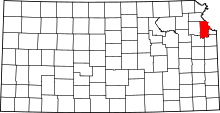 | |
| CDPs | ||
| Unincorporated communities | ||
| Townships | ||
| Ghost town | ||
| Footnotes | ‡This populated place also has portions in an adjacent county or counties | |
Kansas City metropolitan area's cities and counties | ||
|---|---|---|
| Central city |  | |
| Largest cities (over 100,000 in 2000) | ||
| Medium-sized cities (10,000 to 100,000 in 2000) | ||
| Smaller Cities (between 5,000 and 9,900 in 2010) | ||
| Counties | ||