Lee County, Illinois
| Lee County, Illinois | |
|---|---|
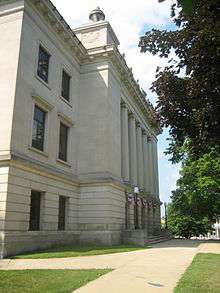 Lee County Courthouse | |
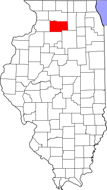 Location in the U.S. state of Illinois | |
 Illinois's location in the U.S. | |
| Founded | 27 February 1839 |
| Named for | Henry Lee III |
| Seat | Dixon |
| Largest city | Dixon |
| Area | |
| • Total | 729 sq mi (1,888 km2) |
| • Land | 725 sq mi (1,878 km2) |
| • Water | 4.1 sq mi (11 km2), 0.6% |
| Population | |
| • (2010) | 36,031 |
| • Density | 50/sq mi (20/km2) |
| Congressional district | 16th |
| Time zone | Central: UTC−6/−5 |
| Website |
www |
Lee County is a county located in the U.S. state of Illinois. According to the 2010 census, it has a population of 36,031.[1] Its county seat is Dixon.[2]
The Dixon, IL Micropolitan Statistical Area includes all of Lee County.
History
The area's first non-native settlers were mostly from the six New England states.[3] The early nineteenth century saw a wave of westward movement from New England, due largely to completion of the Erie Canal and the end of the Black Hawk War.[4][5]
The area that included present-day Lee County was delineated as St. Clair County in 1809. In 1823, a large section of northern St. Clair County was partitioned off as Fulton County. In 1825, the northwestern portion of that county was partitioned off as Putnam County. In 1831, the area was further partitioned into Jo Daviess County. A section of that county was partitioned off in 1836 as Ogle County, and in 1839 the bottom half of Ogle County was split off as Lee County. It is largely understood that the county's name honors "Lighthorse Harry" Lee, an officer in the American Revolutionary War.[6] An alternative theory suggests the name honors Richard Henry Lee, a member of the Continental Congress (the Declaration of Independence was adopted pursuant to the Lee Resolution).
President Ronald Reagan lived in Dixon as a boy and attended Dixon High School.[7]
 Lee County's boundaries have remained unchanged since its creation in 1839.
Geography
According to the U.S. Census Bureau, the county has a total area of 729 square miles (1,890 km2), of which 725 square miles (1,880 km2) is land and 4.1 square miles (11 km2) (0.6%) is water.[8]
Climate and weather
| Dixon, Illinois | ||||||||||||||||||||||||||||||||||||||||||||||||||||||||||||
|---|---|---|---|---|---|---|---|---|---|---|---|---|---|---|---|---|---|---|---|---|---|---|---|---|---|---|---|---|---|---|---|---|---|---|---|---|---|---|---|---|---|---|---|---|---|---|---|---|---|---|---|---|---|---|---|---|---|---|---|---|
| Climate chart (explanation) | ||||||||||||||||||||||||||||||||||||||||||||||||||||||||||||
| ||||||||||||||||||||||||||||||||||||||||||||||||||||||||||||
| ||||||||||||||||||||||||||||||||||||||||||||||||||||||||||||
In recent years, average temperatures in the county seat of Dixon have ranged from a low of 10 °F (−12 °C) in January to a high of 82 °F (28 °C) in July, although a record low of −27 °F (−33 °C) was recorded in January 1999 and a record high of 110 °F (43 °C) was recorded in July 1936. Average monthly precipitation ranges from 1.43 inches (36 mm) in February to 4.88 inches (124 mm) in June.[9]
Major highways
Other features
Demographics
| Historical population | |||
|---|---|---|---|
| Census | Pop. | %± | |
| 1840 | 2,035 | — | |
| 1850 | 5,292 | 160.0% | |
| 1860 | 17,651 | 233.5% | |
| 1870 | 27,171 | 53.9% | |
| 1880 | 27,491 | 1.2% | |
| 1890 | 26,187 | −4.7% | |
| 1900 | 29,894 | 14.2% | |
| 1910 | 27,750 | −7.2% | |
| 1920 | 28,004 | 0.9% | |
| 1930 | 32,329 | 15.4% | |
| 1940 | 34,604 | 7.0% | |
| 1950 | 36,451 | 5.3% | |
| 1960 | 38,749 | 6.3% | |
| 1970 | 37,947 | −2.1% | |
| 1980 | 36,328 | −4.3% | |
| 1990 | 34,392 | −5.3% | |
| 2000 | 36,062 | 4.9% | |
| 2010 | 36,031 | −0.1% | |
| Est. 2016 | 34,251 | [10] | −4.9% |
| U.S. Decennial Census[11] 1790-1960[12] 1900-1990[13] 1990-2000[14] 2010-2013[1] | |||
As of the 2010 United States Census, there were 36,031 people, 13,758 households, and 9,064 families residing in the county.[15] The population density was 49.7 inhabitants per square mile (19.2/km2). There were 15,049 housing units at an average density of 20.8 per square mile (8.0/km2).[8] The racial makeup of the county was 90.9% white, 4.8% black or African American, 0.7% Asian, 0.2% American Indian, 1.9% from other races, and 1.5% from two or more races. Those of Hispanic or Latino origin made up 5.0% of the population.[15] In terms of ancestry, 38.0% were German, 18.8% were Irish, 8.4% were English, and 8.2% were American.[16]
Of the 13,758 households, 30.0% had children under the age of 18 living with them, 51.2% were married couples living together, 10.0% had a female householder with no husband present, 34.1% were non-families, and 28.8% of all households were made up of individuals. The average household size was 2.41 and the average family size was 2.94. The median age was 42.0 years.[15]
The median income for a household in the county was $48,502 and the median income for a family was $60,759. Males had a median income of $42,114 versus $30,920 for females. The per capita income for the county was $24,440. About 7.6% of families and 9.6% of the population were below the poverty line, including 11.8% of those under age 18 and 6.5% of those age 65 or over.[17]
Communities
Cities
Villages
Townships
Lee County is divided into twenty-two townships:
Politics
Since the election of 1860 the Republican party candidate for president has won Lee County, Illinois with only one exception, that being in 1912 when Theodore Roosevelt won the county while running as a member of the Progressive Party, unofficially known as the "Bull Moose" party.
| Year | Republican | Democratic | Third parties |
|---|---|---|---|
| 2016 | 55.6% 8,612 | 35.7% 5,528 | 8.7% 1,349 |
| 2012 | 52.5% 8,059 | 45.2% 6,937 | 2.3% 352 |
| 2008 | 50.5% 8,258 | 47.5% 7,765 | 2.0% 334 |
| 2004 | 58.6% 9,307 | 40.4% 6,416 | 1.0% 153 |
| 2000 | 55.2% 8,069 | 41.8% 6,111 | 3.0% 440 |
| 1996 | 47.1% 6,677 | 41.6% 5,895 | 11.4% 1,610 |
| 1992 | 43.2% 6,652 | 35.9% 5,530 | 21.0% 3,235 |
| 1988 | 65.5% 8,903 | 33.9% 4,608 | 0.6% 85 |
| 1984 | 73.8% 11,178 | 25.9% 3,919 | 0.4% 58 |
| 1980 | 73.7% 11,373 | 20.5% 3,170 | 5.8% 895 |
| 1976 | 57.5% 8,674 | 40.3% 6,076 | 2.2% 326 |
| 1972 | 68.7% 10,636 | 30.9% 4,788 | 0.4% 65 |
| 1968 | 62.9% 9,598 | 31.0% 4,727 | 6.1% 930 |
| 1964 | 53.6% 8,445 | 46.4% 7,315 | |
| 1960 | 64.7% 10,835 | 35.2% 5,896 | 0.1% 8 |
| 1956 | 72.0% 11,653 | 28.0% 4,531 | 0.0% 5 |
| 1952 | 71.7% 11,941 | 28.2% 4,700 | 0.1% 10 |
| 1948 | 67.0% 9,001 | 32.5% 4,368 | 0.5% 72 |
| 1944 | 67.9% 10,397 | 32.0% 4,899 | 0.1% 21 |
| 1940 | 65.0% 11,228 | 34.7% 6,005 | 0.3% 52 |
| 1936 | 54.9% 8,914 | 42.2% 6,845 | 2.9% 473 |
| 1932 | 51.5% 7,802 | 47.4% 7,182 | 1.2% 177 |
| 1928 | 67.1% 9,238 | 32.5% 4,476 | 0.3% 46 |
| 1924 | 69.4% 8,363 | 19.6% 2,367 | 11.0% 1,327 |
| 1920 | 78.9% 7,615 | 17.8% 1,715 | 3.3% 316 |
| 1916 | 64.0% 7,985 | 32.7% 4,087 | 3.3% 414 |
| 1912 | 23.0% 1,482 | 31.0% 1,995 | 46.0% 2,959 |
| 1908 | 63.5% 4,255 | 32.0% 2,144 | 4.5% 302 |
| 1904 | 69.8% 4,634 | 24.2% 1,604 | 6.1% 404 |
| 1900 | 63.6% 4,820 | 33.3% 2,528 | 3.1% 237 |
| 1896 | 64.8% 4,797 | 33.3% 2,469 | 1.9% 139 |
| 1892 | 54.2% 3,513 | 42.3% 2,740 | 3.5% 224 |
See also
Notes
References
- 1 2 "State & County QuickFacts". United States Census Bureau. Archived from the original on 13 July 2011. Retrieved 6 July 2014.
- ↑ "Find a County". National Association of Counties. Retrieved 7 June 2011.
- ↑ Stevens, Frank Everett. History of Lee County, Illinois, Vol. 1 p. 382
- ↑ Holbrook, Stewart Hall. The Yankee Exodus: An Account of Migration from New England, University of Washington Press (1968)
- ↑ Shalev, Eran. American Zion: The Old Testament as a Political Text from the Revolution to ..., Yale University Press (26 March 2013) ISBN 9780300186925 pp. 70-71
- ↑ Gannett, Henry (1905). The Origin of Certain Place Names in the United States. U.S. Government Printing Office. p. 184.
- ↑ "School House to White House: The Education of the Presidents". National Archives and Records Administration. Retrieved 30 December 2007.
- 1 2 "Population, Housing Units, Area, and Density: 2010 - County". United States Census Bureau. Retrieved 12 July 2015.
- 1 2 "Monthly Averages for Dixon, Illinois". The Weather Channel. Retrieved 27 January 2011.
- ↑ "Population and Housing Unit Estimates". Retrieved 9 June 2017.
- ↑ "U.S. Decennial Census". United States Census Bureau. Retrieved 6 July 2014.
- ↑ "Historical Census Browser". University of Virginia Library. Retrieved 6 July 2014.
- ↑ "Population of Counties by Decennial Census: 1900 to 1990". United States Census Bureau. Retrieved 6 July 2014.
- ↑ "Census 2000 PHC-T-4. Ranking Tables for Counties: 1990 and 2000" (PDF). United States Census Bureau. Retrieved 6 July 2014.
- 1 2 3 "Profile of General Population and Housing Characteristics: 2010 Demographic Profile Data". United States Census Bureau. Retrieved 12 July 2015.
- ↑ "Selected Social Characteristics in the United States – 2006-2010 American Community Survey 5-Year Estimates". United States Census Bureau. Retrieved 12 July 2015.
- ↑ "Selected Economic Characteristics – 2006-2010 American Community Survey 5-Year Estimates". United States Census Bureau. Retrieved 12 July 2015.
- ↑ Leip, David. "Dave Leip's Atlas of U.S. Presidential Elections". uselectionatlas.org.
External links
Places adjacent to Lee County, Illinois | ||||||||||
|---|---|---|---|---|---|---|---|---|---|---|
| ||||||||||
Municipalities and communities of Lee County, Illinois, United States | ||
|---|---|---|
| Cities | ||
| Villages | ||
| Townships | ||
| Unincorporated communities |
| |
| Footnotes | ‡This populated place also has portions in an adjacent county or counties | |
