Aral, Xinjiang
| Aral 阿拉尔市 ئارال شەھىرى | |
|---|---|
| County-level & Sub-prefectural city | |
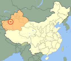 Aral (red) in Xinjiang province (orange) and China | |
| Coordinates: 40°30′56″N 81°15′49″E / 40.51556°N 81.26361°E | |
| Country | People's Republic of China |
| Autonomous region | Xinjiang |
| Area | |
| • Total | 5,258.739 km2 (2,030.410 sq mi) |
| Population (2010 Census) | |
| • Total | 166,205 |
| • Density | 32/km2 (82/sq mi) |
| Time zone | UTC+8 (China Standard) |
| Aral, Xinjiang | |||||||||||
| Chinese name | |||||||||||
|---|---|---|---|---|---|---|---|---|---|---|---|
| Simplified Chinese | 阿拉尔 | ||||||||||
| Traditional Chinese | 阿拉爾 | ||||||||||
| |||||||||||
| Uyghur name | |||||||||||
| Uyghur |
ئارال | ||||||||||
| |||||||||||
Aral[1][2] is a sub-prefecture-level city surrounded by Aksu Prefecture in Xinjiang Uyghur Autonomous Region, China. Aral in Uighur means "island."[3] Official spelling is 'Aral' but it is often written as 'Alar'.
History
The city was created by the Xinjiang production and Construction Corp as a means of emigration of Han Chinese to the region. Aral was opened as its own city in 2002 and thus saw a steady increase of population, reaching 166,205 in 2010.
Education
This city is also the location of Tarim University.
Geography
The city has an administrative area of 5,258.739 km2 (2,030.410 sq mi). It is bordered by mountainous regions to the north and northwest and the Taklamakhan desert to the east and south.
See also
Footnotes
- ↑ The official spelling according to Zhōngguó dìmínglù 中国地名录 (Beijing, SinoMaps Press 中国地图出版社 1997); ISBN 7-5031-1718-4
- ↑ The official spelling is Aral, according to the Zhōngguó dìmínglù 中国地名录 (Beijing, SinoMaps Press 1997); ISBN 7-5031-1718-4; p. 1, 299.
- ↑ http://www.uighurdictionary.com/cgi-bin/eudict_ud.pl
Coordinates: 40°30′56″N 81°15′49″E / 40.51556°N 81.26361°E
This article is issued from
Wikipedia.
The text is licensed under Creative Commons - Attribution - Sharealike.
Additional terms may apply for the media files.