Xingyi, Guizhou
| Xingyi 兴义市 | |
|---|---|
| County level city | |
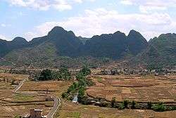 Countryside near Xingyi | |
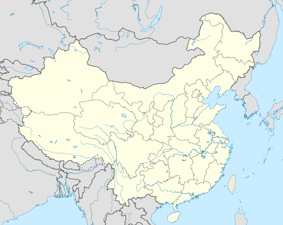 Xingyi Location within China | |
| Coordinates: 25°05′31″N 104°53′42″E / 25.092°N 104.895°ECoordinates: 25°05′31″N 104°53′42″E / 25.092°N 104.895°E | |
| Country | People's Republic of China |
| Province | Guizhou |
| Autonomous prefecture | Qianxi'nan Buyei and Miao Autonomous Prefecture |
| Area | |
| • Total | 2,911 km2 (1,124 sq mi) |
| Population (2010) | |
| • Total | 784,032 |
| • Density | 270/km2 (700/sq mi) |
| Time zone | UTC+8 (China Standard Time) |
| Postal code | 562400 |
| Area code(s) | 859 |
| License plate prefixes | 贵E |
| Website | www.gzxy.gov.cn (Chinese) |
Xingyi (simplified Chinese: 兴义; traditional Chinese: 興義; pinyin: Xīngyì) is a county-level city in the Qianxinan Buyei and Miao Autonomous Prefecture of Guizhou Province in southern China.
Geography
The city has an area of 2911 square kilometers, and a population of 784,032 as of 2010.[1] It is under the administration of the Qianxinan Buyei and Miao Autonomous Prefecture.
Transportation
Xingyi is served by the Nanning–Kunming Railway and by the Xingyi Airport.
Biodiversity hotspot
Based on Red Data Book listed endangered species of fish, amphibians, reptiles, and mammals, Xingyi is one of nine vertebrate biodiversity hotspots of China.[2]
Climate
| Climate data for Xingyi (1981−2010) | |||||||||||||
|---|---|---|---|---|---|---|---|---|---|---|---|---|---|
| Month | Jan | Feb | Mar | Apr | May | Jun | Jul | Aug | Sep | Oct | Nov | Dec | Year |
| Record high °C (°F) | 27.6 (81.7) |
31.0 (87.8) |
33.8 (92.8) |
34.5 (94.1) |
36.5 (97.7) |
33.7 (92.7) |
33.5 (92.3) |
32.1 (89.8) |
33.6 (92.5) |
30.4 (86.7) |
28.2 (82.8) |
26.5 (79.7) |
36.5 (97.7) |
| Average high °C (°F) | 11.7 (53.1) |
14.7 (58.5) |
19.4 (66.9) |
24.0 (75.2) |
25.7 (78.3) |
26.3 (79.3) |
26.9 (80.4) |
27.1 (80.8) |
25.1 (77.2) |
21.0 (69.8) |
17.6 (63.7) |
13.3 (55.9) |
21.1 (69.9) |
| Daily mean °C (°F) | 7.6 (45.7) |
10.0 (50) |
13.8 (56.8) |
18.3 (64.9) |
20.6 (69.1) |
21.9 (71.4) |
22.5 (72.5) |
22.3 (72.1) |
20.5 (68.9) |
16.9 (62.4) |
13.2 (55.8) |
9.1 (48.4) |
16.4 (61.5) |
| Average low °C (°F) | 5.0 (41) |
6.9 (44.4) |
10.2 (50.4) |
14.3 (57.7) |
16.9 (62.4) |
18.8 (65.8) |
19.6 (67.3) |
19.2 (66.6) |
17.3 (63.1) |
14.2 (57.6) |
10.3 (50.5) |
6.3 (43.3) |
13.3 (55.8) |
| Record low °C (°F) | −3.3 (26.1) |
−2.1 (28.2) |
−1.6 (29.1) |
3.6 (38.5) |
8.5 (47.3) |
12.8 (55) |
14.1 (57.4) |
14.3 (57.7) |
10.0 (50) |
6.4 (43.5) |
0.8 (33.4) |
−4.7 (23.5) |
−4.7 (23.5) |
| Average precipitation mm (inches) | 26.9 (1.059) |
33.5 (1.319) |
37.8 (1.488) |
50.6 (1.992) |
152.2 (5.992) |
298.3 (11.744) |
299.0 (11.772) |
230.5 (9.075) |
150.3 (5.917) |
101.4 (3.992) |
48.0 (1.89) |
22.4 (0.882) |
1,450.9 (57.122) |
| Average relative humidity (%) | 84 | 78 | 72 | 70 | 75 | 83 | 84 | 83 | 81 | 84 | 82 | 82 | 80 |
| Source: China Meteorological Data Service Center | |||||||||||||
References
- ↑ "Profile of Xingyi" (in Chinese). xzqh.org. Archived from the original on January 22, 2009. Retrieved 2009-01-28.
- ↑ Chen, Yang; An-Ping Chen; Jing-Yun Fang (2002). "Geographical distribution patterns of endangered fishes, amphibians, reptiles and mammals and their hotspots in China: a study based on "China Red Data Book of Endangered Animals"". Biodiversity Science. 10 (4): 359–368.
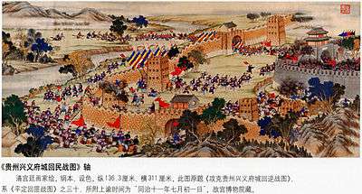
Capture of Xingyi by the Qing Dynasty during the Panthay Rebellion.
External links
This article is issued from
Wikipedia.
The text is licensed under Creative Commons - Attribution - Sharealike.
Additional terms may apply for the media files.