Delingha
| Delhi 德令哈市 · ᠳᠡᠯᠡᠬᠡᠢ ᠬᠣᠲᠠ · གཏེར་ལེན་ཁ་གྲོང་ཁྱེར། | |
|---|---|
| County-level city | |
 | |
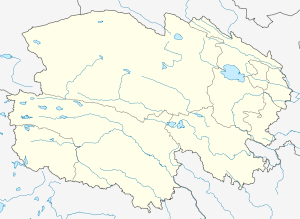
.png) Location of Delingha City (red) within Haixi Prefecture (yellow) and Qinghai | |
 Delhi Location of the city centre in Qinghai | |
| Coordinates: 37°23′N 97°23′E / 37.383°N 97.383°ECoordinates: 37°23′N 97°23′E / 37.383°N 97.383°E | |
| Country | People's Republic of China |
| Province | Qinghai |
| Prefecture | Haixi |
| Area[1] | |
| • Total | 27,700 km2 (10,700 sq mi) |
| Elevation | 2,982 m (9,783 ft) |
| Population (2010)[1] | |
| • Total | 78,184 |
| Time zone | UTC+8 (China Standard) |
| Postal code | 817000 |
| Area code(s) | 0977 |
Delingha (Chinese: 德令哈; pinyin: Délìnghā; Tibetan: གཏེར་ལེན་ཁ།, Wylie: gter-len-kha, ZYPY: Dêrlênka ), or Delhi (SASM/GNC/SRC romanization of Mongolian: Delhi hot ᠳᠡᠯᠡᠬᠡᠢ ᠬᠣᠲᠠ), is the seat of the Haixi Mongol and Tibetan Autonomous Prefecture in northern Qinghai province, China. It is located approximately 200 kilometres (120 mi) southeast of the Da Qaidam Administrative Region. It is a mainly industrial county-level city. The Ba'yin River divides the city into two parts: Hedong (河东; "River East") and Hexi (河西; "River West"). Because the prefecture seat is located in Hedong, it is slightly more flourishing than Hexi, which is chiefly agricultural.[1]
Established in 1988, Delingha administers 7 township-level divisions covering an area of 27,700 square kilometres (10,700 sq mi) and has a total population of 78,184, making it the smallest of the 5 cities in Qinghai. The name of the city comes from Mongolian and means "golden world" ᠠᠯᠲᠠᠨ ᠳᠡᠯᠡᠬᠡᠢ,[1] reflecting the relatively large Mongol population of the city. Da Qaidam administrative zone merged into Delingha in mid-2018.
Geography
Climate
Delingha has a cold arid climate (Köppen BWk), that borders on a semi-arid climate (Köppen BSk).
| Climate data for Delingha | |||||||||||||
|---|---|---|---|---|---|---|---|---|---|---|---|---|---|
| Month | Jan | Feb | Mar | Apr | May | Jun | Jul | Aug | Sep | Oct | Nov | Dec | Year |
| Average high °C (°F) | −3.7 (25.3) |
0.7 (33.3) |
6.7 (44.1) |
12.9 (55.2) |
17.8 (64) |
20.7 (69.3) |
23.1 (73.6) |
23.0 (73.4) |
18.3 (64.9) |
11.5 (52.7) |
3.7 (38.7) |
−1.6 (29.1) |
11.1 (52) |
| Daily mean °C (°F) | −10.9 (12.4) |
−6.6 (20.1) |
−0.5 (31.1) |
5.6 (42.1) |
11.0 (51.8) |
14.2 (57.6) |
16.5 (61.7) |
16.1 (61) |
11.2 (52.2) |
3.9 (39) |
−3.8 (25.2) |
−9.2 (15.4) |
4.0 (39.2) |
| Average low °C (°F) | −16.8 (1.8) |
−12.8 (9) |
−7.0 (19.4) |
−1.2 (29.8) |
4.5 (40.1) |
8.2 (46.8) |
10.7 (51.3) |
10.2 (50.4) |
5.2 (41.4) |
−2.0 (28.4) |
−9.4 (15.1) |
−14.9 (5.2) |
−2.1 (28.2) |
| Average precipitation mm (inches) | 4.0 (0.157) |
2.9 (0.114) |
4.6 (0.181) |
6.5 (0.256) |
21.2 (0.835) |
38.4 (1.512) |
40.9 (1.61) |
31.4 (1.236) |
17.6 (0.693) |
6.4 (0.252) |
1.2 (0.047) |
2.4 (0.094) |
177.5 (6.987) |
| Source: [www.weather.com.cn/html/cityintro/101150716.shtml Weather China] | |||||||||||||
Transportation
The Delingha Airport and Delingha Railway Station serve the city.
Missile headquarters
Delingha is the missile headquarters for Qinghai, and houses DF-4s with four associated launch sites. Delingha is one of five locations where anywhere between 10 and 20 DF-4s were deployed in 1998.[2]
Economy and industry
Delingha will be home to a 400 million yuan "Mars village" used by the Chinese Academy of Sciences to plan future Mars explorations missions.[3]
References
- 1 2 3 4 德令哈概况 (in Chinese). Xinhua.net. Retrieved 2011-12-08.
- ↑ Dekhang, Tsultrim (9 October 1998). "Nuclear Weapons on the Tibetan Plateau". The Government of Tibet in Exile. Archived from the original on 18 November 2008. Retrieved 2009-03-09.
- ↑ Chen, Laurie (September 7, 2017). "China's Mars base plan revealed ... and covering 95,000 sq km, there's certainly plenty of space". South China Morning Post. Retrieved September 9, 2017.