Rongcheng, Shandong
| Rongcheng 荣成市 | |
|---|---|
| County-level city | |
 Location in Weihai | |
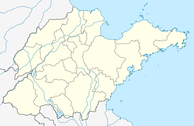 Rongcheng Location in Shandong | |
| Coordinates: 37°09′55″N 122°29′12″E / 37.16528°N 122.48667°ECoordinates: 37°09′55″N 122°29′12″E / 37.16528°N 122.48667°E | |
| Country | People's Republic of China |
| Province | Shandong |
| Prefecture-level city | Weihai |
| Area | |
| • Total | 1,392 km2 (537 sq mi) |
| Population (2002) | |
| • Total | 670,000 |
| • Density | 480/km2 (1,200/sq mi) |
| Time zone | UTC+8 (China Standard) |
| Area code(s) | 0631 |
Rongcheng (simplified Chinese: 荣成; traditional Chinese: 榮成; pinyin: Róngchéng) is a county-level city of Weihai City, at the eastern extremity of Shandong Province, China, looking out to the Yellow Sea in all directions but the west.
History
According to historical records, the First Emperor of the Qin dynasty had visited Rongcheng twice, building bridges and temples. In 1735, during the Qing dynasty, the Yongzheng Emperor gave Rongcheng its present name.
Administration
There are 10 subdistricts and 12 towns under Rongcheng's administration.
Subdistricts:
- Ningjin Subdistrict (宁津街道), Gangwan Subdistrict (港湾街道), Taoyuan Subdistrict (桃园街道), Wanglian Subdistrict (王连街道), Dongshan Subdistrict (东山街道), Chishan Subdistrict (斥山街道), Yatou Subdistrict (崖头街道), Chengxi Subdistrict (城西街道), Xunshan Subdistrict (寻山街道), Laoshan Subdistrict (崂山街道)
Towns:
Transport
- China National Highway 309
- Shandong Provincial Highway 301
- Shandong Provincial Highway 908
External links
| Sub-provincial cities |
| ||||||||||||||||||||||||||||||
|---|---|---|---|---|---|---|---|---|---|---|---|---|---|---|---|---|---|---|---|---|---|---|---|---|---|---|---|---|---|---|---|
| Prefecture-level cities |
| ||||||||||||||||||||||||||||||
| |||||||||||||||||||||||||||||||
This article is issued from
Wikipedia.
The text is licensed under Creative Commons - Attribution - Sharealike.
Additional terms may apply for the media files.