Haidong
| Haidong 海东市 | |
|---|---|
| Prefecture-level city | |
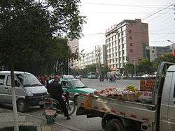 A street in Ping'an District | |
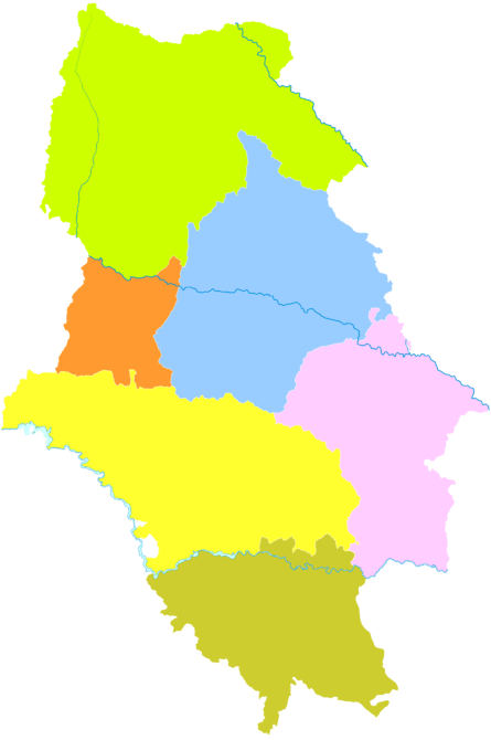
 Location of Haidong Prefecture in Qinghai | |
| Country | People's Republic of China |
| Province | Qinghai |
| Municipal seat | Ledu District |
| Area | |
| • Total | 12,810 km2 (4,950 sq mi) |
| Population (2010 Census) | |
| • Total | 1,396,846 |
| • Density | 110/km2 (280/sq mi) |
| Time zone | UTC+8 (China Standard) |
| ISO 3166 code | CN-QH-02 |
| Website |
www |
Haidong (simplified Chinese: 海东; traditional Chinese: 海東; pinyin: Hǎidōng; Wylie: Haitung) is a prefecture-level city of Qinghai province in Western China. Its name literally means "east of the (Qinghai) Lake." On 8 February 2013 Haidong was upgraded from a prefecture (海东地区) into a prefecture-level city.[1] Haidong is the second largest city in Qinghai after Xining.
Geography
Haidong is the easternmost division of Qinghai province. It is bounded by Xining, the provincial capital, to the West, the Datong River Valley to the north, Gansu to the east, and the Yellow River to the south. Mountain ranges tower above the district of which the main valley is the one of the Huang Shui (Tib. Tsong Chu), a major tributary of the Yellow River. This valley stretches from west to east and makes up - together with the area around Xining, the landscape which is called Tsongkha ("Onion Valley") by Tibetans. It has a total area of 13,100 square kilometres (5,100 sq mi)
Administrative divisions
| Map | |||||
|---|---|---|---|---|---|
| Name | Simplified Chinese | Hanyu Pinyin | Population (2010 Census) |
Area (km²) | Density (/km²) |
| Ping'an District | 平安区 | Píng'ān Qū | 102,975 | 750 | 137 |
| Ledu District | 乐都区 | Lèdū Qū | 260,185 | 2,821 | 92 |
| Minhe Hui and Tu Autonomous County | 民和回族土族自治县 | Mínhé Huízú Tǔzú Zìzhìxiàn |
350,118 | 1,780 | 197 |
| Huzhu Tu Autonomous County | 互助土族自治县 | Hùzhù Tǔzú Zìzhìxiàn |
356,437 | 3,321 | 107 |
| Hualong Hui Autonomous County | 化隆回族自治县 | Huàlóng Huízú Zìzhìxiàn |
203,317 | 2,740 | 74 |
| Xunhua Salar Autonomous County | 循化撒拉族自治县 | Xúnhuà Sǎlāzú Zìzhìxiàn |
123,814 | 1,749 | 70 |
Demographics
As of 2005, the total population of Haidong is approximately 1,480,000. It is the most densely populated area of Qinghai, with almost a third of the province's population (its surface makes up only two percent of Qinghai).
Further reading
References
- ↑ 2013年县级以上行政区划变更情况. XZQH (行政区划网). Retrieved 28 February 2013.