Dujiangyan City
| Dujiangyan 都江堰市 | ||||||||||||||||||||||||||||||||||||||||||||||||||||||||||||
|---|---|---|---|---|---|---|---|---|---|---|---|---|---|---|---|---|---|---|---|---|---|---|---|---|---|---|---|---|---|---|---|---|---|---|---|---|---|---|---|---|---|---|---|---|---|---|---|---|---|---|---|---|---|---|---|---|---|---|---|---|
| County-level city | ||||||||||||||||||||||||||||||||||||||||||||||||||||||||||||
 | ||||||||||||||||||||||||||||||||||||||||||||||||||||||||||||
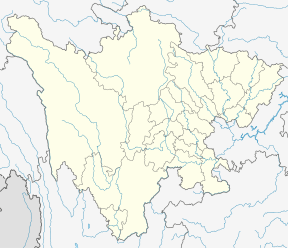 Dujiangyan Location in Sichuan Province | ||||||||||||||||||||||||||||||||||||||||||||||||||||||||||||
| Coordinates (Dujiangyan Government): 30°59′17″N 103°38′49″E / 30.988°N 103.647°ECoordinates: 30°59′17″N 103°38′49″E / 30.988°N 103.647°E | ||||||||||||||||||||||||||||||||||||||||||||||||||||||||||||
| Country | People's Republic of China | |||||||||||||||||||||||||||||||||||||||||||||||||||||||||||
| Province | Sichuan | |||||||||||||||||||||||||||||||||||||||||||||||||||||||||||
| Sub-provincial city | Chengdu | |||||||||||||||||||||||||||||||||||||||||||||||||||||||||||
| Municipal seat | Guankou (灌口街道) | |||||||||||||||||||||||||||||||||||||||||||||||||||||||||||
| Area | ||||||||||||||||||||||||||||||||||||||||||||||||||||||||||||
| • Total | 1,208 km2 (466 sq mi) | |||||||||||||||||||||||||||||||||||||||||||||||||||||||||||
| Population (2010)[1] | ||||||||||||||||||||||||||||||||||||||||||||||||||||||||||||
| • Total | 657,996 | |||||||||||||||||||||||||||||||||||||||||||||||||||||||||||
| • Density | 545/km2 (1,410/sq mi) | |||||||||||||||||||||||||||||||||||||||||||||||||||||||||||
| Time zone | UTC+8 (China Standard) | |||||||||||||||||||||||||||||||||||||||||||||||||||||||||||
| Postal code | 6118XX | |||||||||||||||||||||||||||||||||||||||||||||||||||||||||||
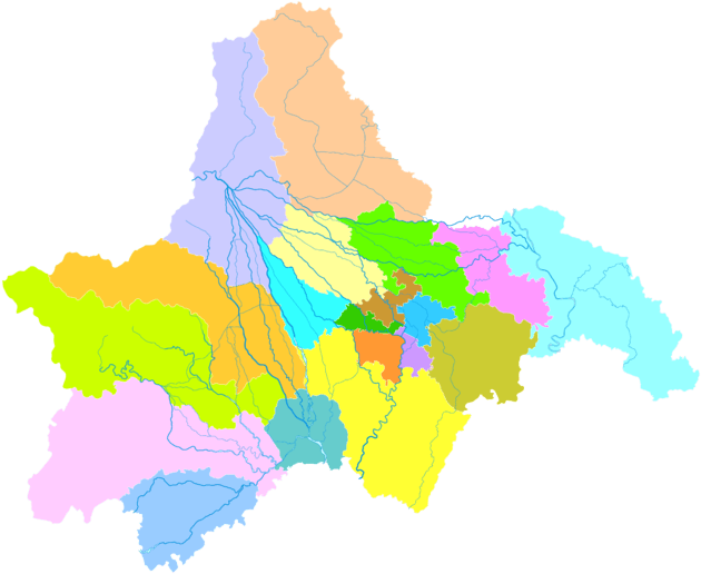
| Chengdu district map |
| |||||||||||||||||||||||||||||||||||||||||||||||||||||||||||
| Website |
www | |||||||||||||||||||||||||||||||||||||||||||||||||||||||||||
| Dujiangyan | |||||||||
| Chinese | 都江堰 | ||||||||
|---|---|---|---|---|---|---|---|---|---|
| Postal |
Tukiangyen Kwanhsien (until 1988) | ||||||||
| |||||||||
| Guanxian | |||||||||
| Traditional Chinese | 灌縣 | ||||||||
|---|---|---|---|---|---|---|---|---|---|
| Simplified Chinese | 灌县 | ||||||||
| Postal | Kwanhsien | ||||||||
| |||||||||
Dujiangyan (Chinese: 都江堰; pinyin: Dūjiāngyàn) is a county-level city, a subdivision of Chengdu, the capital of Sichuan Province, People's Republic of China. Its north-west region forms a border with southern Ngawa Tibetan and Qiang Autonomous Prefecture. It has an area of 1,208 km2 (466 sq mi) and had a population of 600,000 in 2003.[2]
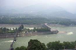
Dujiangyan was formerly a county named Guanxian or Guan County (灌县; ""irrigation" county"). The county became a county-level city in 1988 and was renamed after the Dujiangyan Irrigation System, in the city's northwest, famous for providing Chengdu with water for over two millennia, since around 250 BC.
History
Around 250 BC during the Warring States period, Li Bing, a governor of Shu (present Sichuan Province) in the Qin state with his son directed the construction of Dujiangyan. Li Bing gave up the old ways of dam building, which were simply directed at flood control, employing a new method of channeling and dividing the water of the Min River. He accomplished this by separating the project into two main parts: the headwork and the irrigation system. The whole system has functioned for 2,000 years, preventing floods and providing substantial irrigation and facilitating shipping and wood drifting. It has contributed greatly to the richness of Chengdu Plain with its reputation as "The Land of Abundance".
On 12 May 2008, the city was the closest to the epicenter of the 2008 Sichuan earthquake and the city suffered severe damage. Xinjian Primary School, Juyuan Middle School, and Xiang'e Middle School collapsed in the earthquake.[3][4][5]
Climate
Dujiangyan has a monsoon-influenced humid subtropical climate (Köppen Cwa) with cool, dry winters and hot, very wet summers.
| Climate data for Dujiangyan (1981−2010) | |||||||||||||
|---|---|---|---|---|---|---|---|---|---|---|---|---|---|
| Month | Jan | Feb | Mar | Apr | May | Jun | Jul | Aug | Sep | Oct | Nov | Dec | Year |
| Record high °C (°F) | 17.9 (64.2) |
21.0 (69.8) |
29.7 (85.5) |
31.3 (88.3) |
33.4 (92.1) |
34.7 (94.5) |
35.5 (95.9) |
35.0 (95) |
34.2 (93.6) |
28.2 (82.8) |
24.8 (76.6) |
17.2 (63) |
35.5 (95.9) |
| Average high °C (°F) | 8.3 (46.9) |
10.3 (50.5) |
14.6 (58.3) |
20.2 (68.4) |
24.7 (76.5) |
26.7 (80.1) |
28.7 (83.7) |
28.3 (82.9) |
24.3 (75.7) |
19.2 (66.6) |
14.9 (58.8) |
9.7 (49.5) |
19.2 (66.5) |
| Daily mean °C (°F) | 5.1 (41.2) |
7.0 (44.6) |
10.7 (51.3) |
15.8 (60.4) |
20.3 (68.5) |
22.9 (73.2) |
24.8 (76.6) |
24.3 (75.7) |
20.7 (69.3) |
16.1 (61) |
11.6 (52.9) |
6.4 (43.5) |
15.5 (59.9) |
| Average low °C (°F) | 2.5 (36.5) |
4.5 (40.1) |
7.6 (45.7) |
12.2 (54) |
16.7 (62.1) |
19.7 (67.5) |
21.6 (70.9) |
21.2 (70.2) |
18.2 (64.8) |
13.9 (57) |
9.2 (48.6) |
3.9 (39) |
12.6 (54.7) |
| Record low °C (°F) | −3.4 (25.9) |
−4.1 (24.6) |
−2.9 (26.8) |
3.6 (38.5) |
6.4 (43.5) |
13.3 (55.9) |
15.6 (60.1) |
15.0 (59) |
11.9 (53.4) |
2.9 (37.2) |
0.4 (32.7) |
−7.1 (19.2) |
−7.1 (19.2) |
| Average precipitation mm (inches) | 16.3 (0.642) |
23.4 (0.921) |
40.7 (1.602) |
63.8 (2.512) |
90.9 (3.579) |
118.8 (4.677) |
230.1 (9.059) |
257.6 (10.142) |
166.3 (6.547) |
65.8 (2.591) |
30.6 (1.205) |
12.5 (0.492) |
1,116.8 (43.969) |
| Average precipitation days (≥ 0.1 mm) | 10.4 | 13.1 | 15.3 | 16.2 | 17.5 | 17.2 | 18.7 | 17.2 | 20.3 | 18.5 | 12.4 | 8.6 | 185.4 |
| Average relative humidity (%) | 82 | 81 | 79 | 77 | 73 | 77 | 81 | 81 | 83 | 85 | 83 | 82 | 80 |
| Source #1: China Meteorological Data Service Center | |||||||||||||
| Source #2: Weather China (precipitation days 1971-2000) | |||||||||||||
Administrative divisions
Dujiangyan has 17 towns and two townships:
- Towns:
- Guankou (灌口镇)
- Xingfu (幸福镇)
- Puyang (蒲阳镇)
- Juyuan (聚源镇)
- Chongyi (崇义镇)
- Tianma (天马镇)
- Shiyang (石羊镇)
- Liujie (柳街镇)
- Yutang (玉堂镇)
- Zhongxing (中兴镇)
- Qingchengshan (青城山镇)
- Longchi (龙池镇)
- Xujia (胥家镇)
- Anlong (安龙镇)
- Daguan (大观镇)
- Zipingpu (紫坪铺镇)
- Cuiyuehu (翠月湖镇)
- Townships:
- Xiang'e (向峨乡)
- Hongkou (虹口乡)
Transport
Sister cities

See also
Notes
- ↑ 我市2010年第六次全国人口普查数据公报 (in Chinese). Government of Chengdu. 13 May 2011. Archived from the original on 30 September 2011. Retrieved 2011-08-04.
- ↑ (in Chinese) Profile of Dujiangyan City Archived 17 May 2008 at the Wayback Machine..
- ↑ "Chinese Are Left to Ask Why Schools Crumbled." The New York Times.
- ↑ "Provincial authority outlines school collapse reasons." China.org.
- ↑ "Overwhelmed by death, Sichuan disinfects." Reuters India.
References
- "Dujiangyan." ChinaCulture. 2003. Ministry of Culture. 13 Nov. 2006 <https://web.archive.org/web/20061210035257/http://www.chinaculture.org/gb/en_travel/2003-09/24/content_35909.htm>.
External links
| Wikimedia Commons has media related to Dujiangyan. |