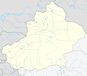
Kunyu, Xinjiang
| Kunyu 昆玉市 قۇرۇمقاش شەھىرى | |
|---|---|
| County-level & Sub-prefectural city | |
 Kunyu Location in Xinjiang | |
| Coordinates: 37°12′34″N 79°17′27″E / 37.20944°N 79.29083°ECoordinates: 37°12′34″N 79°17′27″E / 37.20944°N 79.29083°E | |
| Country | China |
| Autonomous region | Xinjiang |
| Established | 26 February 2016 |
| Area | |
| • Total | 687.13 km2 (265.30 sq mi) |
| Population (2016) | |
| • Total | 47,500 |
| • Density | 69/km2 (180/sq mi) |
| Time zone | UTC+8 (China Standard Time) |
| Area code(s) | 0903 |
| Kunyu, Xinjiang | |||||||||||
| Chinese name | |||||||||||
|---|---|---|---|---|---|---|---|---|---|---|---|
| Chinese | 昆玉 | ||||||||||
| |||||||||||
| Alternative Chinese name | |||||||||||
| Simplified Chinese | 库鲁木喀什 | ||||||||||
| Traditional Chinese | 库魯木喀什 | ||||||||||
| |||||||||||
| Uyghur name | |||||||||||
| Uyghur |
قۇرۇمقاش | ||||||||||
| |||||||||||
Kunyu is a county-level city in Xinjiang Uyghur Autonomous Region, China. It is geographically located in Hotan Prefecture of southern Xinjiang, but is directly administered by the Xinjiang regional government.[1]
The city was formerly the settled and cultivated areas of the 224th Regiment of the 14th Division of the Xinjiang Production and Construction Corps (XPCC).[2] In January 2016, the State Council of China approved the establishment of Kunyu City,[1] and it was officially established on 26 February 2016. The city covers an area of 687.13 square kilometres (265.30 sq mi).[2] Kunyu is located 78 kilometres (48 mi) from Hotan city, and is known for its Hotan dates.[2]
References
- 1 2 新疆兵团十四师获准设县级昆玉市,处于“反分裂斗争最前沿”. The Paper (in Chinese). 2016-01-21.
- 1 2 3 "中国最年轻城市在新疆挂牌成立 取名昆玉市" (in Chinese). Xinhua. 2016-02-28.
This article is issued from
Wikipedia.
The text is licensed under Creative Commons - Attribution - Sharealike.
Additional terms may apply for the media files.