Changji Hui Autonomous Prefecture
| Changji Prefecture 昌吉州 سانجى ئوبلاستى | |
|---|---|
| Autonomous prefectures | |
|
Changji Hui Autonomous Prefecture 昌吉回族自治州 سانجى خۇيزۇ ئاپتونوم ئوبلاستى | |
 Fukang, Changji | |
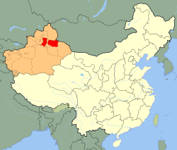 Changji prefecture (red) in Xinjiang (orange) | |
| Country | People's Republic of China |
| Autonomous region | Xinjiang |
| Time zone | UTC+8 (China Standard) |
| ISO 3166 code | CN-XJ-23 |
| Changji Hui Autonomous Prefecture | |||||||||||
| Chinese name | |||||||||||
|---|---|---|---|---|---|---|---|---|---|---|---|
| Chinese | 昌吉回族自治州 | ||||||||||
| Hanyu Pinyin | Chāngjí Huízú Zìzhìzhōu | ||||||||||
| |||||||||||
| Uyghur name | |||||||||||
| Uyghur |
سانجى خۇيزۇ ئاپتونوم ئوبلاستى | ||||||||||
| |||||||||||
Changji Hui Autonomous Prefecture is an autonomous prefecture located in the northeast of Xinjiang. The prefecture has an area of 77,129 km2 (29,780 sq mi) and its seat is Changji City.
Subdivisions
Changji directly controls 2 county-level cities, 4 counties and 1 autonomous county.
| Map | ||||||||
|---|---|---|---|---|---|---|---|---|
| Name | Hanzi | Hanyu Pinyin | Xiao'erjing | Uyghur (UEY) | Uyghur Latin (ULY) | Population (2010 Census) | Area (km²) | Density (/km²) |
| Changji City | 昌吉市 | Chāngjí Shì | ﭼْﺎکِ شِ | سانجى شەھىرى | Sanji Shehiri | 426,253 | 7,981 | 53.40 |
| Fukang City | 阜康市 | Fùkāng Shì | ﻓُﻮْﻛْﺎ شِ | فۇكاڭ شەھىرى | Fukang Shehiri | 165,006 | 8,545 | 19.31 |
| Hutubi County | 呼图壁县 | Hūtúbì Xiàn | خُوتُوبِ ﺷِﯿًﺎ | قۇتۇبى ناھىيىسى | Qutubi Nahiyisi | 210,201 | 9,518 | 22.08 |
| Manas County | 玛纳斯县 | Mǎnàsī Xiàn | مَانَاسِ ﺷِﯿًﺎ | ماناس ناھىيىسى | Manas Nahiyisi | 237,558 | 9,154 | 25.95 |
| Qitai County | 奇台县 | Qítái Xiàn | ٿِتَیْ ﺷِﯿًﺎ | گۇچۇڭ ناھىيىسى | Guchung Nahiyisi | 210,566 | 16,709 | 12.60 |
| Jimsar County | 吉木萨尔县 | Jímùsà'ěr Xiàn | کِمُوسَاعَر ﺷِﯿًﺎ | جىمىسار ناھىيىسى | Jimisar Nahiyisi | 113,284 | 8,170 | 13.86 |
| Mori Kazakh Autonomous County | 木垒哈萨克自治县 | Mùlěi Hāsàkè Zìzhìxiàn | مُولِؤ هَاسَاکْ ذِجِشِیًا | مورى قازاق ئاپتونوم ناھىيىسى | Mori Qazaq Aptonom Nahiyisi | 65,719 | 13,582 | 4.83 |

- Defunct: Miquan (county-level city)
Demographics
According to the 2010 census, Changji had a population of 1,428,587 inhabitants, with a population density of 19.4 inhabitants per km². Its population in the 2000 census was 1,503,097. Part of the change in population is due to boundary changes, for example, the formerly county-level city Miquan was merged into Midong District and became part of Ürümqi in 2007. The population in 2000 minus Miquan was 1,322,145.[1]
| Nationality | 2000[2] | 2010[3] | ||
|---|---|---|---|---|
| Population | % | Population | % | |
| Han | 1,129,384 | 75.14% | 1,075,852 | 75.31% |
| Hui | 173,563 | 11.55% | 136,013 | 12.15% |
| Kazakh | 119,942 | 7.98% | 133,286 | 8.40% |
| Uyghur | 58,984 | 3.92% | 63,606 | 4.13% |
| Mongols | 6,062 | 0.40% | 5,214 | 0.42% |
| Dongxiang | 2,908 | 0.19% | 3,176 | 0.20% |
| Manchu | 2,828 | 0.19% | 2,264 | 0.16% |
| Uzbek | 2,189 | 0.15% | 1,727 | 0.15% |
| Tujia | 1,171 | 0.08% | ||
| Others | 7,237 | 0.48% | 6,278 | 0.44% |
| Total | 1,503,097 | 100% | 1,428,587 | 100% |
Sister cities

References
- ↑ "CHĀNGJÍ HUÍZÚ ZÌZHÌZHŌU (Hui Autonomous Prefecture) Subdivision". City Population.
- ↑ 2000年人口普查中国民族人口资料,民族出版社,2003/9 ( ISBN 7-105-05425-5)
- ↑ Stanley W. Toops (August 2012). Susan M. Walcott, Corey Johnson, eds. Eurasian Corridors of Interconnection: From the South China to the Caspian Sea. Routledge. pp. 65–66. ISBN 978-1135078751.
This article is issued from
Wikipedia.
The text is licensed under Creative Commons - Attribution - Sharealike.
Additional terms may apply for the media files.