Changsha
| Changsha 长沙市 | |
|---|---|
| Prefecture-level city | |
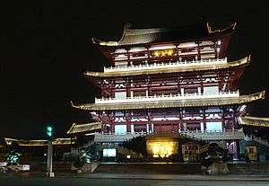
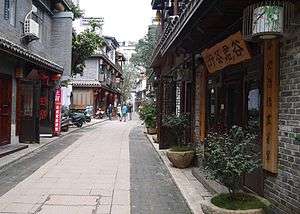
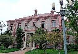
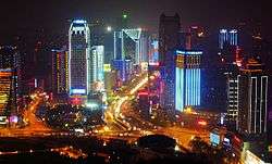
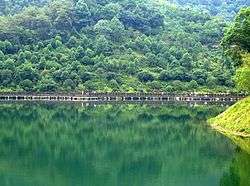
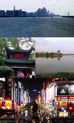 Clockwise from top: Skyline of Changsha, Yuehu Park, Huangxing South Pedestrian Street, Aiwan Pavilion | |
| Nickname(s): "星城" (Star City) | |
|
Motto(s): "心忧天下,敢为人先" (Care About the World, Dare to Be Pioneer) | |
.png) Location of Changsha City in Hunan | |
 Changsha Location of Changsha City in Hunan | |
| Coordinates: 28°13′40″N 112°56′20″E / 28.2277765095°N 112.9388453666°ECoordinates: 28°13′40″N 112°56′20″E / 28.2277765095°N 112.9388453666°E | |
| Country | People's Republic of China |
| Province | Hunan |
| Municipal seat | Yuelu District |
| Divisions | 9 County-level divisions, 172 Township divisions |
| Government | |
| • Party Secretary | Yi Lianhong |
| • Mayor | Hu Henghua |
| Area | |
| • Prefecture-level city | 11,819 km2 (4,563 sq mi) |
| • Urban (2018)[1] | 738 km2 (285 sq mi) |
| Elevation | 63 m (207 ft) |
| Population (2015) | |
| • Prefecture-level city | 7,431,800 |
| • Density | 630/km2 (1,600/sq mi) |
| • Urban (2018)[1] | 4,020,000 |
| • Urban density | 5,400/km2 (14,000/sq mi) |
| • Metro | 4,597,134 |
| • Rank in China | 19th |
| Ethnicity | |
| • Han | 99.22% |
| • Minorities | 0.78% |
| Time zone | UTC+8 (China Standard) |
| Postal code | 410000 |
| Area code(s) | 0731 |
| ISO 3166 code | CN-HN-01 |
| GDP Total (2016) |
CNY 931 billion (US$139 billion)[2] |
| GDP per capita (2016) |
CNY 127,346 (US$19,025) |
| GDP growth rate |
|
| License Plate |
湘A 湘O (police and authorities) |
| City tree | Camphor tree |
| City flower | Azalea |
| Languages | Mandarin, Changsha dialect |
| Website | www.changsha.gov.cn |
| Changsha | |||||||||||||||||||||||||||||||||||
.svg.png) "Changsha" in Simplified (top) and Traditional (bottom) Chinese characters | |||||||||||||||||||||||||||||||||||
| Simplified Chinese | 长沙 | ||||||||||||||||||||||||||||||||||
|---|---|---|---|---|---|---|---|---|---|---|---|---|---|---|---|---|---|---|---|---|---|---|---|---|---|---|---|---|---|---|---|---|---|---|---|
| Traditional Chinese | 長沙 | ||||||||||||||||||||||||||||||||||
| Hanyu Pinyin | Chángshā | ||||||||||||||||||||||||||||||||||
| Xiang | Tsã13-sɔ33 | ||||||||||||||||||||||||||||||||||
| Literal meaning | "Long Sandbar" | ||||||||||||||||||||||||||||||||||
| |||||||||||||||||||||||||||||||||||
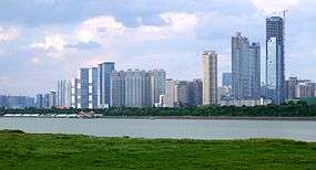
Changsha (Chinese: 长沙) is the capital and most populous city of Hunan province in the south central part of the People's Republic of China. It covers 11,819 km2 (4,563 sq mi) and is bordered by Yueyang and Yiyang to the north, Loudi to the west, Xiangtan and Zhuzhou to the south, Yichun and Pingxiang of Jiangxi province to the east. According to 2010 Census, Changsha has 7,044,118 residents, constituting 10.72% of the province's population.[3] It is part of the Chang-Zhu-Tan city cluster or megalopolis.
Changsha is located in the Xiang River valley plain, bordering on Luoxiao Mountains on the east, Wuling Mountains on the west, edging in Dongting Lake on the north and bounded on the south by Hengshan Mountains. It has a monsoonal humid subtropical climate, with an average annual air temperature of 16.8 to 17.3 °C (62.2 to 63.1 °F) and an annual rainfall of 1,358.6 to 1,552.5 mm (53.49 to 61.12 in).[4]
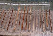
Changsha has a history of more than 3,000 years.[5] Changsha was the capital of Changsha State in the Han Dynasty (206 BC – 220 AD), and the capital of the Chu State (907–951) in the Ten Kingdoms period. The lacquerware and Silk Texts recovered from Mawangdui (2nd century BC) there are an indication of the richness of local craft traditions. In 1904, Changsha was opened to foreign trade, and large numbers of Europeans and Americans settled there. Changsha was the site of Mao Zedong's conversion to communism. It was also the scene of major battles in the Sino-Japanese War (1931–1945) and was briefly occupied by the Japanese. Changsha is now an important commercial, manufacturing and transportation centre.
Etymology
The origins of the name "Changsha" in unknown. The name first appears in the 11th century BC, during the reign of King Cheng of the Zhou dynasty: a vassal lord from the Changsha area sent a type of softshell turtle known as "Changsha softshell turtle" (simplified Chinese: 长沙鳖; traditional Chinese: 長沙鼈; pinyin: Chángshā biē) to the Zhou king as a tribute. In the 2nd century AD, historian Ying Shao wrote that the Qin dynasty use of the name Changsha for the area was a continuance of its old name.[6]
History
Pre-History
Development started around 3000 BC when Changsha developed with the proliferation of Longshan culture, although there is no firm evidence of such a link.[7] Despite this, pottery and bronze ware have been discovered.
Folklore
In the Central Plain region during the Zhou and Shang dynasties, Yandi and Huangdi in regards to their relationship between the Central Plains, paid a visit. Sima Qian writes in his Records of the Grand Historian "Huangdi, loving his (oldest son) Shaohao, gave him a parcel of land, an area amounted to Changsha and surrounding land."
1st-century History
Evidence exists that people lived and thrived in the area during the Bronze Age. Numerous examples of pottery and other objects have been discovered.
Jing-Chu Culture and Culture of Central Plains
Eastern Zhou's collapse swept in turmoil with the Spring and Autumn Period (770-476BC). The Yue culture spread and took a stronghold through the region, especially through Changsha. During the height of the Warring States Period, the Chu Kingdom took a hardline nationalist and reform approach and took a large-scale military operations in South China. Chu Kingdom took control of Changsha and turned the city into an important part of the southern part of Chu. After years of war and occupation, Changsha slowly replaced Yue culture with Chu culture. In 1951-1957, archaeologists explored numerous large and medium-sized Chu tombs from the warring states era. More than 3,000 tombs have been discovered.
The city is sometimes called Qingyang (simplified Chinese: 青阳; traditional Chinese: 青陽; pinyin: Qīngyáng) in Warring States period texts.
Qin and Han dynasties
Changsha transformed into the Changsha Kingdom. It existed as a fiefdom under the tutelage of the Qin and later the Han dynasty. Under the Qin dynasty (221–206 BC), it became a staging post for Qin expeditions into Guangdong province. By 202 BC, it was already a fortified city. During the Han dynasty, it was also the capital of Changsha Kingdom, an imperial fiefdom of the Han. From Han times (206 BC – AD 220), it held the name Linxiang County and was the seat of the Changsha commandery. The county was renamed back Changsha in 589
During the Han dynasty the Mawangdui tombs were constructed between 186 and 165 BC. The earliest tomb (no. 2), when excavated in the 1970s, was seen to have preserved the corpse of Lady Xin Zhui in a surprisingly good condition. Also found in the tomb were the earliest versions of the Dao De Jing, the main text of Taoism, among many other historical documents.
Three Kingdoms to Sui and Tang dynasty
With the collapse of the Han dynasty, China fell into turmoil amidst of the rise of the Three Kingdoms. The power base of Changsha fragmented into three factions.
Western Jin
Changsha soon fell under control of the Jin dynasty. Emperor Wudi appointed the ruler and governor to be the sixth son of a general Sima Yi. The local government had over 100 counties at the beginning of the dynasty. Over the course of the dynasty, the local government of Changsha lost control over a few counties, leaving them to local rule.
Sui dynasty
In 589, the Sui dynasty emerged as the sole power in China. This emergence ended the northern and Southern dynasties era and reunified China once again under one government.
With the emergence of the Sui dynasty, Changsha was renamed to the name of Tanzhou. In addition, a new form of government was reintroduced. Changsha's 3-tier division system was changed to a 2-tier state and county system, eliminating the middle canton region. This new system is a significant improvement for efficiency. The existing counties in the Hunan region, including Changsha, were either outright replaced or greatly restructured. Some of the new counties created, such as Wangcheng, Liuyang, Liling still exist to this day. Neighboring town such as Xiangtan have experienced such restructure of counties that still exist to this day.
- Tang dynasty
The Tang dynasty brought new prosperity and peace to Changsha. the city became a place of trade between China and Southeast Asia. Changsha experienced violence during the Anshi Rebellion when rebels swept through the area.
Song dynasty
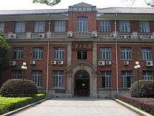
- Yuelu Academy was founded in AD 976 (during the period of the Song dynasty). It was destroyed by war in 1127 and was rebuilt in 1165 (during the Southern Song dynasty). The celebrated philosopher Zhu Xi taught at the Academy in 1165. It was again destroyed, this time by the Mongols, but was restored in the late 15th century (Ming dynasty). Early 19th century graduates of the academy formed what one historian called a "network of messianic alumni", including Zeng Guofan, architect of the Tongzhi Restoration,[8] and Cai E, a major leader in the defense of the Republic of China.[9] (In 1903 the academy became Hunan High School. The modern day Hunan University is a descendant of the academy. The architecture of some of the buildings of the university was restored from 1981 to 1986, presumably according to their original Song design.)
Yuan and Ming dynasty
Changsha was fiercely defended by local Song troops during the Mongol conquest of the Song Dynasty and, after it fell into Mongol hands an event of mass suicide by the Changsha defenders took place in the city.
Under the Ming (1368–1644) and Qing (1644–1911/12) dynasties, Changsha was made a superior prefecture. Its name was also reverted to Changsha.
Qing Dynasty
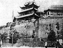
From 1664 onward, it was the capital of Hunan, prospering as one of China's chief rice markets. During the Taiping Rebellion, the city was besieged by the rebels (1854) but never fell; it then became the principal base for the suppression of the rebellion. It was opened to foreign trade in 1904. Further development followed the opening of the railway to Hankou in Hubei province in 1918, which was later extended to Guangzhou in Guangdong province in 1936. Although Changsha's population grew, the city remained primarily commercial in character and before 1937 had little industry apart from some small cotton-textile, glass, and nonferrous-metal plants and handicraft enterprises.
In 1852 Taiping forces laid a siege on Changsha through 3 months, but they subsequently gave up the offensive and moved onto Wuhan.
The 1903 Treaty of Shanghai between the Qing dynasty and Japan opened the city to foreign trade. Consequently, factories, churches and schools were built. A college was started by Yale University bachelors, which later became a medical centre named Xiangya and a secondary school named the Yali School.
Modern era
Mao Zedong, the founder of the People's Republic of China, began his political career in Changsha. He was a student at the Hunan Number 1 Teachers' Training School from 1913 to 1918. He later returned as a teacher and principal from 1920 to 1922. The school was destroyed during the Chinese Civil War but has since been restored. The former office of the Hunan Communist Party Central Committee where Mao Zedong once lived is now a museum that includes Mao's living quarters, photographs and other historical items from the 1920s.
Until May 1927, communist support remained strong in Changsha before the massacre carried out by the right-wing faction of the KMT troops. The faction owed its allegiance to Chiang Kai-shek during its offensive against the KMT's left-wing faction under Wang Jingwei, who was then allied closely with the Communists. The purge of communists and suspected communists was part of Chiang's plans for consolidating his hold over the KMT, weakening Wang's control, and thereby over the entire China. In a period of twenty days, Chiang's forces killed more than ten thousand people in Changsha and its outskirts.
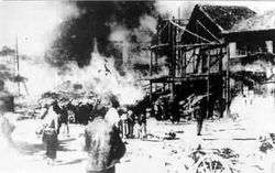
During the Second Sino-Japanese War (1937–45), the strategic location of Changsha made it the focus of four campaigns by the Japanese to capture it from the hands of the Chinese Nationalists: these campaigns were the 1st Changsha,[10] the 2nd Changsha, the 3rd Changsha, and the 4th Changsha. The city was able to repulse the first three attacks, thanks to Xue Yue's leadership, but ultimately fell into Japanese hands in 1944 for a year until the Japanese were defeated in a counterattack and forced to surrender.[11][12] Before these Japanese campaigns, the city was already virtually destroyed by the 1938 Changsha Fire, which was a deliberate fire ordered by Kuomintang commanders who mistakenly feared the city was about to fall to the Japanese; Generalissimo Chiang Kai-shek had suggested that the city should be burned so that the Japanese force would gain nothing after entering it.[13]
The city later became the territory of then-expanding Communist China when it was finally completed in 1949 after the Kuomintang were driven to Taiwan.
Late 20th-century
Since the late 1990s, Changsha has rapidly developed, becoming one of the important cities in the central and western regions. At the end of 2007, Changsha, with Xiangtan, Zhuzhou was approved by the State Council for the Chang-Zhu-Tan " (Greater Changsha) resource-saving and environment-friendly society" comprehensive reform pilot area, an important engine of the rise of central China. In 2015, Xiangjiang New Area was approved as a national new district
Geography
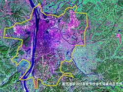
Changsha is located in the northeast of Hunan Province, the lower reaches of the Xiang River and the western part of the Changliu Basin. It lies between 111°53′ to 114°15′ east longitude and 27°51′ to 28°41′ north latitude. The city borders Yichun and Pingxiang of Jiangxi Province in the east, Zhuzhou and Xiangtan in the south, Loudi and Yiyang in the west, and Yueyang and Yiyang in the north. It is about 230 kilometres from east to west and about 88 kilometres from north to south. Changsha covers an area of 11,819 km2 (4,563 sq mi), of which the urban area of 2,150.9 km2 (830.5 sq mi), the urban built-up area is 374.64 km2 (144.65 sq mi). The highest point in Changsha is Mount Qixing (七星岭) located in Daweishan Town, 1,607.9 m (5,275 ft). The lowest point is Zhanhu (湛湖) in Qiaokou Town, 23.5 m (77 ft).[14]
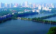
The Xiang is the main river in the city, it runs 74 km (46 mi) from south to north throughout the territory. There are 15 tributaries flowing into the Xiang River, of which Liuyang, Laodao, Jinjiang and Wei are the four largest tributaries in Changsha.[14] The Xiang River divides the city proper into two parts of the west and the east, The eastern part is mainly commercial area and the west is mainly cultural and educational area. On October 10, 2001, the seat of Changsha City was transferred from Fanzheng Street to Guanshaling. Since then, the economy of both sides of the Xiang River has achieved a balanced development.[15]
Climate
Changsha has a humid subtropical climate (Köppen Cfa), with annual average temperature being at 17.03 °C (62.7 °F), with a mean of 4.6 °C (40.3 °F) in January and 29.0 °C (84.2 °F) in July. Average annual precipitation is 1,331 millimetres (52.4 in), with a 275-day frost-free period. With a monthly possible-sunshine percentage ranging from 19% in March to 57% in August, the city receives 1,545 hours of bright sunshine annually. The four seasons are distinct. The summers are long and very hot, with heavy rainfall, and autumn is comfortable and is the driest season. Winter is chilly and overcast with lighter rainfall more likely than downpours; cold snaps occur with temperatures occasionally dropping below freezing. Spring is especially rainy and humid with the sun shining less than 30% of the time. The minimum temperature ever recorded since 1951 at the current Wangchengpo Weather Observing Station was −12.0 °C (10.4 °F), recorded on 9 February 1972. The maximum was 40.6 °C (105.1 °F) on 13 August 1953 and 2 August 2003 [the unofficial record of 43.0 °C (109.4 °F) was set on 10 August 1934].
| Climate data for Changsha Wangchengpo Weather Observing Station (望城坡; WMO ID 57687), 1971–2013 | |||||||||||||
|---|---|---|---|---|---|---|---|---|---|---|---|---|---|
| Month | Jan | Feb | Mar | Apr | May | Jun | Jul | Aug | Sep | Oct | Nov | Dec | Year |
| Record high °C (°F) | 26.9 (80.4) |
30.6 (87.1) |
32.7 (90.9) |
36.1 (97) |
36.3 (97.3) |
38.2 (100.8) |
39.7 (103.5) |
40.6 (105.1) |
38.2 (100.8) |
35.1 (95.2) |
30.9 (87.6) |
24.9 (76.8) |
40.6 (105.1) |
| Average high °C (°F) | 8.7 (47.7) |
9.7 (49.5) |
14.7 (58.5) |
21.3 (70.3) |
26.1 (79) |
29.9 (85.8) |
33.7 (92.7) |
33.3 (91.9) |
28.3 (82.9) |
23.1 (73.6) |
17.2 (63) |
11.3 (52.3) |
21.4 (70.6) |
| Daily mean °C (°F) | 4.7 (40.5) |
6.2 (43.2) |
10.9 (51.6) |
16.8 (62.2) |
21.6 (70.9) |
25.9 (78.6) |
29.3 (84.7) |
28.7 (83.7) |
24.2 (75.6) |
18.5 (65.3) |
12.5 (54.5) |
7.1 (44.8) |
17.2 (63) |
| Average low °C (°F) | 1.6 (34.9) |
3.4 (38.1) |
7.8 (46) |
13.7 (56.7) |
18.4 (65.1) |
22.4 (72.3) |
25.3 (77.5) |
24.9 (76.8) |
20.3 (68.5) |
14.7 (58.5) |
9.0 (48.2) |
3.4 (38.1) |
13.7 (56.7) |
| Record low °C (°F) | −9.5 (14.9) |
−12.0 (10.4) |
−2.3 (27.9) |
1.9 (35.4) |
8.9 (48) |
13.1 (55.6) |
19.7 (67.5) |
16.7 (62.1) |
11.8 (53.2) |
2.4 (36.3) |
−2.8 (27) |
−10.3 (13.5) |
−12 (10.4) |
| Average precipitation mm (inches) | 66.1 (2.602) |
95.2 (3.748) |
128.5 (5.059) |
207.2 (8.157) |
178.5 (7.028) |
202.4 (7.969) |
93.0 (3.661) |
107.0 (4.213) |
56.8 (2.236) |
84.2 (3.315) |
71.2 (2.803) |
41.2 (1.622) |
1,331.3 (52.413) |
| Average precipitation days (≥ 0.1 mm) | 13.6 | 14.0 | 17.8 | 18.8 | 16.3 | 13.3 | 9.7 | 9.9 | 9.8 | 11.1 | 10.2 | 9.4 | 153.9 |
| Average relative humidity (%) | 83 | 85 | 85 | 84 | 83 | 84 | 77 | 79 | 81 | 81 | 80 | 79 | 82 |
| Mean monthly sunshine hours | 76.2 | 63.0 | 69.4 | 88.3 | 122.8 | 144.8 | 238.3 | 229.6 | 160.0 | 133.4 | 115.7 | 103.2 | 1,544.7 |
| Percent possible sunshine | 24 | 20 | 19 | 23 | 29 | 35 | 56 | 57 | 43 | 38 | 36 | 32 | 35 |
| Source: China Meteorological Administration | |||||||||||||
Administration
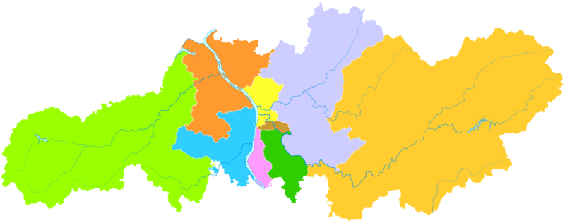
The municipality of Changsha exercises jurisdiction over 6 districts, 1 county and 2 county-level cities:
| Map | |||||
|---|---|---|---|---|---|
| Subdivision | Simplified Chinese | Pinyin | Pop.
(2010 Census) |
Area (km²) | Dens. (/km²) |
| City Proper | |||||
| Furong District | 芙蓉区 | Fúróng Qū | 523,730 | 42 | 12,470 |
| Tianxin District | 天心区 | Tiānxīn Qū | 475,663 | 74 | 6,428 |
| Yuelu District | 岳麓区 | Yuèlù Qū | 801,861 | 552 | 1,453 |
| Kaifu District | 开福区 | Kāifú Qū | 567,373 | 187 | 3,034 |
| Yuhua District | 雨花区 | Yǔhuā Qū | 725,353 | 114 | 6,363 |
| Wangcheng District | 望城区 | Wàngchéng Qū | 523,489 | 970 | 540 |
| Suburban and rural | |||||
| Liuyang City | 浏阳市 | Liúyáng Shì | 1,278,928 | 4,999 | 256 |
| Ningxiang City | 宁乡市 | Níngxiāng Shì | 1,168,056 | 2,906 | 402 |
| Changsha County | 长沙县 | Chángshā Xiàn | 979,665 | 1,997 | 491 |
Government
The current CPC Party Secretary of Changsha is Hu Henghua and the current Mayor is Hu Zhongxiong.
Transportation
Changsha is well connected by roads, river, rail, and air transportation modes, and is a regional hub for industrial, tourist, and service sectors.
Public transport
The city's public transportation system consists of an extensive bus network with over a hundred lines as well as taxis.
Metro Rail
Changsha Metro is planning a 6-line network.[16] Metro Line 2 opened on 29 April 2014[17] with 20 stations for Line 2[16] now open on 28 June 2016.[18][19] A further four lines are planned for construction before the year 2025.[17] Line 3 will run southwest–northeast and will be 33.4 kilometres (20.8 mi) long. Line 4 will run northwest-southeast and will be 29.1 kilometres (18.1 mi) long.[20] A maglev link running 16.5 kilometres (10.3 mi) between Changsha South station and Changsha airport was opened in April 2016, with a construction cost of €400m.[17][21][22] Connecting Changsha with Zhuzhou and Xiangtan, Changzhutan Intercity Rail has been opened to traffic operations on December 26, 2016.[23]
Roads
The G4, G4E, G4W2, G5513 and G0401 of National Expressways, G107, G106 and G319 of National Highways, S20, S21, S40, S41, S50, S60 and S71 of Hunan provincial Expressways, connect the Changsha metro area nationally. There are three main bus terminals in Changsha: the South Station, East Station and West Station, dispatching long- and short-haul trips to cities within and outside the province of Hunan.
River
Changsha is surrounded by major rivers, including the Xiang River (湘江) and its tributaries such as the Liuyang, Jin, Wei, Longwanggang and Laodao Rivers. Ships transport mainly goods from Xianing port located in North Changsha domestically and internationally.
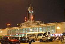
Rail
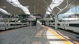
Changsha Railway Station is located in the city center and provides express and regular services to most cities in China via the Beijing–Guangzhou and Shimen–Changsha Railways. The Changsha South Railway Station is a new high speed railway station, located in Yuhua district on the Beijing–Guangzhou High-Speed Railway (as part of the planned Beijing–Guangzhou–Shenzhen–Hong Kong High-Speed Railway). The station with 8 platforms[24] was finally opened on 26 December 2009.[25] Since then the passenger volume has increased greatly.[26] The Hangzhou-Changsha-Huaihua sector of the Shanghai-Changsha-Kunming high-speed railway entered service in 2014.
Air
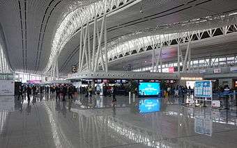
Changsha Huanghua International Airport is a regional hub for China Southern Airlines. The airport serves daily flights to major cities in China, including Beijing, Shanghai and Guangzhou, as well as Hong Kong, Macau and Taipei. Other major airlines also provide daily service between Changsha and other domestic and international destinations.The airport provides direct flights to 45 major international cities including Los Angeles, Singapore, Seoul, Pusan, Osaka, Tokyo, Kuala Lumpur, Frankfurt as well as Sydney.[27] As of 5 August 2016, the airport daily handled 70,011 people.[28]
Economy
Changsha's population nearly tripled between the start of its rebuilding in 1949 and the early 1980s. The city is now a major port, handling rice, cotton, timber, and livestock, and is also a collection and distribution point on the railway from Hankou to Guangzhou. It is a centre of rice milling and also has oil-extraction, tea and tobacco production, and meat-processing plants. Its textile industry produces cotton yarn and fabrics and engages in dyeing and printing. Agricultural chemicals and fertilizers, farm implements, and pumping machinery are also produced.
Changsha has a large thermal generating station linked by a power grid with the nearby industrial centres of Zhuzhou and Xiangtan; the three cities were designated in the 1970s as the nucleus of a major industrial complex. In the 1960s there was some development of heavy industry. The manufacture of machinery, especially machine tools and precision tools, became important, and Changsha became a center of China's aluminum industry. The city also has cement, rubber, ceramic, and papermaking plants and is a centre for many types of traditional handicrafts, producing Xiang embroidery, leather goods, umbrellas, and buttons. Coal is mined in the vicinity.
Changsha is one of China's 20 most "economically advanced" cities. In 2008, Changsha's nominal GDP was ¥300.1 billion (US$43 billion), a year-on-year growth of 15.1% from the previous year. Its per capita GDP was ¥45,765 (US$6,589).[29] Its GDP grew at an average of 14% per year from 2001 to 2005, compared to the national average of 9% in the period. As of 2005, the service sector generated roughly around 49% of Changsha's GDP, up 112% from 2001 figures, leading to a disposable income for urban residents of 12,343 RMB annually. This growth is expected to continue driving the city's economic growth.[30] The manufacturing and construction sectors have grown relatively steadily, growing 116% during 2001-2005. The primary sector, including agriculture, forestry, animal husbandry, and fishery, has grown slightly over this same period. In addition, the consumer market has grown dramatically along with income levels, with the minimum salary level at 600 RMB per month in comparison to Beijing's at 640 RMB or Shanghai's at 750 RMB per month.[31] Urban residents in 2005 had an average income of about US$1,500, 15% higher than the national average and up 10% from 2001 figures.[32]
Changsha has attracted a substantial level of foreign investment. In 2005, for example, nearly US$1 billion worth of foreign direct investment (FDI) poured into the city, mainly in hi-tech, manufacturing, food production, and services. This figure is up 40% from 2001. 59% of the total FDI has come from Hong Kong, South Korea, Singapore, and Japan; 28% has come from the Americas and 9% from Europe.[33] By the end of 2008 more than 500 foreign companies had made over US$10 million worth of investments in Changsha.[34] Changsha had total retail sales of 74 RMB billion in 2006.[35]
But rapid economic growth has made environmental pollution a serious problem in Changsha, caused by rapidly increasing numbers of private cars, widespread construction sites, and numerous industrial facilities on the outskirts of the city.
Sky City
On 20 July 2013, the Sky City skyscraper broke ground.[36] A groundbreaking ceremony of the building was held. At completion it will be the new world's tallest skyscraper. The planned final height is 838 meters with 220 floors.[36] The Broad Sustainable Building company, which specializes in the rapid construction of large buildings, planned to complete construction in early 2014.[36][37][38] However, the project was halted by the authorities on 24 July 2013 due to its having started construction without prior law permits.[39][40] Some experts also questioned the safety of the 838-meter skyscraper's being built in only 7 months.[41] On 4 September 2013, China.com.cn reported that the project had begun environmental assessment for obtaining the official planning approval for the project.[42] By 30 October the building was already in the final approval phase.[43]
On 8 June 2016 it was reported by the People's Daily that the project had been finally cancelled due to protests over environmental damage to the Daze Lake wetland.
Development Zones
The Changsha ETZ was founded in 1992. It is located in Xingsha, the eastern Changsha. The total planned area is 38.6 km2 (14.9 sq mi) and the current area is 38.6 km2 (14.9 sq mi). Near the zone are National Highways 319 and 107 as well as the G4 Beijing–Hong Kong–Macau Expressway. The zone is also very close to Changsha's downtown area and the railway station, while the distance between the zone and the city's airport is a mere 8 km (5.0 mi). The major industries in the zone include the high-tech industry, the biology project technology industry, and the new material industry.[44]
The Liuyang ETZ is a national biological industry base created on 10 January 1998, located in Dongyang Town. Its pillar industry comprises biological pharmacy, Information technology and Health food. As of 2015, It has more than 700 registered enterprises. The total industrial output value of the zone hits 85.6 billion yuan (US$13.7 billion) and its business income is 100.2 billion yuan (US$16.1 billion).[45] Its builtup area covers 16.5 km2 (6.4 sq mi).[46]
Population and Demographics
Changsha has an urban population of 7,044,118. A total of 12,966,836 reside in the metropolitan area.[47]
Ethnic Groups
The majority of people living in Changsha are Han Chinese. A sizeable population of several ethnic minority groups also make Changsha home. The three largest minorities, the Hui, Tujia, and Miao peoples, make up sizeable sub-populations in the city. The 2000 census shows that a total of 48,564 people who are members of ethnic minorities live in Changsha. The other minorities make up a significantly smaller part of the population. Twenty ethnic minorities have fewer than 1000 individuals living in the city.[47][48]
Culture
Media
Hunan Broadcasting System is China's largest television after China Central Television (CCTV). Its headquarters is in Changsha and produces some of the most popular programs in China, including Super Girl. These programs have also brought a new entertainment industry into the city, which includes singing bars, dance clubs, theater shows, as well as related businesses including hair salons, fashion stores, and shops for hot spicy snacks at night (especially during summer). While Changsha has developed into an entertainment hub, the city has also become increasingly westernized and has attracted a growing number of foreigners.
Cuisine
There are various types of cuisine found in Changsha, yet Hunan cuisine remains to be the most popular genre. Hot and spicy food is typical of the region.
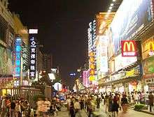
In addition, street food is also popular. Changsha Stinky Tofu is always identified as the icon of Changsha Street food and is renowned in the nation.
The city has its own Siu yeh culture.
In May 2008, the BBC broadcast, as part of its Storyville documentary series, the four-part The Biggest Chinese Restaurant in the World, which explored the inner workings of the 5,000-seating-capacity West Lake Restaurant (Xihu Lou Jiujia) in Changsha.
Sports
Changsha has one of China's largest multi-purpose sports stadiums—Helong Stadium, with 55,000 seats. The stadium was named after the Communist military leader He Long. It is the home ground of local football team Hunan Billows F.C., which plays in China League Two. The more modest 6,000-seat Hunan Provincial People's Stadium, also located in Changsha, is used by the team for their smaller games.[49]
Historical culture
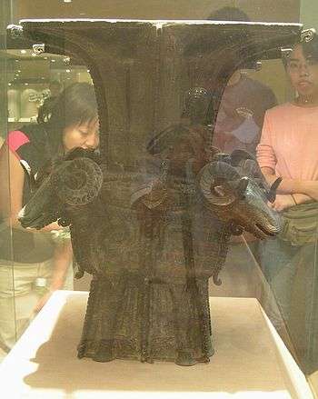
Changsha hosts the Hunan Provincial Museum. 180,000 historical significant artifacts franginng from the Zhou dynasty to the recent Qing Dynasty are hosted in the 51,000 acres of space in the museum.[50]
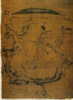
Mawangdui is a well-known tomb located 22 kilometers east of Changsha.[51][52] It was discovered with numerous artifacts from the Han dynasty. Numerous Silk Funeral banners surround the tomb, along with a wealth of classical texts.[53][54] The tomb of Lady Dai lies in Mawangdui is well known due to its well-preserved state: scientists were able to detect blood, conduct an autopsy and determined that she died of heart disease due to a poor diet.[55][56]
Changsha is a sister city with St. Paul, Minnesota. St. Paul is developing a China garden at Phalen Park, based on the design of architects from Changsha.[57] Current plans include a pavilion replicating one in Changsha, while in return St. Paul will send the city five statues of the Peanuts characters. They will be placed in Phalen's sister park, Yanghu Wetlands.[58]
Education
Colleges and universities
Changsha is the seat of many ancient schools and academies.[59] It is the site of the Hunan Medical University (1914) and has several colleges and institutes of higher learning.
National
Public
- Hunan Normal University
- Hunan Agricultural University
- Hunan First Normal University
- Hunan University of Commerce
- Hunan University of Traditional Chinese Medicine
- Hunan University of Finance and Economics
- Central South University of Forestry and Technology
- Changsha University
- Changsha Medical University
- Changsha University of Science and Technology
Note: Institutions without full-time bachelor programs are not listed.
International schools
Notable high schools
Notable Primary Schools
- Changsha Experimental Primary School
- Datong Primary School
- Qingshuitang Primary School
- Shazitang Primary School
- Yanshan Primary School
- Yucai Primary School
- Yuying Primary School
Notable people
Greater Changsha Metropolitan Region is the birthplace of:
- Mao Zedong – Founding father of the People's Republic of China
- Zeng Guofan – Most influential politician of China in 19th Century
- Liu Shaoqi – President of the People's Republic of China (PRC), 1959–1968
- Zhu Rongji – Premier of the People's Republic of China, 1997–2002
- Hu Yaobang – General Secretary of the Chinese Communist Party (1980–1987)
- Yang Kaihui – Mao Zedong's first wife
- Huang Xing – Chinese revolutionary leader and the first army commander-in-chief of the Republic of China
- Tian Han – author of the lyrics to "March of the Volunteers", China's national anthem
- Qi Xueqi – general in the Kuomintang (KMT)
- Lei Feng – A People's Liberation Army's cultural icon
- Liang Heng – writer and literary scholar
- Tan Dun – contemporary composer (soundtracks for the films Crouching Tiger, Hidden Dragon and Hero)
- Tang Sulan – writer and politician.
- Xiong Ni – Olympic male diver and gold medalist
- Li Xiaopeng – Olympic male gymnast and gold medalist
- Liu Xuan - Olympic female gymnast and gold medalist
- Meng Jia – singer and actress, former member of the Korean-Chinese girl group Miss A
- Lay (entertainer) – a member of South Korean-Chinese boy band under SM entertainment, EXO
- Qi Baishi – Painter
- Shen Wei - dancer and the choreographer of modern dance for the 2008 Beijing Olympics
- He Jiong – One of the most famous TV show hosts in China
- Xiao Zhen Zhen - One of the most famous Chinese beauties.
Astronomy
Changsha is represented by the star Zeta Corvi in a Chinese constellation.[60]
See also
References
- 1 2 Cox, Wendell (2018). Demographia World Urban Areas. 14th Annual Edition (PDF). St. Louis: Demographia. p. 22.
- ↑ "Statistical Communiqué of Changsha on the 2016 National Economic and Social Development (Chinese·中文)". Archived from the original on 17 April 2016. Retrieved 27 May 2016.
- ↑ "湖南省第六次全国人口普查 - 湖南省第六次全国人口普查主要数据公报[1]". Archived from the original on 4 March 2016. Retrieved 29 October 2016.
- ↑ Changsha.gov: Geography of Changsha Archived 19 September 2016 at the Wayback Machine.
- ↑ The Complete list of national famous historical and cultural cities (promulgated by State Council of China): Chinese-EconomicsNet.com (2015-9-1) Archived 4 January 2017 at the Wayback Machine. or Netease (2015-9-1) Archived 17 September 2016 at the Wayback Machine.
- ↑ Zhongguo gujin diming dacidian 中国古今地名大词典 [Dictionary of Chinese Place-names Ancient and Modern] (Shanghai: Shanghai cishu chubanshe, 2005), 505.
- ↑ www.chinaeducenter.com. "Changsha City Guide - China Education Center". www.chinaeducenter.com. Archived from the original on 2 February 2017. Retrieved 19 January 2017.
- ↑ William T. Rowe. China's Last Empire: The Great Qing. (Cambridge, MA: Belknap Press of Harvard University Press, History of Imperial China, 2009; ISBN 9780674036123), p. 162-163 Archived 6 December 2014 at the Wayback Machine.
- ↑ Daniel McMahon, "The Yuelu Academy and Hunan's Nineteenth-Century Turn toward Statecraft," Late Imperial China 26.1 (2005): 72-109 Project MUSE Archived 3 March 2016 at the Wayback Machine..
- ↑ Van De Ven, Hans J., War and Nationalism in China, 1925–1945, pg. 237.
- ↑ Duxiu Chen; Gregor Benton (1998). Gregor Benton, ed. Chen Duxiu's last articles and letters, 1937-1942 (illustrated ed.). University of Hawaii Press. p. 45. ISBN 0824821122. Archived from the original on 16 May 2016. Retrieved 2 March 2012.
24. Xi'an never fell. Under the Guonaindang General Xue Yue, Changsha was successfully defended three times against the Japanese; Changsha (and the vital Guangzhou-Hankou Railway) did not fall to the Japanese until early 1945.
- ↑ Natkiel, Richard (1985). Atlas of World War II. Brompton Books Corp. p. 147. ISBN 1-890221-20-1.
- ↑ Taylor, Jay (2009). The Generalissimo: Chiang Kai-shek and the Making of Modern China. p. 158.
- 1 2 according to the natural environment of Changsha / 自然环境 from Changsha Statistical Yearbook 2017 / 长沙统计年鉴2017 see changsha.gov
- ↑ sina.com (2013-5-8)china-zjj
- 1 2 "线路图 (Official Map)". hncsmtr.com (in Chinese). Changsha Metro Group Co., Ltd. Archived from the original on 29 April 2014. Retrieved 30 April 2014.
- 1 2 3 "Changsha metro opens". railwaygazette.com. 29 April 2014. Archived from the original on 29 April 2014. Retrieved 30 April 2014.
- ↑ 长沙地铁1号线正式开通试运营 告别单线出行迎来换乘时代_图片频道_新华网 (in Chinese). Xinhua News. Archived from the original on 25 October 2016. Retrieved 25 October 2016.
- ↑ 长沙地铁1号线一期工程可研报告获批 2015年全面竣工 (in Chinese). Changsha News Online (长沙新闻网). 26 October 2010. Archived from the original on 18 June 2015. Retrieved 30 April 2014.
- ↑ "Metro projects underway in Changsha, Xi'an, Wuhan and Xiamen". railwaygazette.com. 13 July 2011. Archived from the original on 21 October 2014. Retrieved 30 April 2014.
- ↑ "Changsha airport maglev line openes". Railway Gazette. 4 April 2016. Archived from the original on 8 April 2016. Retrieved 4 April 2016.
- ↑ Changsha to Construct Maglev Train Archived 16 January 2014 at the Wayback Machine., 2014-01-09
- ↑ 广铁集团公司关于长株潭城际铁路开通运营的公告 (in Chinese). 12306.cn. 25 December 2016. Archived from the original on 25 December 2016. Retrieved 25 December 2016.
- ↑ 琛, 黄; Su Yi (2 January 2010). "长沙南站好多市民过眼瘾". 长沙晚报. 新民网. Archived from the original on 18 June 2015. Retrieved 21 June 2014.
- ↑ 抢占先机 武广高速铁路通车长沙商圈又添新丁 Archived 3 March 2016 at the Wayback Machine.(in Chinese)
- ↑ Bradsher, Keith (24 September 2013). "Speedy Trains Transform China". New York Times. Archived from the original on 26 September 2013. Retrieved 26 September 2013.
- ↑ "Archived copy". Archived from the original on 11 September 2016. Retrieved 24 August 2016.
- ↑ 湖南省机场管理集团有限公司,贵宾服务 (in Chinese). Hunan Airport Management Group Co., Ltd. Archived from the original on 23 September 2016. Retrieved 9 September 2016.
- ↑ Changsha Statistical Yearbook 2007
- ↑ China Briefing Archived 8 March 2009 at the Wayback Machine.. China Briefing. Retrieved on 2011-08-28.
- ↑ China Briefing Changsha Report Archived 8 March 2009 at the Wayback Machine.. China-briefing.com. Retrieved on 2011-08-28.
- ↑ Changsha Statistical Yearbook 2005
- ↑ "Strategic & Commercial Intelligence: Changsha investment Environment study 2006 Advisory" (PDF). www.kpmg.com.cn. KPMG. Archived (PDF) from the original on 12 June 2013. Retrieved 21 June 2014.
- ↑ Changsha Economic Data and News Archived 2 June 2011 at the Wayback Machine.. The China Perspective. Retrieved on 2011-08-28.
- ↑ China Business News Archived 13 January 2009 at the Wayback Machine.. China-Briefing. Retrieved on 2011-08-28.
- 1 2 3 CNN, By Ramy Inocencio, for. "Could world's tallest building bring China to its knees? - CNN.com". Archived from the original on 9 June 2017. Retrieved 29 October 2016.
- ↑ "Huilongzhou Village is witnessing a paradigm shift". Archived from the original on 4 March 2016. Retrieved 29 October 2016.
- ↑ 338. 六大释疑详解长沙"世界最高楼" 能保9级地震不倒 - 头条新闻 - 湖南在线 - 华声在线. Archived from the original on 25 December 2014. Retrieved 29 October 2016.
- ↑ 湖南"世界第一高楼"被叫停 未报建开工属违法. 潇湘晨报. sciencenet.cn. 25 July 2013. December 2014 Archived Check
|archiveurl=value (help) from the original on|archive-url=requires|archive-date=(help). Retrieved 21 June 2014. - ↑ "China blocks world's tallest skyscraper but not the curse | beyondbrics". Blogs.ft.com. 25 July 2013. Archived from the original on 9 August 2013. Retrieved 17 August 2013.
- ↑ Wu Yimin (吴逸敏 (22 July 2013). 长沙"世界第一高楼"安全性遭疑 七月建838米不靠谱. 东方网. November 2013 Archived Check
|archiveurl=value (help) from the original on|archive-url=requires|archive-date=(help). Retrieved 21 June 2014. - ↑ 長沙世界第一高樓"天空城市"開始環評 [Changsha's World's Tallest Building "Sky City" begins environmental assessment]. China.com.cn. 4 September 2013. Archived from the original on 13 November 2013. Retrieved 13 November 2013.
- ↑ "Sky City to Possibly Begin Construction, BSB Makes Plans for Sky City II". ctbuh.org. Council on Tall Buildings and Urban Habitat. 30 October 2013. Archived from the original on 26 June 2014. Retrieved 22 January 2014.
- ↑ Changsha National Economic and Technology Development Zone Archived 26 August 2011 at the Wayback Machine.. RightSite.asia. Retrieved on 2011-08-28.
- ↑ About Liuyang ETZ: letz.gov.cn Archived 24 February 2017 at the Wayback Machine.
- ↑ 浏阳经开区2016年经济工作报告 [Development Report of LETZ in 2016]. Liuyang People's Government. Archived from the original on 24 February 2017.
- 1 2 湖南人口信息服务网 - 人口普查资料. Hunan Bureau of Statistics (湖南统计局). Archived from the original on 31 March 2016. Retrieved 23 January 2017.
- ↑ "中华人民共和国国家统计局". www.stats.gov.cn. Archived from the original on 9 May 2011. Retrieved 23 January 2017.
- ↑ "Hunan Xiangtao FC". soccerway.com. Archived from the original on 13 February 2013. Retrieved 25 December 2011.
- ↑ "Hunan Provincial Museum". www.hnmuseum.com. Archived from the original on 2 February 2017. Retrieved 28 January 2017.
- ↑ Buck, David D., 1975, Three Han Dynasty Tombs at Ma-Wang-Tui. World Archaeology, 7(1): 30-45.
- ↑ Lee, Sherman E., 1994, A History of Far Eastern Art, Fifth edition, Prentice Hall
- ↑ Hsu, Mei-Ling, 1978, The Han Maps and Early Chinese Cartography. Annals of the Association of American Geographers, 68(1): 45-60
- ↑ "马王堆汉墓陈列全景数字展厅--湖南省博物馆". www.hnmuseum.com (in Chinese). Archived from the original on 18 October 2016. Retrieved 29 January 2017.
- ↑ Harper, Don, 1998, Early Chinese Medical Literature: The Mawangdui Medical Manuscripts, Kegan Paul International
- ↑ "A Selection of Artifacts from Mawangdui - Photo Gallery - Archaeology Magazine Archive". archive.archaeology.org. Archived from the original on 2 February 2017. Retrieved 29 January 2017.
- ↑ Phalen Regional Park China Garden Archived 13 January 2017 at the Wayback Machine.
- ↑ St. Paul Chinese garden getting pavilion gift from sister city Archived 21 July 2017 at the Wayback Machine.
- ↑ Yeulu Academy, Changsha Archived 16 April 2011 at the Wayback Machine.. Dm.hnu.cn. Retrieved on 2011-08-28.
- ↑ Star Name - R.H. Allen p.182. Penelope.uchicago.edu. Retrieved on 2011-08-28.
External links
| Wikimedia Commons has media related to Changsha. |