Hoxud County
| Hoxud County 和硕县 خوشۇت ناھىيىسى | |
|---|---|
| County | |
.png) Location of Hoxud County (red) within Bayingolin Prefecture (yellow) and Xinjiang | |
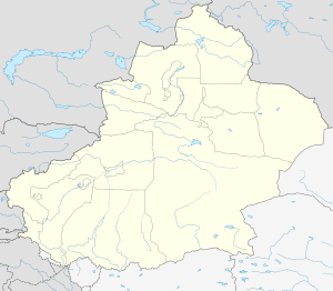
 Hoxud Location of the seat in Xinjiang | |
| Coordinates: 42°16′N 86°51′E / 42.267°N 86.850°ECoordinates: 42°16′N 86°51′E / 42.267°N 86.850°E | |
| Country | People's Republic of China |
| Autonomous region | Xinjiang |
| Autonomous prefecture | Bayingolin |
| Time zone | UTC+8 (China Standard) |
| Website |
www |
| Hoxud County | |||||||||||
| Chinese name | |||||||||||
|---|---|---|---|---|---|---|---|---|---|---|---|
| Simplified Chinese | 和硕县 | ||||||||||
| Traditional Chinese | 和碩縣 | ||||||||||
| |||||||||||
| Mongolian name | |||||||||||
| Mongolian Cyrillic | Хошууд сиан | ||||||||||
| Mongolian script | ᠬᠣᠱᠤᠳ ᠰᠢᠨ | ||||||||||
| |||||||||||
| Uyghur name | |||||||||||
| Uyghur |
خوشۇت ناھىيىسى | ||||||||||
| |||||||||||
Hoxud County is a county in the Xinjiang Uyghur Autonomous Region and is under the administration of the Bayin'gholin Mongol Autonomous Prefecture. It contains an area of 12,753 km2 (4,924 sq mi). According to the 2002 census, it has a population of 60,000.
External links
This article is issued from
Wikipedia.
The text is licensed under Creative Commons - Attribution - Sharealike.
Additional terms may apply for the media files.