Shizuishan
| Shizuishan 石嘴山市 · شِذُوِشًا شِ | |
|---|---|
| Prefecture-level city | |
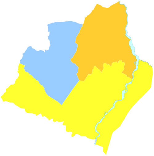
.png) The territory of Shizuishan prefecture-level city (yellow) within the Ningxia AR | |
| Country | People's Republic of China |
| Region | Ningxia |
| Area | |
| • Urban (2018)[1] | 233 km2 (90 sq mi) |
| Population (2007) | |
| • Prefecture-level city | 730,400 |
| • Urban (2018)[2] | 720,000 |
| • Urban density | 3,100/km2 (8,000/sq mi) |
| Time zone | UTC+8 (China Standard) |
| ISO 3166 code | CN-NX-02 |
| Website |
www |
Shizuishan (Chinese: 石嘴山; pinyin: Shízuǐshān) is a prefecture-level city and is the northernmost and, by population, the second-largest (after the regional capital of Yinchuan) city in the Ningxia Hui Autonomous Region, and is bordered on all sides except the south by Inner Mongolia. It also sits on the western (left) bank of the Yellow River.
History
In 1934, Shizuishan was occupied by the army of warlord Sun Dianying during his attempt to conquer Ningxia from the Ma clique. Sun set up a rival provincial government in the town,[3] but he was eventually defeated by Ningxia's official governor Ma Hongkui. Shizuishan was consequently returned to Ma control.[4]
Administrative divisions
| Map | ||||||
|---|---|---|---|---|---|---|
| Name | Hanzi | Hanyu Pinyin | Xiao'erjing | Population (2003 est.) |
Area (km²) | Density (/km²) |
| Dawukou District | 大武口区 | Dàwǔkǒu Qū | دَاءُﻛِﻮْ ٿُو | 230,000 | 1,007 | 228 |
| Huinong District | 惠农区 | Hùinóng Qū | ﺧُﻮِﻧْﻮ ٿُو | 200,000 | 1,088 | 184 |
| Pingluo County | 平罗县 | Píngluó Xiàn | پٍلُوَع ﺷِﯿًﺎ | 290,000 | 2,608 | 111 |
Geography
Shizuishan is located on the western bank of the Yellow River at latitude 38° 21′~39° 25′ N and longitude 105° 58′~106° 39′ E, spanning 88.8 kilometres (55.2 mi) from east to west and 119.5 kilometres (74.3 mi) from south to north.
Environmental issues
Shizuishan City in Western China was once described as the best place to make a film about the end of the world. In 2005, the Chinese government blacklisted the city for its pollution problem and told local leaders to shut down the worst polluting industrial plants. Since then the city has attempted to reinvent itself, but pollution is still taking its toll on the people.[Cite?] -
Education
References
- ↑ Cox, W (2018). Demographia World Urban Areas. 14th Annual Edition (PDF). St. Louis: Demographia. p. 22.
- ↑ Cox, W (2018). Demographia World Urban Areas. 14th Annual Edition (PDF). St. Louis: Demographia. p. 22.
- ↑ Jowett (2017), p. 217.
- ↑ Jowett (2017), pp. 217, 218.
Bibliography
External links
Major cities along the Yellow River | ||
|---|---|---|
| Province-level subdivisions | Cities (from upper reaches to lower reaches) | 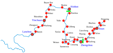 |
| Gansu | ||
| Ningxia | ||
| Inner Mongolia | ||
| Shanxi | ||
| Shaanxi | ||
| Henan | ||
| Shandong | ||
Major cities along the Pearl River · Major cities along the Yangtze River | ||