Yushu, Jilin
| Yushu 榆树市 | |||||||||||||||||||||||||||||||||
|---|---|---|---|---|---|---|---|---|---|---|---|---|---|---|---|---|---|---|---|---|---|---|---|---|---|---|---|---|---|---|---|---|---|
| County-level city | |||||||||||||||||||||||||||||||||
 Yushu Location in Jilin | |||||||||||||||||||||||||||||||||
| Coordinates: 44°49′34″N 126°33′00″E / 44.826°N 126.550°ECoordinates: 44°49′34″N 126°33′00″E / 44.826°N 126.550°E[1] | |||||||||||||||||||||||||||||||||
| Country | People's Republic of China | ||||||||||||||||||||||||||||||||
| Province | Jilin | ||||||||||||||||||||||||||||||||
| Sub-provincial city | Changchun | ||||||||||||||||||||||||||||||||
| Area[2] | |||||||||||||||||||||||||||||||||
| • Total | 4,724 km2 (1,824 sq mi) | ||||||||||||||||||||||||||||||||
| Population (2010)[3] | |||||||||||||||||||||||||||||||||
| • Total | 1,160,568 | ||||||||||||||||||||||||||||||||
| • Density | 250/km2 (640/sq mi) | ||||||||||||||||||||||||||||||||
| Time zone | UTC+8 (China Standard) | ||||||||||||||||||||||||||||||||
| Postal code | 1304XX | ||||||||||||||||||||||||||||||||
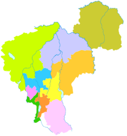
| Changchun district map |
| ||||||||||||||||||||||||||||||||
Yushu (simplified Chinese: 榆树; traditional Chinese: 榆樹; pinyin: Yúshù) is a county-level city under the jurisdiction of Changchun, the capital of Jilin province, People's Republic of China. It is more than 140 kilometres (87 mi) to the northeast of central Changchun, and around 100 kilometres (62 mi) south of Harbin. The name of the place means "Elm Tree". The northernmost county-level division of Changchun, it borders Dehui to the southwest as well as the prefecture-level division of Harbin (Heilongjiang) to the northeast.
Administrative divisions
There are 4 subdistricts, 16 towns, 20 townships, and 1 ethnic township.[4]
Subdistricts:
- Huachang Subdistrict (华昌街道), Zhenyang Subdistrict (正阳街道), Peiying Subdistrict (培英街道), Chengjiao Subdistrict (城郊街道)
Towns:
- Sihe (泗河镇), Daling (大岭镇), Dapo (大坡镇), Huaijia (怀家镇), Tuqiao (土桥镇), Xinli (新立镇), Heilin (黑林镇), Wukeshu (五棵树镇), Minjia (闵家镇), Xiangyang (向阳镇), Gongpeng (弓棚镇), Baoshou (保寿镇), Xiushui (秀水镇), Liujia (刘家镇), Bahao (八号镇), Xinzhuang (新庄镇)
Townships:
- Huancheng Township (环城乡), Chengfa Township (城发乡), Lihe Township (李合乡), Yujia Township (于家乡), Qingding Township (青顶乡), Shisihu Township (十四户乡), Guangming Township (光明乡), Xiejia Township (谢家乡), Fu'an Township (福安乡), Dayu Township (大于乡), Xuanfeng Township (先锋乡), Qianjin Township (前进乡), Wulong Township (武龙乡), Dagang Township (大岗乡), Shuangjing Township (双井乡), Hongxing Township (红星乡), Siyu Township (恩育乡), Tai'an Township (太安乡), Yumin Township (育民乡), Qingshan Township (青山乡), Yanhe Korean Ethnic Township (延和朝鲜族乡)
References
- ↑ Google (2014-07-02). "Yushu" (Map). Google Maps. Google. Retrieved 2014-07-02.
- ↑ Changchun Statistical Yearbook 2011 (《长春统计年鉴2011》). Accessed 8 July 2014.
- ↑ 2010 Census county-by-county statistics (《中国2010年人口普查分县资料》). Accessed 8 July 2014.
- ↑ 长春市-行政区划网 www.xzqh.org
External links
This article is issued from
Wikipedia.
The text is licensed under Creative Commons - Attribution - Sharealike.
Additional terms may apply for the media files.