Wusu
| Usu 乌苏市 ۋۇسۇ شەھىرى | |
|---|---|
| County-level city | |
 Wusu CBD | |
.png) Location of Wusu County (red) within Tacheng Prefecture (yellow) and Xinjiang | |
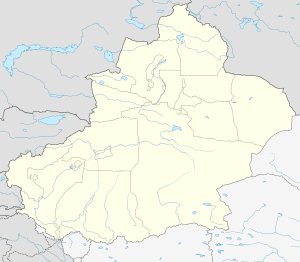
 Usu Location in Xinjiang | |
| Coordinates: 44°25′08″N 84°42′50″E / 44.419°N 84.714°ECoordinates: 44°25′08″N 84°42′50″E / 44.419°N 84.714°E | |
| Country | People's Republic of China |
| Autonomous region | Xinjiang |
| Prefecture | Tacheng |
| Area | |
| • Total | 14,394 km2 (5,558 sq mi) |
| Population (2003) | |
| • Total | 210,000 |
| • Density | 15/km2 (38/sq mi) |
| Wusu | |||||||||
| Chinese name | |||||||||
|---|---|---|---|---|---|---|---|---|---|
| Simplified Chinese | 乌苏 | ||||||||
| Traditional Chinese | 烏蘇 | ||||||||
| |||||||||
| Mongolian name | |||||||||
| Mongolian script | ᠬᠦᠷ | ||||||||
| Uyghur name | |||||||||
| Uyghur |
ۋۇسۇ | ||||||||
| |||||||||
| Kazakh name | |||||||||
| Kazakh |
وسۋ Şïxw Шихв | ||||||||
Usu[1] as the official romanized name and transliterated from Mongolian, also known as Wusu, is a county-level city with more than 100,000 residents in Xinjiang, China. It is a part of Tacheng Prefecture of Ili Kazakh Autonomous Prefecture. Oil-production is a major part of the economy while the county is an oasis in the Dzungarian Basin. Wusu lies between the major cities of Bole and Shihezi in Northern Xinjiang and west of Urumqi and Kuitun, south of Karamay.
Transport
Wusu is served by China National Highway 312, the Northern Xinjiang and the Second Ürümqi-Jinghe Railways.
References
- ↑ The official spelling according to Zhōngguó dìmínglù 中国地名录 (Beijing, SinoMaps Press 中国地图出版社 1997); ISBN 7-5031-1718-4
This article is issued from
Wikipedia.
The text is licensed under Creative Commons - Attribution - Sharealike.
Additional terms may apply for the media files.