Sanmenxia
| Sanmenxia 三门峡市 | |
|---|---|
| Prefecture-level city | |
 | |
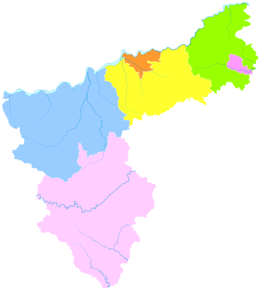
 Location of Sanmenxia City jurisdiction in Henan | |
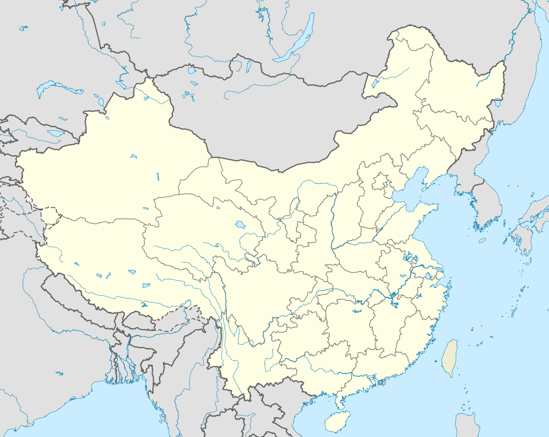 Sanmenxia Location in China | |
| Coordinates: 34°46′N 111°12′E / 34.767°N 111.200°ECoordinates: 34°46′N 111°12′E / 34.767°N 111.200°E | |
| Country | People's Republic of China |
| Province | Henan |
| Area | |
| • Prefecture-level city | 9,936.65 km2 (3,836.56 sq mi) |
| • Urban | 204.6 km2 (79.0 sq mi) |
| • Metro | 1,385.6 km2 (535.0 sq mi) |
| Elevation | 376 m (1,234 ft) |
| Population (2010 census[1]) | |
| • Prefecture-level city | 2,234,018 |
| • Density | 220/km2 (580/sq mi) |
| • Urban | 325,628 |
| • Urban density | 1,600/km2 (4,100/sq mi) |
| • Metro | 583,869 |
| • Metro density | 420/km2 (1,100/sq mi) |
| Time zone | UTC+8 (China Standard) |
| Postal Code | 472000 |
| Area code(s) | (0)398 |
| ISO 3166 code | CN-HA-12 |
| GDP | 70.6 billion RMB (10.8 billion USD)[2] |
| Major Ethnicities | Han |
| County-level divisions | 6 |
| License plate prefixes | 豫M |
| Website |
smx |
Sanmenxia (simplified Chinese: 三门峡; traditional Chinese: 三門峽; pinyin: Sānménxiá; postal: Sanmenhsia) is a prefecture-level city in western Henan Province, China. The westernmost prefecture-level city in Henan, Sanmenxia borders Luoyang to the east, Nanyang to the southeast, Shaanxi Province to the west and Shanxi Province to the north. The city lies on the south side of the Yellow River at the point where the river cuts through the Loess Plateau on its way to the North China Plain.
It was home to 2,234,018 inhabitants at the 2010 census whom 583,869 lived in the built-up area made of Hubin urban district and Pinglu county in Yuncheng, now within the agglomeration.
Names and History
The city's name in Chinese (三门峡) means "The Gorge of Three Gateways" and is derived from two islands that split the Yellow River into three parts.
According to Chinese mythology, Yu the Great used a divine axe to cut the mountain ridge three times, creating the Sanmenxia gorges to prevent massive flooding. The three "men" or gates were then named "The Gateway of Man" (人门), "The Gateway of Gods" (神门) and "The Gateway of Devils" (鬼门).
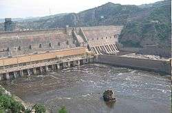
With the construction of the Sanmenxia Dam in the late 1950s, the ancient passes were flooded.
During the Western Zhou Dynasty, Sanmenxia was part of the territory of the State of Western Guo, ruled by relatives of the ruling Ji family of Zhou. Guo moved its capital from modern day Baoji to Shangyang (上阳), next to Sanmenxia. Later, this territory was annexed the State of Jin.
Archaeological finds near Sanmenxia between 1956 and 1991 revealed mass chariot graves and bronzeware of Western Guo State rulers. Furthermore, the archaeological site “Shihao Section of Xiaohan Ancient Road”, an excavated pathway that is recognized by UNESCO as part of the world heritage site “Silk Roads”, is also located in Sanmenxia.
Geography and climate
Sanmenxia is located in western Henan on the southern (right) bank of the Yellow River, and is surrounded on three sides by mountains, with elevations generally increasing from northeast to southwest. Most of the prefecture is at an altitude of 300 to 1,500 metres (980 to 4,920 ft), although the highest peak in the province, at 2,413.8 metres (7,919 ft), is located in Lingbao. The prefecture is at the intersection of Henan, Shanxi, and Shaanxi provinces, bordering Luoyang to the east, Nanyang to the south, Weinan (Shaanxi) to the west, and Yuncheng (Shanxi) to the north across the Yellow River.
Sanmenxia has a mostly dry, monsoon-influenced continental climate with four seasons. Winters are moderately cold and very dry, while summers are hot and humid. Monthly daily average temperatures range from −0.3 °C (31.5 °F) in January to 26.4 °C (79.5 °F) in July, and the annual mean is 13.9 °C (57.0 °F). More than half of the annual precipitation falls from July to September. There are between 184 and 218 frost-free days per annum. In the Köppen system, the city is in the transition zone between a humid subtropical climate (Köppen Cwa) and humid continental climate (Köppen Dwa), and receives barely enough precipitation to avoid being semi-arid (Köppen BSk).[3]
| Climate data for Sanmenxia (1971−2000) | |||||||||||||
|---|---|---|---|---|---|---|---|---|---|---|---|---|---|
| Month | Jan | Feb | Mar | Apr | May | Jun | Jul | Aug | Sep | Oct | Nov | Dec | Year |
| Record high °C (°F) | 15.6 (60.1) |
23.3 (73.9) |
28.9 (84) |
36.7 (98.1) |
39.8 (103.6) |
40.2 (104.4) |
40.1 (104.2) |
39.0 (102.2) |
38.6 (101.5) |
33.3 (91.9) |
26.3 (79.3) |
16.6 (61.9) |
40.2 (104.4) |
| Average high °C (°F) | 4.6 (40.3) |
7.9 (46.2) |
13.5 (56.3) |
21.3 (70.3) |
26.8 (80.2) |
30.9 (87.6) |
31.6 (88.9) |
30.3 (86.5) |
25.5 (77.9) |
20.0 (68) |
12.5 (54.5) |
6.3 (43.3) |
19.3 (66.7) |
| Daily mean °C (°F) | −0.3 (31.5) |
2.7 (36.9) |
8.1 (46.6) |
15.3 (59.5) |
20.6 (69.1) |
24.9 (76.8) |
26.4 (79.5) |
25.4 (77.7) |
20.3 (68.5) |
14.4 (57.9) |
7.3 (45.1) |
1.3 (34.3) |
13.9 (57) |
| Average low °C (°F) | −4.1 (24.6) |
−1.2 (29.8) |
3.8 (38.8) |
10.3 (50.5) |
15.2 (59.4) |
19.6 (67.3) |
22.4 (72.3) |
21.5 (70.7) |
16.3 (61.3) |
10.1 (50.2) |
3.3 (37.9) |
−2.4 (27.7) |
9.6 (49.2) |
| Record low °C (°F) | −12.5 (9.5) |
−10.9 (12.4) |
−6.2 (20.8) |
−0.3 (31.5) |
4.7 (40.5) |
12.4 (54.3) |
16.1 (61) |
12.8 (55) |
6.5 (43.7) |
−2.1 (28.2) |
−8 (18) |
−12.8 (9) |
−12.8 (9) |
| Average precipitation mm (inches) | 5.7 (0.224) |
7.4 (0.291) |
22.1 (0.87) |
38.7 (1.524) |
51.8 (2.039) |
65.7 (2.587) |
112.6 (4.433) |
95.4 (3.756) |
84.0 (3.307) |
50.1 (1.972) |
20.1 (0.791) |
5.4 (0.213) |
559.0 (22.008) |
| Average precipitation days (≥ 0.1 mm) | 3.3 | 3.6 | 5.7 | 7.1 | 7.7 | 8.9 | 10.5 | 10.1 | 9.4 | 8.3 | 5.4 | 2.8 | 82.8 |
| Source: Weather China | |||||||||||||
Administration
The prefecture-level city of Sanmenxia administers two districts, two county-level cities and two counties.
- Hubin District(湖滨区)
- Shanzhou District(陕州区)
- Lingbao City(灵宝市)
- Yima City(义马市)
- Lushi County(卢氏县)
- Mianchi County(渑池县)
| Map |
|---|
Transportation
References
- ↑ http://www.citypopulation.de/php/china-shanxi-admin.php
- ↑ Exchange rate as of 28 May 2011.
- ↑ Peel, M. C. and Finlayson, B. L. and McMahon, T. A. (2007). "Updated world map of the Köppen-Geiger climate classification". Hydrol. Earth Syst. Sci. 11: 1633-1644. ISSN 1027-5606.
External links
- Government Website of Sanmenxia (in simplified Chinese)
- City Map (in simplified Chinese)
Major cities along the Yellow River | ||
|---|---|---|
| Province-level subdivisions | Cities (from upper reaches to lower reaches) | 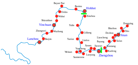 |
| Gansu | ||
| Ningxia | ||
| Inner Mongolia | ||
| Shanxi | ||
| Shaanxi | ||
| Henan | ||
| Shandong | ||
Major cities along the Pearl River · Major cities along the Yangtze River | ||