Millingport, North Carolina
| Millingport, North Carolina | |
|---|---|
| Unincorporated community | |
 Millingport, North Carolina  Millingport, North Carolina | |
| Coordinates: 35°22′51″N 80°18′18″W / 35.38083°N 80.30500°WCoordinates: 35°22′51″N 80°18′18″W / 35.38083°N 80.30500°W | |
| Country | United States |
| State | North Carolina |
| County | Stanly |
| Area[1] | |
| • Total | 5.682 sq mi (14.72 km2) |
| • Land | 5.682 sq mi (14.72 km2) |
| • Water | 0 sq mi (0 km2) |
| Elevation | 653 ft (199 m) |
| Population (2010)[1] | |
| • Total | 599 |
| • Density | 110/sq mi (41/km2) |
| Time zone | UTC-5 (Eastern (EST)) |
| • Summer (DST) | UTC-4 (EDT) |
| Area code(s) | 704 |
| GNIS feature ID | 990015[2] |
Millingport is an unincorporated community and census-designated place in Stanly County, North Carolina, United States. Its population was 599 as of the 2010 census.[1] North Carolina Highway 73 passes through the community.
Geography
According to the U.S. Census Bureau, the community has an area of 5.682 square miles (14.72 km2), all of it land.[1]
References
- 1 2 3 4 "2010 Census Gazetteer Files - Places: North Carolina". U.S. Census Bureau. Retrieved February 26, 2017.
- ↑ "Millingport". Geographic Names Information System. United States Geological Survey.
Municipalities and communities of Stanly County, North Carolina, United States | ||
|---|---|---|
| Cities | 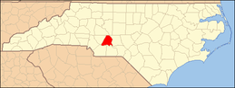 | |
| Towns | ||
| CDPs | ||
| Unincorporated communities | ||
| Footnotes | ‡This populated place also has portions in an adjacent county or counties | |
This article is issued from
Wikipedia.
The text is licensed under Creative Commons - Attribution - Sharealike.
Additional terms may apply for the media files.