National routes (South Africa)

National routes in South Africa are a class of roads and freeways which connect major cities. They form the highest category in the South African route numbering scheme, and are designated with route numbers beginning with "N", from N1 to N18. Most segments of the national route network are officially proclaimed National Roads that are maintained by the South African National Roads Agency (SANRAL), but some segments are maintained by provincial or local road authorities.[1]
The system was mostly built during the 1970s by the National Party government of South Africa, although construction of new roads and repairs of existing stretches continue today. The system was modeled on the United States Interstate Highway network, an idea first brought into effect by US President Dwight D. Eisenhower during the 1950s, based on the German Autobahn, which he experienced when touring Germany after the Second World War.
Although the terms National Road and National Route are sometimes regarded as synonymous, they have distinct meanings, and not all national routes are National Roads, while some "R"-numbered routes are proclaimed National Roads.[1]
Definition
National routes are defined and numbered by the Route Numbering and Road Traffic Signs Sub Committee within the Roads Co-ordinating Body,[2] an organisation which contains representatives from road authorities in national, provincial and local government. The term "national road" is frequently used to refer to a national route, but technically a "national road" is any road maintained by the South African National Roads Agency (SANRAL) and need not necessarily form part of a national route, and there are "R" routes that are proclaimed National Roads.[1] There are also parts of the national route network that are maintained by provincial or local authorities rather than SANRAL.[3]
List of routes
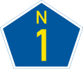
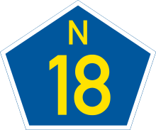
National Routes are denoted with the letter N followed by a number indicating the specific route. On maps and some signage, national routes are shown by a pentagon with the number of the road inside. There are fifteen declared national routes, which are listed below.[4]


Proposed routes
- N21 / Peninsula Expressway: A proposed ring road that will involve upgrading the R300 running parallel to the N7 through Bellville into a toll road connecting the West Coast to Muizenberg. See Peninsula Expressway, Cape Town.
Earlier scheme
An earlier scheme, deviating considerably from the current numbering, is described in the 1970 Shell Road Atlas of South Africa and other contemporaneous sources:
- N1 - equivalent to the current N9 from George to Colesberg, and then the current N1 from there to Beitbridge (with deviations as some newer parts had yet to be built)
- N2 - equivalent to the section of the current N2 from Cape Town to Durban
- N3 - equivalent to the current N3 from Durban to Ladysmith, then following the current N11 to Volksrust, and the current R23 from there to Heidelberg, and then continuing equivalent to the N3 until its end in Johannesburg
- N4 - equivalent to the section of the current N4 from Pretoria to Komatipoort
- N5 - equivalent to the current N5 but from Winburg past Harrismith to Ladysmith (the latter part now signed as the N3)
- N6 - equivalent to the current N6, except that it begins from King William's Town, the section from there to Stutterheim now being the R346, and ending in Reddersburg.
- N7 - equivalent to the section of the current N10 from Ncanaha to just past Middelburg
- N8 - equivalent to the section of the current R64 from Kimberley to Bloemfontein
- N9 - equivalent to the section of the current N1 from Cape Town to Colesburg
- N10 - equivalent to the section of the current R56 between Kokstad and Pietermaritzburg
- N11 - equivalent to the current N7
- N12 - equivalent to the section of the current N12 from George to Beaufort West
- N13 - equivalent to the section of the current N12 from Three Sisters to Johannesburg
- N14 - equivalent to the section of the current N2 from Durban to Swaziland
- N15 - equivalent to the section of the current R75 from Port Elizabeth to Uitenhage
- N16 - equivalent to the section of the current N3 between Heidelberg and Harrismith
- N17 - equivalent to the section of the current N10 between Noupoort and Namibia
- N18 - equivalent to the section of the current R61 from Queenstown to Port St. Johns
- N19 - equivalent to the section of the current R56 from south of Jamestown to Kokstad
See also
Notes
- 1 2 3 https://www.nra.co.za/live/content.php?Item_ID=96
- ↑ Falkner, John (May 2012). South African Numbered Route Description and Destination Analysis (Report). National Department of Transport. p. xi. Archived from the original on 6 June 2014. Retrieved 22 January 2014.
- ↑ nra.co.za - Declaration
- ↑ Falkner, John (May 2012). South African Numbered Route Description and Destination Analysis (Report). National Department of Transport. pp. 1–35. Archived from the original on 6 June 2014. Retrieved 22 January 2014.
- ↑ Anonymous. Shell Road Atlas of Southern Africa. Shell, 1970

.svg.png)
.svg.png)
.svg.png)
.svg.png)


.svg.png)
.svg.png)
.svg.png)
.svg.png)
.svg.png)