Mthatha
| Mthatha Uta Umtata | |
|---|---|
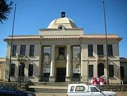 The Nelson Mandela Museum in Mthatha | |
 Mthatha  Mthatha Mthatha (South Africa)  Mthatha Mthatha (Africa) | |
| Coordinates: 31°34′00″S 28°46′00″E / 31.56667°S 28.76667°ECoordinates: 31°34′00″S 28°46′00″E / 31.56667°S 28.76667°E | |
| Country | South Africa |
| Province | Eastern Cape |
| District | O.R.Tambo |
| Municipality | King Sabata Dalindyebo |
| Established | 1876 |
| Area[1] | |
| • Total | 54.97 km2 (21.22 sq mi) |
| Population (2011)[1] | |
| • Total | 96,114 |
| • Density | 1,700/km2 (4,500/sq mi) |
| Racial makeup (2011)[1] | |
| • Black African | 94.6% |
| • Coloured | 2.7% |
| • Indian/Asian | 1.2% |
| • White | 1.0% |
| • Other | 0.5% |
| First languages (2011)[1] | |
| • Xhosa | 85.0% |
| • English | 8.6% |
| • Afrikaans | 1.1% |
| • Other | 5.2% |
| Time zone | UTC+2 (SAST) |
| Postal code (street) | 5099 |
| PO box | 5099 |
| Area code | 047 |
| Website | http://www.mthatha.co.za |
Mthatha[2] /əmˈtɑːtɑː/ (![]()
History
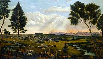
The settlement existed in the 1870s as a buffer-zone, in response to reported tensions between Pondo and neighbouring Thembu groups, and in 1875 a magistrate's office was opened, the first magistrate appointed that year being a man named J F Boyes. The settlement developed during the next few years, becoming a military post for the British colonial forces in 1882. The town itself was founded in 1883, along the banks of the Mthatha River. Nearly a century later, the Mthatha Dam was constructed about eight kilometers upstream of the town.[5] Mthatha became the leading administrative center of the area, having both Anglican and Catholic cathedrals.The town became the headquarters of the Transkeian Territories General Council (known as the Bunga) and building which served as a parliament was erected in 1903.[4] This was followed by the construction of the town hall in 1908. [6] A branch of the University of Fort Hare was established in the town, and after the independence of the Transkei in 1977 it became the University of Transkei. In 2005, University of Transkei with Border Technikon and Eastern Cape Technikon were merged to form the Walter Sisulu University for Technology and Science. The campus was the base for the region's first community radio station, UCRFM, which started in 1996 and has become a significant community broadcaster.
On 1 August 1973, Mthatha High Court was opened.[4][7]
In 1973, a summit meeting of the black homeland leaders was held at Umtata, when they decided to federate their own states after independence. In 1976, Transkei was granted independence as a bantustan, a nominally independent state not recognised outside of South Africa, and Mthatha served as the capital under the name "Umtata".[4] During the Transkei regime, an airport named the then leader of Transkei KD Matanzima was built. On 21 May 2012, the airport was formally handed over to Lindiwe Sisulu, then Minister of Defence, by Noxolo Kiviet, then Premier of the Eastern Cape. However, the South African National Defence Force revoked its control of the airport in 2013. The airport was renamed Mthatha Airport.
After the end of apartheid, some sections of the African business and professional community migrated to traditionally white areas of economic activity, and this has been widely posited as a cause of economic recession in the municipality, but a number of construction projects offer some hope for renewal.
Many of South Africa's black leaders — including Walter Sisulu, Bantu Holomisa, and Nelson Mandela — come from this area, and the retired Mandela visited his home village of Qunu a few kilometres south of Mthatha.
Mthatha is a focal point of the Nelson Mandela Route which celebrates the life of late Nelson Mandela. There are three Nelson Mandela Museums: Spread across three sites, it collects, interprets and exhibits key aspects of the story of the life and times of Nelson Mandela in context. The three historical sites of the museum are all in the locality at Mvezo, Qunu, and the Bunga Building in Mthatha itself. In the Bunga Building is the story of the Long Walk to Freedom and an exhibition of the many gifts received by Nelson Mandela.
On 2 March 2004 Umtata was renamed "Mthatha".
Mthatha has 2 major taxi businesses (Uncedo Taxi Association and Border Taxi Association). These Taxi Associatios had a feud over The R61 road from Mthatha to Libode and Ports St John's.This Feud resulted Taxi Ranks being closed by The Government. Also over 60 reported human fatalities were reported and the taxis had a gunshots incidents were these reported deaths happened.By 2018 New Minister of Police Bheki Cele Closed all taxi ranks in Mthatha and demanded that the Taxi Associations must negotiate with the police about the killings and said that they should merge to form one Taxi Association but they refused and they started taking people legal after Bheki Cele said they shouldn't and some Taxis were taken by the police.Sagasranks where opened in Mthatha but the ranks that were not opened triggered Riot's with people protesting and police firing rubber bullets and teargas with one affecting a nearby school (st John's college). [8]
Religion
The city is the episcopal see of both the Roman Catholic Diocese of Mthatha and the Anglican Diocese of Mthatha.
Economy
Mthatha falls under OR Tambo District Municipality which is the poorest district in the Eastern Cape in terms of all poverty measures. It has the lowest HDI (0.45) and the highest poverty gap (2 231 million) in the Eastern Cape. The number of people living in poverty is also high in this district (64.6%), unemployment is at 65.5% and the literacy rate 42.2%. [9]
In 2006 it was reported the King Sabata Dalindyebo Local Municipality was owed R250 million by residents in unpaid service fees—counts among its creditors the South African Revenue Service (to which it owes R18-million), the Public Investment Commission (R84 million), the national water affairs and forestry department (R46 million) and the Development Bank of Southern Africa (R13 million). [10] According to SA Delivery, The average annual income of a black Mthatha resident is R15,762 compared to R131,583 and R41,875 for a white and coloured person respectively. [11] The town has also been plagued by complaints around its roads. However, despite that a new dawn is beckoning for Mthatha with the construction of infrastructure like BT Ngebs Mall and Mayfair Hotel.
Facilities
- Stadiums: Mthatha Stadium, Khaya Majola, Rotary
- Malls: BT Ngebs Mall and Mthatha Plaza, Circus Triangle
- University: Walter Sisulu University
- Clinics: Ngangelizwe Clinic
- Hospitals: Life St Mary's Hospital, Mthatha Private Hospital and Nelson Mandela Academic Hospital
Notable people from Mthatha
- Mandisi Qetsele
- Akona Ndungane
- Alan Barrow
- Bongani Mayosi
- Bubele Mhlana
- Carlo Del Fava
- Jeff Hawkes
- Jessica Haines
- Luyolo Nomandela
- Masibusane Zongo
- Ngazibini Sigwili
- Odwa Ndungane
- Sean Park
- Siya Mdaka
- Vusumuzi Masondo
- Nelson Mandela
- Nambitha Mpumlwana
- Chuma Dukuza
- Jet Novuka
- Archibald Siphiwo Nkonyeni
- Ifani
- Busiswa
- Black Coffee
- Athi-Patra Ruga
- Sihle Tinto
Climate
| Month | Jan | Feb | Mar | Apr | May | Jun | Jul | Aug | Sep | Oct | Nov | Dec | Year |
|---|---|---|---|---|---|---|---|---|---|---|---|---|---|
| Record high °C (°F) | 42 (108) |
40 (104) |
40 (104) |
36 (97) |
34 (93) |
30 (86) |
30 (86) |
33 (91) |
44 (111) |
38 (100) |
41 (106) |
41 (106) |
44 (111) |
| Average high °C (°F) | 27 (81) |
27 (81) |
26 (79) |
25 (77) |
23 (73) |
21 (70) |
21 (70) |
22 (72) |
23 (73) |
23 (73) |
25 (77) |
27 (81) |
24 (75) |
| Average low °C (°F) | 16 (61) |
16 (61) |
15 (59) |
12 (54) |
8 (46) |
4 (39) |
4 (39) |
7 (45) |
9 (48) |
11 (52) |
13 (55) |
15 (59) |
11 (52) |
| Record low °C (°F) | 9 (48) |
9 (48) |
7 (45) |
1 (34) |
−1 (30) |
−3 (27) |
−3 (27) |
−1 (30) |
1 (34) |
2 (36) |
4 (39) |
7 (45) |
−3 (27) |
| Average precipitation mm (inches) | 87 (3.43) |
89 (3.5) |
83 (3.27) |
58 (2.28) |
18 (0.71) |
11 (0.43) |
18 (0.71) |
15 (0.59) |
35 (1.38) |
73 (2.87) |
75 (2.95) |
88 (3.46) |
650 (25.59) |
| Average precipitation days (≥ 1mm) | 15 | 14 | 13 | 8 | 5 | 3 | 3 | 5 | 8 | 13 | 13 | 14 | 113 |
| Source: South African Weather Service, 1961-1990 [12] | |||||||||||||
Kei River
- Mthatha River
- Transkei
- Mzimvubu
References
- 1 2 3 4 "Main Place Mthatha". Census 2011.
- ↑ Jenkins, Elwyn (2007), Falling into place: the story of modern South African place names, David Philip Publishers, p. 75
- ↑ K D Matanzima Airport
- 1 2 3 4 "Umtata". South African Venues. Retrieved 28 July 2017.
- ↑ Fatoki, OS, Muyima, NYO and Lujiza, M (October 2001). "Situation analysis of water quality in the Umtata River catchment" (PDF). Water SA. 27 (4). Archived from the original (PDF) on 27 September 2007.
- ↑ "Umtata South Africa". Britannica. Retrieved 28 July 2017.
- ↑ "A High Court is established in Umtata, capital of the Transkei". South African History Online. Retrieved 28 July 2017.
- ↑ "E Cape in name change spotlight". News24. 2004-10-27. Retrieved 2016-03-25.
- ↑ "Mthatha". Olive Leaf Foundation. Retrieved 28 July 2017.
- ↑ Mgibisa, Mbuyisa. "Mthatha in dire straits". Mail & Guardian. Retrieved 28 July 2017.
- ↑ Harrison, Karen. "Can Mthatha turn the corner?" (PDF). SA Delivery. Retrieved 28 July 2017.
- ↑ "Climate data: Umtata: standard normal 1961 to 1990". South African Weather Service. Archived from the original on 8 March 2010. Retrieved 16 July 2010.
External links
| Wikimedia Commons has media related to Mthatha. |
Municipalities and communities of OR Tambo District Municipality, Eastern Cape | ||
|---|---|---|
District seat: Mthatha | ||
| Ingquza Hill | .svg.png) | |
| Port St Johns | ||
| Nyandeni | ||
| Mhlontlo | ||
| King Sabata Dalindyebo | ||