Lucayan Archipelago
| Lucayan Archipelago | |
|---|---|
| Antilles | |
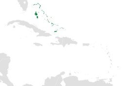 Location within the Caribbean | |
| Region | Caribbean |
| Countries and territories | |
| Area | |
| • Total | 14,308 km2 (5,524 sq mi) |
| Population (2016) | |
| • Total | 443,000 |
| • Density | 24.6/km2 (64/sq mi) |
| Demonym(s) | Bahamian, Turks Islander, Caicos Islander |
| Time zone | UTC−5 (EST) |
| • Summer (DST) | UTC−4 (EDT) |
The Lucayan Archipelago (named for the original native Lucayan people), also known as the Bahama Archipelago, is an island group comprising the Commonwealth of The Bahamas and the British Overseas Territory of the Turks and Caicos Islands. The archipelago is in the western North Atlantic Ocean, north of Cuba along with the other Antilles, and east and southeast of Florida.
William Keegan writes that the Bahama archipelago includes the territories of both the Commonwealth of The Bahamas and the Turks and Caicos Islands, adding: "Modern political considerations aside, the islands form a single archipelago with common geological, ecological, and cultural roots."[1] Because the two nations of the Lucayan Archipelago do not border the Caribbean Sea, they are part of the West Indies but not the Caribbean. They are, however, often grouped with the Caribbean nations for convenience.
Proposed federation
The leaders of The Bahamas as well as Turks and Caicos Islands discussed the possibility of forming a federation in 2010.[2]
Countries and territories
The Mouchoir Bank, the Silver Bank, and the Navidad Bank are a submerged continuation of the archipelago in the southeast, as are the Turks and Caicos Islands.[3] While Mouchoir Bank belongs to the Turks and Caicos Islands, Silver Bank and Navidad Bank are part of the Dominican Republic.
See also
Notes
- ↑ Keegan:20, 183
- ↑ Tyson, Vivian. Bahamas wants federation talks with TCI Archived 2011-10-04 at the Wayback Machine.. Turks and Caicos Sun, 2010.
- ↑ Carew, James; Mylroie, John (1997). Vacher, H.L.; Quinn, T., eds. Geology of Bahamas, in Geology and Hydrology of Carbonate Islands, Developments in Sedimentology 54. Amsterdam: Elsevier Science B.V. pp. 91–139. ISBN 9780444516442.
References
- Keegan, William F. (1992) The People Who Discovered Columbus: The Prehistory of the Bahamas. University Press of Florida ISBN 0-8130-1137-X
Further reading
- Granberry, Julian (October 1991). "Lucayan Toponyms". Journal of the Bahamas Historical Society. 13. Retrieved 8 December 2013.