Shigar Valley
| Shigar وادی شگر شگر | |
|---|---|
| District Shigar | |
      | |
 Shigar وادی شگر Hassanabad on Pakistan Map | |
| Coordinates: 35°25′32″N 75°43′59″E / 35.42556°N 75.73306°ECoordinates: 35°25′32″N 75°43′59″E / 35.42556°N 75.73306°E | |
| Country |
|
| Autonomous region |
|
| Time zone | UTC+5 (PST) |
| • Summer (DST) | UTC+6 (GMT+5) |
| Website |
www |
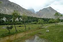
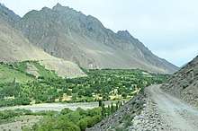
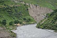
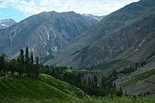
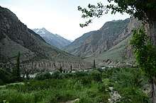
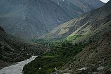
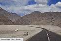
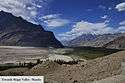
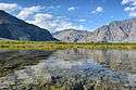
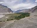
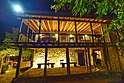
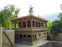
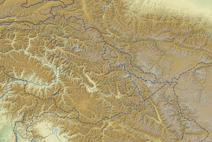
The Shigar Valley (Urdu: وادی شگر) is a valley in Gilgit Baltistan in northern Pakistan that is watered by the Shigar River, and centred on the town of Shigar. The valley stretches about 170 km from Skardu to Askole and is the gateway to the high mountains of the Karakoram. The town of Shigar is the largest settlement in valley. Even though the Shigar Valley is a remote and largely inaccessible place, there are several villages in the valley. Askole is the last settlement in the Shigar Valley, which is still far from the high mountains. Shigar was an administrative sub-division of Skardu District that is now a district in its own right.
This Valley is a stream of the Indus River, which is near to the town of Skardu. Geeks of hiking, trekking and mountaineering love to visit this beauty, despite of the tough conditions there. Also, the valley is an attraction for the tourists as it is a gateway to Karakoram Hills, one of the world’s highest peaks.[1]
See also
References
External links
| Wikimedia Commons has media related to Shigar Valley. |
- https://gbit.pk/10-beautiful-places-visit-shigar-valley-skardu-baltistan/
- Photos from Shigar by Arif A Khan