| Rank | Country | Southernmost point | Latitude |
|---|
| — | .svg.png) Antarctica Antarctica | South Pole | 90°00'S |
| Antarctic Circle | 66°33′39"S |
| 1 |  United Kingdom United Kingdom | Southern Thule,  South Georgia and the South Sandwich Islands South Georgia and the South Sandwich Islands
Pednathise Head, Scilly Isles, United Kingdom
Lizard Point (mainland) | 59°42'S
49°52'N
49°57'N |
| 2 |  Chile Chile | Islote Águila, Diego Ramírez Islands
Cape Froward (mainland) | 56°32'S
53°53'S |
| 3 |  Argentina Argentina | Southernmost point of Isla Grande de Tierra del Fuego
Monte Dinero (mainland) | 55°04'S
52°24'S |
| 4 |  Australia Australia | Bishop and Clerk Islets
South East Cape (Tasmania)
South Point (mainland) | 55°03'S
43°38'S
39°08'S |
| — |  Falkland Islands Falkland Islands | Beauchene Island | 52°53'S |
| 5 |  New Zealand New Zealand | Jacquemart Island
Slope Point (South Island) | 52°37'S
46°40'S |
| 6 |  France France | Îles de Boynes,  French Southern and Antarctic Lands French Southern and Antarctic Lands
Lavezzi Islands (Metropolitan France)
Puig de Comanegra (mainland) | 50°01'S
41°20'N
42°20'N |
| 7 |  South Africa South Africa | Marion Island, Prince Edward Islands
Cape Agulhas (mainland) | 46°59'S
34°50'S |
| 8 |  Uruguay Uruguay | Isla de Lobos
Punta del Este (mainland) | 35°02'S
34°58'S |
| 9 |  Brazil Brazil | Border with Uruguay, Rio Grande do Sul, just north of Barra del Chuy (Uruguay) | 33°45'S |
| 10 |  Lesotho Lesotho | Quthing District | 30°40'S |
| 11 |  Namibia Namibia | near Onseepkans | 28°58'S |
| — |  French Polynesia French Polynesia | Southern Rock, Marotiri | 27°55'S |
| 12 |  Paraguay Paraguay | Yacyretá Island | 27°43'S |
| 13 |  Swaziland Swaziland | near Lavumisa | 27°19'S |
| 14 |  Botswana Botswana | Bokspits | 26°54'S |
| 15 |  Mozambique Mozambique | Coastal border with South Africa near Zitundo | 26°52'S |
| 16 |  Madagascar Madagascar | Cape Vohimena | 25°37'S |
| Tropic of Capricorn | 23°26′21″S |
| 17 |  Bolivia Bolivia | Border with Chile, Sur Lípez Province | 22°54'S |
| 18 |  Zimbabwe Zimbabwe | Mozambique/South Africa/Zimbabwe tripoint | 22°25'S |
| — | Réunion | Saint-Joseph | 22°23'S |
| 19 |  Tonga Tonga | ʻAta Island | 22°21'S |
| 20 |  Fiji Fiji | Ceva-I-Ra atoll | 21°44'S |
| 21 |  Mauritius Mauritius | Near Souillac | 20°32'S |
| 22 |  Vanuatu Vanuatu | Anatom | 20°15'S |
| 23 |  Peru Peru | Border with Chile on the Pacific coast of Tacna Province | 18°21'S |
| 24 |  Zambia Zambia | Border with Zimbabwe, Kalomo District | 18°05'S |
| 25 |  Angola Angola | Border with Namibia near Dirico, Cuando Cubango Province | 18°02'S |
| 26 |  Malawi Malawi | Nsanje District | 17°07'S |
| 27 |  United States United States | Rose Atoll ("unincorporated territory")
Palmyra Island ("incorporated Territory")[note 1][note 2]
Ka Lae, Hawaii (50 states)
Cape Sable, Florida (contiguous states) | 14°34'S
5°53'N
18°54'N
25°07'N |
| 28 |  Samoa Samoa | Nu'ulua Island | 14°04'S |
| 29 |  Democratic Republic of the Congo Democratic Republic of the Congo | Haut-Katanga Province | 13°27'S |
| 30 |  Comoros Comoros | Île Canzouni, Mohéli | 12°25'S |
| 31 |  Solomon Islands Solomon Islands | East Rennell, Rennell Island | 11º47'S |
| 32 |  Papua New Guinea Papua New Guinea | Vanatinai
near Suau, Samarai-Murua District (mainland) | 11°46'S
10°42'S |
| 33 |  Tanzania Tanzania | Border with Mozambique, south of Ligunga in Namtumbo District | 11°45'S |
| 34 |  Kiribati Kiribati | Flint Island, Line Islands | 11°26'S |
| 35 |  Indonesia Indonesia | Pamana Island | 11°00'S |
| 36 |  Tuvalu Tuvalu | Niulakita | 10°48'S |
| 37 | 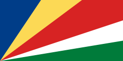 Seychelles Seychelles | Goëlettes Island, Farquhar Atoll | 10°13'S |
| 38 | 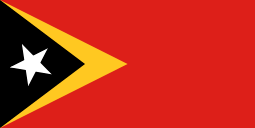 East Timor East Timor | Border with Indonesia near Bisae Súnan, Passabe Subdistrict, Oecusse | 09°30'S |
| — | 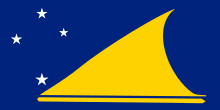 Tokelau Tokelau | Fenua Loa, Fakaofo | 09°21'S |
| — | 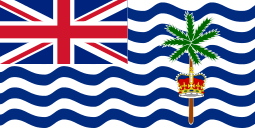 British Indian Ocean Territory British Indian Ocean Territory | Southern tip of Diego Garcia | 07°26'S |
| 39 |  Republic of the Congo Republic of the Congo | Coastal border with Cabinda Province, Angola, Pointe-Noire Department | 05°02'S |
| 40 |  Ecuador Ecuador | Border with Peru, Chinchipe Canton | 05°00'S |
| 41 |  Kenya Kenya | Coastal border with Tanzania, near Lunga Lunga, Kwale County | 04°43'S |
| 42 |  Burundi Burundi | Border with Tanzania at Colline Chibumba, near Mugina | 04°28'S |
| 43 |  Colombia Colombia | Quebrada de San Antonio near Leticia, Amazonas | 04°14'S |
| 44 |  Gabon Gabon | Coastal border with Republic of Congo, Haute-Banio Department | 03°59'S |
| 45 |  Rwanda Rwanda | Border with Burundi, Nyaruguru District, southwest of Butare | 02°51'S |
| 46 |  Somalia Somalia | Border with Kenya at Chiamboni, Badhadhe District | 01°40'S |
| 47 |  Uganda Uganda | Border with Tanzania, Kabale District | 01°29'S |
| 48 |  Equatorial Guinea Equatorial Guinea | Adams Islet, south of Annobón | 01°28'S |
| 49 |  Maldives Maldives | Gan Island in Addu Atoll | 00°42'S |
| 50 |  Nauru Nauru | Nauru International Airport, Yaren | 00°33'S |
| 51 |  São Tomé and Príncipe São Tomé and Príncipe | Ilhéu das Rolas | 00°01'S |
| Equator | 00°00′00″ |
| 52 |  Venezuela Venezuela | Border with Brazil, Río Negro Municipality, Amazonas | 00°40'N |
| 53 |  Malaysia Malaysia | Border with Indonesia to the southeast of Tebedu, Sarawak | 00°51'N |
| 54 |  Federated States of Micronesia Federated States of Micronesia | Kapingamarangi | 01°01'N |
| 55 |  Singapore Singapore | Pulau Satumu | 01°09'N |
| 56 |  Guyana Guyana | Border with Brazil near Wai-Wai, Upper Takutu-Upper Essequibo Region | 01°11'N |
| 57 |  Cameroon Cameroon | Border with Republic of Congo, Boumba-et-Ngoko Department, just north of Ouésso (Congo) | 01°39'N |
| 58 |  Suriname Suriname | Border with Brazil, Coeroeni | 01°50'N |
| — | French Guiana | Border with Brazil, Maripasoula | 02°06'N |
| 59 |  Central African Republic Central African Republic | Central African Republic/Republic of Congo/Cameroon tripoint, Sangha-Mbaéré | 02°13'N |
| 60 |  Palau Palau | Transit Reef, Hatohobei | 02°47'N |
| 61 |  Ethiopia Ethiopia | Border with Kenya east of Moyale, Borena Zone | 03°24'N |
| 62 |  South Sudan South Sudan | Border with Uganda south of Nimule | 03°29'N |
| 63 |  China China | James Shoal (disputed)
Southern tip of Hainan (undisputed)
Hai'an, Guangdong (mainland) | 03°58'N
18°10'N
20°14'N |
| 64 |  Brunei Brunei | Border with Malaysia, Melilas | 04°00'N |
| 65 |  Nigeria Nigeria | Cape Formoso, Brass, Bayelsa State | 04°17'N |
| 66 |  Liberia Liberia | Cape Palmas | 04°21'N |
| 67 |  Côte d'Ivoire Côte d'Ivoire | Coastal border with Liberia | 04°22'N |
| 68 |  Marshall Islands Marshall Islands | Ebon Atoll | 04°34'N |
| 69 |  Philippines Philippines | Saluag Island, Sibutu, Tawi-Tawi province | 04°35'N |
| 70 |  Ghana Ghana | Cape Three Points, Western Region | 04°44'N |
| 71 |  Costa Rica Costa Rica | Cocos Island
border with Panama at Punta Burica (mainland) | 05°31'N
08°04'N |
| 72 |  Thailand Thailand | Border with Malaysia in Yarom, Betong District, Yala Province | 05°37'N |
| 73 |  Sri Lanka Sri Lanka | Dondra Head | 05°55'N |
| 74 |  Togo Togo | Lomé | 06°07'N |
| 75 |  Benin Benin | Grand-Popo, Mono Department | 06°14'N |
| 76 |  India India | Indira Point, Great Nicobar, Andaman and Nicobar Islands
Kanyakumari (Cape Comorin) (mainland) | 06°44'N
08°06'N |
| 77 |  Sierra Leone Sierra Leone | Coastal border with Liberia southeast of Sulima, Pujehun District | 06°56'N |
| 78 |  Panama Panama | Punta Mariato, Cerro Hoya National Park, Veraguas | 07°11'N |
| 79 |  Guinea Guinea | Border with Liberia on River Mani at Bignamou, Yomou Prefecture | 07°12'N |
| 80 |  Chad Chad | Border with Central African Republic near Deng, Logone Oriental Region | 07°27'N |
| 81 |  Vietnam Vietnam | Amboyna Cay (disputed)
Hon Sao Island
Cape Cà Mau (mainland) | 07°51'N
08°25'N
08°35'N |
| 82 |  Sudan Sudan | Including Kafia Kingi[note 3]
border with South Sudan south of Kurmuk, Blue Nile State | 08°41'N
09°30'N |
| 83 |  Burkina Faso Burkina Faso | Border with Côte d'Ivoire, Kpuere, Noumbiel Province | 09°24'N |
| 84 |  Myanmar Myanmar | Christie Island, Myeik Kyunzu
Kawthaung (mainland) | 09°36'N
09°59'N |
| 85 |  Cambodia Cambodia | Koh Puolo Wai
border with Vietnam, Kampot Province (mainland) | 09°55'N
10°24'N |
| 86 |  Trinidad and Tobago Trinidad and Tobago | Icacos, Siparia region, Trinidad Island | 10°03'N |
| 87 |  Mali Mali | Border with Côte d'Ivoire southeast of Manankoro, Bougouni Cercle | 10°09'N |
| 88 |  Taiwan Taiwan | Taiping Island (disputed)
Pratas Island (disputed)
Cape Eluanbi, Kenting National Park (undisputed/mainland) | 10°23'N
20*41N
21°53'N |
| 89 |  Nicaragua Nicaragua | Trinidad, Río San Juan | 10°43'N |
| 90 |  Guinea-Bissau Guinea-Bissau | João Vieira and Poilão Marine National Park
Headland in Cacine, Tombali Region, opposite the coast of Tristan Island (Guinea) (mainland) | 10°52'N
10°55'N |
| 91 |  Djibouti Djibouti | Border with Ethiopia southwest of `As `Ela | 10°56'N |
| 92 |  Niger Niger | Benin/Niger/Nigeria tripoint | 11°42'N |
| 93 |  Netherlands Netherlands | Klein Curaçao
border with Belgium south of Kuttingen, Gulpen-Wittem (European Netherlands) | 11°59'N
50°45'N |
| 94 |  Grenada Grenada | Glover Island, Saint George Parish | 11°59'N |
| 95 |  Yemen Yemen | Darsah Island, Socotra archipelago
south of Al Bahiya, Al Madaribah Wa Al Arah District, Lahij Governorate (mainland) | 12°06'N
12°36'N |
| 96 |  Senegal Senegal | Border with Guinea south of Dindefelo, Kédougou Region | 12°18'N |
| 97 |  Eritrea Eritrea | Border with Djibouti, Southern Denkalya Subregion, southwest of the town of Dadda'to (Djibouti) | 12°22'N |
| 98 |  Saint Vincent and the Grenadines Saint Vincent and the Grenadines | Petit Saint Vincent | 12°32'N |
| 99 |  Honduras Honduras | Pacific coast border with Nicaragua, Choluteca Department | 12°59'N |
| 100 |  Gambia Gambia | Coastal border with Senegal near Kartung, Kombo South | 13°02'N |
| 101 |  Barbados Barbados | South Point, Silver Sands, Christ Church Parish | 13°03'N |
| 102 |  El Salvador El Salvador | El Jaguey, La Unión | 13°09'N |
| 103 |  Saint Lucia Saint Lucia | Moule a Chique, near Vieux Fort | 13°42'N |
| 104 |  Guatemala Guatemala | Border with El Salvador near Garita Chapina, Jutiapa Department | 13°44'N |
| 105 |  Laos Laos | Border with Cambodia near Veun Kham, Khong District, Champasak Province | 13°55'N |
| 106 |  Mexico Mexico | Coastal border with Guatemala at the mouth of the Río Suchiate, Chiapas | 14°32'N |
| 107 |  Mauritania Mauritania | Border with Senegal at the junction of the Karakoro River and Sénégal Rivers, Guidimaka Region | 14°43'N |
| 108 |  Cape Verde Cape Verde | Headland southeast of Tantum, Ilha Brava | 14°48'N |
| 109 |  Dominica Dominica | Coast southeast of Scotts Head | 15°12'N |
| 110 |  Belize Belize | Southwestern border with Guatemala near Chocon (Guatemala) | 15°53'N |
| 111 |  Saudi Arabia Saudi Arabia | Border with Yemen south of Muwassam, Jizan Province (mainland) | 16°23'N |
| 112 |  Oman Oman | Coastal border with Yemen, Dhofar Governorate | 16°39'N |
| — |  Montserrat Montserrat | Old Fort Point, Soufrière Hills Exclusion Zone | 16°40'N |
| 113 |  Antigua and Barbuda Antigua and Barbuda | Redonda Island | 16°56'N |
| 114 |  Saint Kitts and Nevis Saint Kitts and Nevis | Devil's Cave, Saint John Figtree Parish, Nevis | 17°06'N |
| 115 |  Dominican Republic Dominican Republic | Alto Velo Island, Jaragua National Park
south of Oviedo, Pedernales in Jaragua National Park (mainland) | 17°28'N
17°36'N |
| 116 |  Jamaica Jamaica | Portland Point | 17°42'N |
| 117 |  Haiti Haiti | South of Torbeck, Les Cayes Arrondissement | 18°01'N |
| 118 |  Algeria Algeria | Border with Mali, Tin Zaouatine Commune | 18°58'N |
| 119 |  Libya Libya | Chad/Libya/Sudan tripoint | 19°30'N |
| 120 |  Cuba Cuba | East of Cape Cruz, Desembarco del Granma National Park, Granma | 19°50'N |
| 121 |  Japan Japan | Okino Torishima Island
Ishigaki Island (southernmost inhabited point)
Cape Sata (four main Islands) | 20°25'N
24°44'N
30°59'N |
| 122 |  Bangladesh Bangladesh | Chera Dwip, St. Martin's Island
border with Burma at Dakhinpara, Teknaf Upazila, Chittagong Division (mainland) | 20°35'N
20°45'N |
| — | Western Sahara | Cape Blanc (Ras Nouadibhou) | 20°47'N |
| 123 |  Bahamas Bahamas | Southeast of Matthew Town, Great Inagua Island | 20°55'N |
| 124 |  Egypt Egypt | Jebel Bartazuga, Bir Tawil (disputed)
border with Sudan | 21°44'N
22°00'N |
| 125 |  United Arab Emirates United Arab Emirates | Umm Al Zumul, Empty Quarter Emirate | 22°38'N |
| Tropic of Cancer | 23°26′21″N |
| 126 |  Pakistan Pakistan | Keti Bunder South Wildlife Sanctuary, Sindh | 23°42'N |
| 127 |  Qatar Qatar | Border with Saudi Arabia, close to Qatar-UAE Road | 24°28'N |
| 128 |  Iran Iran | Pasabandar, Sistan va Baluchestan Region | 25°04'N |
| 129 |  Bahrain Bahrain | Hawar Islands | 25°34"N |
| 130 |  Nepal Nepal | Border with India near Biratnagar | 26°22'N |
| 131 |  Bhutan Bhutan | Border with India | 26°43'N |
| 132 |  Spain Spain | El Hierro, Santa Cruz de Tenerife, Canary Islands
Punta de Tarifa (mainland) | 27°38'N
36°00'N |
| 133 |  Morocco* Morocco* | Border with Western Sahara (disputed) | 27°40'N |
| 134 |  Kuwait Kuwait | Border with Saudi Arabia | 28°32'N |
| 135 |  Iraq Iraq | Border with Saudi Arabia | 29°04'N |
| 136 |  Jordan Jordan | Intersection of Amman-Tabuk railway with Jordan/border with Saudi Arabia | 29°11'N |
| 137 |  Afghanistan Afghanistan | Border with Pakistan | 29°23'N |
| 138 |  Israel Israel | Near Elat, Hadarom, Red Sea | 29°30'N |
| 139 |  Portugal Portugal | Ilhéu de Fora, Madeira
Cabo de Santa Maria (mainland) | 30°03'N
36°57'N |
| 140 |  Tunisia Tunisia | Algeria/Libya/Tunisia tripoint | 30°15'N |
| 141 |  Syria Syria | Border with Jordan | 32°19'N |
| 142 |  Lebanon Lebanon | Border with Israel | 33°03'N |
| 143 |  South Korea South Korea | Marado, Seogwipo, Jeju Province
Ttangkkeut, Haenam County, South Jeolla Province (mainland) | 33°06'N
34°17'N |
| 144 |  Cyprus Cyprus | Cape Gata | 34°34'N |
| 145 |  Greece Greece | Gavdos, Crete
Cape Tenaro (mainland) | 34°49'N
36°23'N |
| 146 |  Turkmenistan Turkmenistan | Border with Afghanistan | 35°09'N |
| 147 |  Italy Italy | Lampedusa Island, Sicily
Capo Spartivento (mainland) | 35°30'N
37°56'N |
| 148 |  Malta Malta | Delimara Point, Marsaxlokk | 35°47'N |
| 149 |  Turkey Turkey | Border with Syria, Hatay Region | 35°49'N |
| 150 |  Tajikistan Tajikistan | Border with Afghanistan | 36°40'N |
| 151 |  Uzbekistan Uzbekistan | Afghanistan/Tajikistan/Uzbekistan tripoint | 37°11'N |
| 152 |  North Korea North Korea | Cape Tungsan, Kangryong | 37°40'N |
| 153 |  Azerbaijan Azerbaijan | Border with Iran | 38°24'N |
| 154 |  Armenia Armenia | Border with Iran | 38°50'N |
| 155 |  Kyrgyzstan Kyrgyzstan | Border with Tajikistan | 39°10'N |
| 156 |  Albania Albania | Border with Greece, Sarandë Region | 39°39'N |
| 157 |  Kazakhstan Kazakhstan | Border with Uzbekistan | 40°34'N |
| 158 |  Macedonia Macedonia | Border with Greece | 40°52'N |
| 159 |  Georgia Georgia | Border with Azerbaijan | 41°03'N |
| 160 |  Russia Russia | Border with Azerbaijan, Dagestan | 41°11'N |
| 161 |  Bulgaria Bulgaria | Border with Greece | 41°15'N |
| 162 |  Mongolia Mongolia | Border with China | 41°34'N |
| 163 |  Canada Canada | Middle Island, Ontario (Lake Erie)
Point Pelee (mainland) | 41°41'N
41°57'N |
| 164 |  Serbia Serbia | including Kosovo[note 4] | 41°48'N |
| 165 |  Montenegro Montenegro | Ada Bojana Island, Ulcinj municipality | 41°51'N |
| 166 |  Vatican City Vatican City | Border with Italy | 41°54'N |
| 167 |  Croatia Croatia | Islet Galijula in Adriatic Sea | 42°23'N |
| 168 |  Andorra Andorra | Border with Spain | 42°26'N |
| 169 |  Bosnia and Herzegovina Bosnia and Herzegovina | Trebinje; near border with Montenegro | 42°34'N |
| 170 |  Romania Romania | Border with Bulgaria, Teleorman | 43°38'N |
| 171 |  Monaco Monaco | Fontvieille; coast at border with France | 43°44'N |
| 172 |  San Marino San Marino | Border with Italy | 43°54'N |
| 173 |  Ukraine Ukraine | Kiliis'kyi district, Crimea (disputed) | 45°20'N |
| 174 |  Slovenia Slovenia | Border with Croatia | 45°25'N |
| 175 |  Moldova Moldova | Giurgiuleşti: Moldova/Romania/Ukraine tripoint | 45°28'N |
| 176 |  Hungary Hungary | Border with Croatia, Beremend | 45°45'N |
| 177 |  Switzerland Switzerland | Border with Italy, Pedrinate, Ticino | 45°50'N |
| 178 |  Austria Austria | Border with Slovenia, Carinthia | 46°23'N |
| — | Saint Pierre and Miquelon | Saint Pierre Island | 46°45'N |
| 179 |  Liechtenstein Liechtenstein | Border with Switzerland | 47°03'N |
| 180 |  Germany Germany | Border with Austria, Bavaria | 47°17'N |
| 181 |  Slovakia Slovakia | Border with Hungary, Patince | 47°44'N |
| 182 |  Czech Republic Czech Republic | Border with Austria near Vyšší Brod | 48°33'N |
| 183 |  Poland Poland | Border with Ukraine at Opołonek peak | 49°00'N |
| 184 |  Luxembourg Luxembourg | Border with France | 49°27'N |
| 185 | .svg.png) Belgium Belgium | Border with France, Luxembourg, Wallonia | 49°30'N |
| — |  England England | Pednathise Head, Scilly Isles
Lizard Point (mainland) | 49°52'N
49°57'N |
| 186 |  Belarus Belarus | Nizhnie Zhary, Brahin District, Gomel Region | 51°15'N |
| 187 |  Ireland Ireland | Fastnet Rock, County Cork
Brow Head (mainland) | 51°23'N
51°26'N |
| — | .svg.png) Wales Wales | Flat Holm | 51°23'N |
| 188 |  Lithuania Lithuania | Border with Belarus, Lazdijai | 53°54'N |
| — |  Northern Ireland Northern Ireland | Cranfield Point | 54°01'N |
| 189 |  Denmark Denmark | Falster, Storstrom Region | 54°34'N |
| — |  Scotland Scotland | Mull of Galloway | 54°38'N |
| 190 |  Sweden Sweden | Smygehuk, Skåne, east of Trelleborg | 55°20'N |
| 191 |  Latvia Latvia | Murani, Daugavpils Region; Belarus/Latvia/Lithuania tripoint | 55°40'N |
| 192 |  Estonia Estonia | Border with Latvia, Karisöödi village, Mõniste Parish, Võru County | 57°31'N |
| 193 |  Norway Norway | Pysen, Mandal region
Lindesnes (mainland) | 57°57'N
58°00'N |
| 194 |  Greenland Greenland | Islet 2.3 km south of Cape Farewell
mainland | 59°46'N
60°08'N |
| 195 |  Finland Finland | Bogskär in Föglö municipality, Åland
Tulliniemi in Hanko (mainland) | 59°30'N
59°48'N |
| — |  Faroe Islands Faroe Islands | Munkurin | 61°20'N |
| 196 |  Iceland Iceland | Surtsey Island
Kötlutangi (mainland) | 63°17'N
63°23'N |
| Arctic Circle | 66°33′39″N |
|