Bethlehem, Free State
| Bethlehem Bohlokong | |
|---|---|
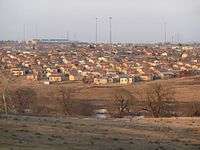
 Aerial View of Bethlehem CBD seen from uitsig | |
 Bethlehem  Bethlehem Bethlehem (South Africa)  Bethlehem Bethlehem (Africa) | |
| Coordinates: 28°13′26″S 28°18′40″E / 28.224°S 28.311°ECoordinates: 28°13′26″S 28°18′40″E / 28.224°S 28.311°E | |
| Country | South Africa |
| Province | Free State |
| District | Thabo Mofutsanyane |
| Municipality | Dihlabeng |
| Established | 1859 |
| Area[1] | |
| • Total | 27.83 km2 (10.75 sq mi) |
| Elevation | 1,700 m (5,600 ft) |
| Population (2011)[1] | |
| • Total | 16,236 |
| • Density | 580/km2 (1,500/sq mi) |
| Racial makeup (2011)[1] | |
| • Black African | 32.7% |
| • Coloured | 8.7% |
| • Indian/Asian | 2.1% |
| • White | 56.0% |
| • Other | 0.4% |
| First languages (2011)[1] | |
| • Afrikaans | 66.7% |
| • Sotho | 19.4% |
| • English | 7.2% |
| • Zulu | 2.7% |
| • Other | 4.0% |
| Time zone | UTC+2 (SAST) |
| Postal code (street) | 9701 |
| PO box | 9700 |
| Area code | 058 |
Bethlehem is a large town in the eastern Free State province of South Africa that is situated on the Liebenbergs river (also called Liebenbergs Vlei) along a fertile valley just north of the Rooiberg Mountains on the N5 road.It is the fastest growing town in the Free state province, with its target of being the Fourth largest city after Kroonstad in balance.
It is a wheat growing area and named after the biblical Bethlehem (from "Beit Lechem", Hebrew for "house of bread").[2]
The town lies at an altitude of 1,700 metres (5,600 ft) and this contributes to its cool climate with frosty winters and mild summers. The average annual temperature is around 24 °C (75 °F)
Bethlehem is situated approximately 240 kilometres (150 mi) north-east of Bloemfontein, 140 kilometres (87 mi) east of Kroonstad and 90 kilometres (56 mi) west of Harrismith. The town is strategically situated in the heart of the picturesque north-eastern Free State and originally developed as a service centre.[3] Bethlehem is the seat of the Dihlabeng Local Municipality (this municipality is situated within the boundaries of the Thabo Mofutsanyana District Municipality in the Eastern Free State).
The township associated with Bethlehem is called Bohlokong, named after the hloko/bohloko grass Diheteropogon filifolius.[4]
History
Bethlehem was founded by three local residents, Kristiaan Klopper, Neil Bishop and Henco Cronjé, who jointly bought the farm Pretorius Kloof. The first stands were sold in 1860 and a justice of peace appointed in 1864.[5]
Society and culture
Museums, provincial heritage sites and memorials
A number of heritage sites are located in Bethlehem:
- 14 President Burgers Street[6]
- A B Baartman Wagon House[7]
- Loch Athlone Dam Wall[8]
- Main Building of the Bethlehem Technical College[9]
- Nederduitse Gereformeerde Mother Church[10]
- Old Magistrates Court[11]
- Old Nederduitse Gereformeerde Mission Church parsonage[12]
- Old Nederduitse Gereformeerde Mission Church[13]
- St Andrews Presbyterian Church[14]
- St Augustine Anglican Church[15]
- Strapps Shop[16]
- The Seminary[17]
- Town Hall[18]
- Wooden Spoon Restaurant[19]
Well-known schools
- Witteberg High School:
School of majestic academical,social and sport achievements.
- Voortrekker high school
- Jordania Primary School
- Truida Kestell Primary School
- Graanveld Primary School
Climate
| Climate data for Bethlehem, Free State (1980–1990) | |||||||||||||
|---|---|---|---|---|---|---|---|---|---|---|---|---|---|
| Month | Jan | Feb | Mar | Apr | May | Jun | Jul | Aug | Sep | Oct | Nov | Dec | Year |
| Record high °C (°F) | 33 (91) |
33 (91) |
31 (88) |
29 (84) |
27 (81) |
22 (72) |
24 (75) |
27 (81) |
32 (90) |
32 (90) |
33 (91) |
32 (90) |
33 (91) |
| Average high °C (°F) | 27 (81) |
26 (79) |
24 (75) |
22 (72) |
19 (66) |
16 (61) |
16 (61) |
19 (66) |
22 (72) |
23 (73) |
25 (77) |
26 (79) |
22 (72) |
| Average low °C (°F) | 13 (55) |
13 (55) |
11 (52) |
7 (45) |
2 (36) |
−2 (28) |
−2 (28) |
1 (34) |
5 (41) |
8 (46) |
10 (50) |
12 (54) |
6 (43) |
| Record low °C (°F) | 7 (45) |
3 (37) |
2 (36) |
−3 (27) |
−6 (21) |
−9 (16) |
−9 (16) |
−9 (16) |
−7 (19) |
−2 (28) |
1 (34) |
1 (34) |
−9 (16) |
| Average precipitation mm (inches) | 96 (3.78) |
77 (3.03) |
94 (3.7) |
58 (2.28) |
9 (0.35) |
12 (0.47) |
7 (0.28) |
27 (1.06) |
35 (1.38) |
83 (3.27) |
96 (3.78) |
86 (3.39) |
680 (26.77) |
| Average precipitation days (≥ 1.0 mm) | 14 | 12 | 11 | 8 | 3 | 3 | 3 | 2 | 4 | 12 | 13 | 14 | 98 |
| Source: South African Weather Service[20] | |||||||||||||
Shopping
Bethlehem has many shopping centres like any other town in the Free State. Bethlehem is the main center of the eastern Free State where people from other towns do their shopping, the main shopping malls are:
- Bethlehem mall
- Dihlabeng mall
- Maluti square.
Others are:
- Village square
- Metropolitan life centre
- Shoprite centre.
With the shopping in this town also characterised by typical high street shopping with majority of shops situated along the Muller, Cambridge, Louw, Church, High and other surrounding streets.
Sport
Premier Soccer League and National First Division clubs Free State Stars and Super Eagles F.C are based in Bethlehem and plays its home games at Goble Park. Bethlehem is also the birthplace of notable rugby union players including brothers, Jannie and Bismarck du Plessis. One of the greatest rugby players in history, Tom van Vollenhoven who played rugby union for South Africa and rugby league for St Helens in England was born in Bethlehem.
Economy
- Bethlehem it is considered as retail, medical, and educational hub for the Eastern Free State. It has three private hospitals and four star Frontier hotel, Casino and Entertainment Centre located near the beautiful Dihlabeng Mall and Bethlehem Aerodrome.
Industry
Bethlehem hosts several industries with beverage companies Coca-Cola and South African Breweries, Nestlé, and petroleum and engineering companies located in the town.
Health
- Dihlabeng Regional Hospital(public)
- Phekolong Hospital (Public)
- Hoogland Medi-Clinic (Private)
- Bethlehem Medical Centre (Semi-Private)
- Nurture Carona Hospital (semi-private)
- Bethlehem Diere Hospital (Private)
- Several government clinics also in the townships of Bohlokong, Thorisong, Vuka, Phumlamqashi, Old Location, Giyani and Bakenpark.
Transportation
Road
Bethlehem is located on the N5 road to the provincial capital Bloemfontein via senekal and winburg to the N1. Other regional roads in the town are R76 road to Kroonstad (north), the R26 road to Reitz and Fouriesburg (north east and south) respectively.
Rail
Bethlehem is located on the main railway line between Bloemfontein and Durban. This railway line transports passengers and freight.
Air
Bethlehem is served by small airport with chartered daily flights to Bloemfontein and Johannesburg.
Coats of arms
Municipal (1)
By 1931, the municipal council had assumed a coat of arms.[21] The arms were registered with the Orange Free State Provincial Administration in October 1958.[22]
The arms were: Party per chevron Azure and Gules, a chevron Or, in chief between two springboks couped at the neck respecting each other, proper, a mullet of the third, and in base three maize cobs, the outer ones pilewise, all proper. In layman's terms, the shield depicted a golden chevron between a gold star and two springboks' head on a blue background, and three maize cobs on a red background.
Municipal (2)
A new coat of arms was designed in the 1980s. It was registered at the Bureau of Heraldry in June 1989.[23]
The arms were: Per chevron, Azure and Gules, a chevron Or between in chief a mullet and in base two bars wavy, Argent (i.e. a golden chevron between a silver star on a blue background and two wavy silver stripes on a red background).
The crest was three golden ears of wheat with blue stalks and leaves, tied together with a red band; the motto was Conjuncti prosperamus.
References
- 1 2 3 4 "Main Place Bethlehem". Census 2011.
- ↑ Raper, RE. Dictionary of Southern African Place Names. Human Science Research Council.
- ↑ http://www.dihlabeng.gov.za
- ↑ Rodney Moffet, Grasses of the Eastern Free State: Their descriptions and uses, UNIQWA, Phuthaditjhaba, 1997
- ↑ Theal, George McCall (1900). History of South Africa: The Republics and Native Territories from 1854 to 1872. S. Sonnenschein & co. p. 80.
- ↑ "14 President Burgers Street Bethlehem". South African Heritage Resources Agency. Archived from the original on 2016-03-03.
- ↑ "A B Baartman Wagon House Muller and Landdros Streets Bethlehem". South African Heritage Resources Agency. Archived from the original on 2012-11-28.
- ↑ "Loch Athlone Dam Wall Pretoriuskloof Nature Reserve Bethlehem". South African Heritage Resources Agency. Archived from the original on 2012-11-28.
- ↑ "Main Building Technical College Bethlehem Wessels Street Bethlehem". South African Heritage Resources Agency. Archived from the original on 2016-03-03.
- ↑ "Nederduitse Gereformeerde Mother Church Church Square Bethlehem". South African Heritage Resources Agency. Archived from the original on 2016-03-03.
- ↑ "Old Magistrates Court Louw Street Bethlehem". South African Heritage Resources Agency. Archived from the original on 2016-03-03.
- ↑ "Old Nederduitse Gereformeerde Mission Church parsonage President Boshoff Street Bethlehem". South African Heritage Resources Agency. Archived from the original on 2016-03-04.
- ↑ "Old Nederduitse Gereformeerde Mission Church Muller Street Bethlehem". South African Heritage Resources Agency. Archived from the original on 2012-11-29.
- ↑ "St Andrews Presbyterian Church 144 Cambridge Street Bethlehem". South African Heritage Resources Agency. Archived from the original on 2016-03-03.
- ↑ "St Augustine Anglican Church 34 Louw Street Bethlehem". South African Heritage Resources Agency. Archived from the original on 2016-03-04.
- ↑ "Strapps Shop 18 Church Street Bethlehem". South African Heritage Resources Agency. Archived from the original on 2016-03-03.
- ↑ "The Seminary Wessels Street Bethlehem". South African Heritage Resources Agency. Archived from the original on 2012-11-28.
- ↑ "Town Hall 20-22 Muller Street Bethlehem". South African Heritage Resources Agency. Archived from the original on 2016-03-04.
- ↑ "Wooden Spoon Braairestaurant 12 Church Street Bethlehem". South African Heritage Resources Agency. Archived from the original on 2016-03-04.
- ↑ "Climate data for Bethlehem". South African Weather Service. Archived from the original on 9 September 2011. Retrieved 19 November 2016.
- ↑ The arms were depicted on a cigarette card issued in 1931.
- ↑ Orange Free State Official Gazette 41 (10 October 1958).
- ↑ http://www.national.archsrch.gov.za%5Bpermanent+dead+link%5D
External links
| Wikimedia Commons has media related to Bethlehem, Free State. |
Places adjacent to Bethlehem, Free State | |
|---|---|
Municipalities and communities of Thabo Mofutsanyana District Municipality, Free State | ||
|---|---|---|
District seat: Phuthaditjhaba (Witsieshoek) | ||
| Setsoto | .svg.png) | |
| Dihlabeng | ||
| Nketoana | ||
| Maluti-a-Phofung | ||
| Phumelela | ||
| Mantsopa | ||