Aegean Sea
| Aegean Sea Αιγαίο Πέλαγος | |
|---|---|
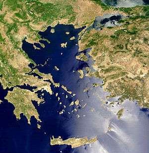 A satellite image of the Aegean Sea | |
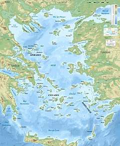 A Topographical and bathymetric map of the Aegean Sea | |
| Location | Mediterranean Sea |
| Coordinates | 39°N 25°E / 39°N 25°ECoordinates: 39°N 25°E / 39°N 25°E |
| Type | Sea |
| Primary outflows | Mediterranean Sea |
| Basin countries | Greece, Turkey[1] |
| Max. length | 700 km (430 mi) |
| Max. width | 400 km (250 mi) |
| Surface area | 214,000 km2 (83,000 sq mi) |
| Islands | 150+ |
The Aegean Sea (/ɪˈdʒiːən/ or /eɪˈdʒiːən/; Greek: Αιγαίο Πέλαγος Aigaío Pélagos [eˈʝeo ˈpelaɣos] (![]()
The sea was traditionally known as the Archipelago (in Ancient Greek, Ἀρχιπέλαγος, meaning "chief sea"), but in English the meaning of Archipelago has changed to refer to the Aegean Islands and, generally, to any island group.
Etymology
In ancient times, there were various explanations for the name Aegean. It was said to have been named after the Greek town of Aegae; after Aegea, a queen of the Amazons who died in the sea; Aigaion, the "sea goat", another name of Briareus, one of the archaic Hecatonchires; or, especially among the Athenians, Aegeus, the father of Theseus, who drowned himself in the sea when he thought his son had died.
A possible etymology is a derivation from the Greek word αἶγες – aiges = "waves" (Hesychius of Alexandria; metaphorical use of αἴξ (aix) "goat"), hence "wavy sea", cf. also αἰγιαλός (aigialos = aiges (waves) + hals (sea)),[2] hence meaning "sea-shore".
The Venetians, who ruled many Greek islands in the High and Late Middle Ages, popularized the name Archipelago (Greek for "main sea" or "chief sea"), a name that held on in many European countries until the early modern period.
In some South Slavic languages the Aegean is often called White Sea (Belo more/Бело море in Serbo-Croatian and Macedonian; Бяло море Byalo more in Bulgarian).[3]
Geography
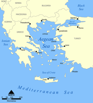
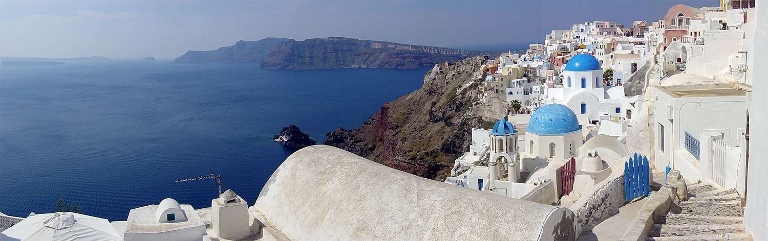
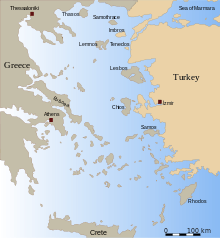
The Aegean Sea covers about 214,000 square kilometres (83,000 sq mi) in area, and measures about 610 kilometres (380 mi) longitudinally and 300 kilometres (190 mi) latitudinally. The sea's maximum depth is 3,543 metres (11,624 ft), east of Crete. The Aegean Islands are found within its waters, with the following islands delimiting the sea on the south (generally from west to east): Kythera, Antikythera, Crete, Kasos, Karpathos and Rhodes.
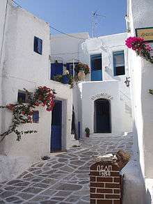
The Aegean Islands, which almost all belong to Greece, can be divided into seven groups:
- Northeastern Aegean Islands (Thracian Sea[4])
- East Aegean Islands (Euboea)
- Northern Sporades
- Cyclades
- Saronic Islands (or Argo-Saronic Islands)
- Dodecanese (or Southern Sporades), with the exclusion of Kastellorizo
- Crete
The word archipelago was originally applied specifically to the Aegean Sea and its islands. Many of the Aegean Islands, or chains of islands, are actually extensions of the mountains on the mainland. One chain extends across the sea to Chios, another extends across Euboea to Samos, and a third extends across the Peloponnese and Crete to Rhodes, dividing the Aegean from the Mediterranean.
The bays and gulfs of the Aegean beginning at the South and moving clockwise include on Crete, the Mirabello, Almyros, Souda and Chania bays or gulfs, on the mainland the Myrtoan Sea to the west with the Argolic Gulf, the Saronic Gulf northwestward, the Petalies Gulf which connects with the South Euboic Sea, the Pagasetic Gulf which connects with the North Euboic Sea, the Thermian Gulf northwestward, the Chalkidiki Peninsula including the Cassandra and the Singitic Gulfs, northward the Strymonian Gulf and the Gulf of Kavala and the rest are in Turkey; Saros Gulf, Edremit Gulf, Dikili Gulf, Gulf of Çandarlı, Gulf of İzmir, Gulf of Kuşadası, Gulf of Gökova, Güllük Gulf.
Extent
The International Hydrographic Organization defines the limits of the Aegean Sea as follows:[5]
On the South. A line running from Cape Aspro (28°16′E) in Asia Minor, to Cum Burnù (Capo della Sabbia) the Northeast extreme of the Island of Rhodes, through the island to Cape Prasonisi, the Southwest point thereof, on to Vrontos Point (35°33′N) in Skarpanto [Karpathos], through this island to Castello Point, the South extreme thereof, across to Cape Plaka (East extremity of Crete), through Crete to Agria Grabusa, the Northwest extreme thereof, thence to Cape Apolitares in Antikithera Island, through the island to Psira Rock (off the Northwest point) and across to Cape Trakhili in Kithera Island, through Kithera to the Northwest point (Cape Karavugia) and thence to Cape Santa Maria (36°28′N 22°57′E / 36.467°N 22.950°E) in the Morea.
In the Dardanelles. A line joining Kum Kale (26°11′E) and Cape Helles.
Hydrography
Aegean surface water circulates in a counterclockwise gyre, with hypersaline Mediterranean water moving northward along the west coast of Turkey, before being displaced by less dense Black Sea outflow. The dense Mediterranean water sinks below the Black Sea inflow to a depth of 23–30 metres (75–98 ft), then flows through the Dardanelles Strait and into the Sea of Marmara at velocities of 5–15 cm/s (2–6 in/s). The Black Sea outflow moves westward along the northern Aegean Sea, then flows southwards along the east coast of Greece.[6]
The physical oceanography of the Aegean Sea is controlled mainly by the regional climate, the fresh water discharge from major rivers draining southeastern Europe, and the seasonal variations in the Black Sea surface water outflow through the Dardanelles Strait.
Analysis[7] of the Aegean during 1991 and 1992 revealed three distinct water masses:
- Aegean Sea Surface Water – 40–50 metres (130–160 ft) thick veneer, with summer temperatures of 21–26 °C and winter temperatures ranging from 10 °C (50 °F) in the north to 16 °C (61 °F) in the south.
- Aegean Sea Intermediate Water – Aegean Sea Intermediate Water extends from 40–50 m to 200–300 metres (660–980 ft) with temperatures ranging from 11–18 °C.
- Aegean Sea Bottom Water – occurring at depths below 500–1000 m with a very uniform temperature (13–14 °C) and salinity (3.91–3.92%).
History
Ancient history
The current coastline dates back to about 4000 BC. Before that time, at the peak of the last ice age (about 18,000 years ago) sea levels everywhere were 130 metres lower, and there were large well-watered coastal plains instead of much of the northern Aegean. When they were first occupied, the present-day islands including Milos with its important obsidian production were probably still connected to the mainland. The present coastal arrangement appeared around 9,000 years ago, with post-ice age sea levels continuing to rise for another 3,000 years after that.[8]
The subsequent Bronze Age civilizations of Greece and the Aegean Sea have given rise to the general term Aegean civilization. In ancient times, the sea was the birthplace of two ancient civilizations – the Minoans of Crete and the Myceneans of the Peloponnese.[9]
Later arose the city-states of Athens and Sparta among many others that constituted the Athenian Empire and Hellenic Civilization. Plato described the Greeks living round the Aegean "like frogs around a pond".[10] The Aegean Sea was later invaded by the Persians and the Romans, and inhabited by the Eastern Romans (Byzantine-Greeks), the Bulgarians, the Venetians, the Genoese, the Seljuq Turks, and the Ottomans. The Aegean was the site of the original democracies, and its seaways were the means of contact among several diverse civilizations of the Eastern Mediterranean.
Economy and politics
Many of the islands in the Aegean have safe harbours and bays. In ancient times, navigation through the sea was easier than travelling across the rough terrain of the Greek mainland (and to some extent the coastal areas of Anatolia). Many of the islands are volcanic, and marble and iron are mined on other islands. The larger islands have some fertile valleys and plains.
Of the main islands in the Aegean Sea, two belong to Turkey – Bozcaada (Tenedos) and Gökçeada (Imbros); the rest belong to Greece. Between the two countries, there are political disputes over several aspects of political control over the Aegean space, including the size of territorial waters, air control and the delimitation of economic rights to the continental shelf.
See also

- Aegean languages
- List of Greek place names
- Thracian Sea
References
- ↑ DRAINAGE BASIN OF THE MEDITERRANEAN SEA, UNECE
- ↑ Henry George Liddell, Robert Scott, A Greek-English Lexicon, s.v. "αἰγιαλός"
- ↑ Zbornik Matice srpske za društvene nauke: (1961), Volumes 28-31, p.74 (in Serbian)
- ↑ "Aegean Sea | Mediterranean Sea". Encyclopedia Britannica. Retrieved 2017-10-18.
- ↑ "Limits of Oceans and Seas, 3rd edition" (PDF). International Hydrographic Organization. 1953. Retrieved 15 February 2016.
- ↑ Aksu, A. E., D. Yasar, et al. (1995). "LATE GLACIAL-HOLOCENE PALEOCLIMATIC AND PALEOCEANOGRAPHIC EVOLUTION OF THE AEGEAN SEA – MICROPALEONTOLOGICAL AND STABLE ISOTOPIC EVIDENCE." Marine Micropaleontology 25(1): 1–28.
- ↑ Yagar, D., 1994. Late glacial-Holocene evolution of the Aegean Sea. Ph.D. Thesis, Inst. Mar. Sci. Technol., Dokuz Eyltil Univ., 329 pp. (Unpubl.)
- ↑ Tjeerd H. van Andel; Judith C. Shackleton (Winter 1982). Late Paleolithic and Mesolithic Coastlines of Greece and the Aegean. 9, . Journal of Field Archaeology. pp. 445–454.
- ↑ Tracey Cullen, Aegean Prehistory: A Review (American Journal of Archaeology. Supplement, 1); Oliver Dickinson, The Aegean Bronze Age (Cambridge World Archaeology).
- ↑ John F. Cherry; Despina Margomenou; Lauren E. Talalay. The familiar phrase giving rise to the title Prehistorians Round the Pond: Reflections on Aegean Prehistory as a Discipline.
External links
| Wikimedia Commons has media related to Aegean Sea. |
| Wikivoyage has a travel guide for Aegean Sea. |
| Wikisource has the text of the 1911 Encyclopædia Britannica article Aegean Sea. |
- "Cultural Portal of the Aegean Archipelago". Foundation of the Hellenic World. Archived from the original on 10 August 2012. Retrieved 9 July 2012.
| |||||||||||||||||||||||||
| |||||||||||||||||||||||||
| |||||||||||||||||||||||||
| |||||||||||||||||||||||||
| |||||||||||||||||||||||||
| |||||||||||||||||||||||||
| |||||||||||||||||||||||||
| Arctic Ocean | |
|---|---|
| Atlantic Ocean |
|
| Indian Ocean | |
| Pacific Ocean |
|
| Southern Ocean | |
| Landlocked seas | |
| |