Laurasia
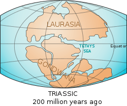 Map of Pangaea with Laurasia and Gondwana. | |
| Historical continent | |
|---|---|
| Formed |
1,071 Mya (Proto-Laurasia) 253 Mya |
| Type | Geological supercontinent |
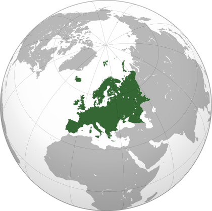
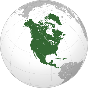
| Today part of |
|
| Smaller continents | |
| Tectonic plate | |
Laurasia (/lɔːˈreɪʒə,
The name combines the names of Laurentia, the name given to the North American craton, and Eurasia. As suggested by the geologic naming, Laurasia included most of the land masses which make up today's continents of the Northern Hemisphere, chiefly Laurentia, Baltica, Siberia, Kazakhstania, and the North China and East China cratons.
Origin
Although Laurasia is known as a Mesozoic phenomenon, today it is believed that the same continents that formed the later Laurasia also existed as a coherent supercontinent after the breakup of Rodinia around 750 million years ago. To avoid confusion with the Mesozoic continent, this is referred to as Proto-Laurasia. It is believed that Laurasia did not break up again before it recombined with the southern continents to form the late Precambrian supercontinent of Pannotia, which remained until the early Cambrian. Laurasia was assembled, then broken up, due to the actions of plate tectonics, continental drift, and seafloor spreading.
Breakup and reformation
During the Cambrian, Laurasia was largely located in equatorial latitudes and began to break up, with North China and Siberia drifting into latitudes further north than those occupied by continents during the previous 500 million years. By the Devonian, North China was located near the Arctic Circle and it remained the northernmost land in the world during the Carboniferous Ice Age between 300 and 280 million years ago. No evidence, though, exists for any large-scale Carboniferous glaciation of the northern continents. This cold period saw the rejoining of Laurentia and Baltica with the formation of the Appalachian Mountains and vast coal deposits, found in regions including West Virginia, Britain, and Germany.
Siberia moved southwards and joined with Kazakhstania, a small continental region believed today to have been created during the Silurian by extensive volcanism. When these two continents joined together, Laurasia was nearly reformed, and by the beginning of the Triassic, the East China craton had rejoined the redeveloping Laurasia as it collided with Gondwana to form Pangaea. North China became, as it drifted southwards from near-Arctic latitudes, the last continent to join with Pangaea.
Final split
Around 200 million years ago, Pangaea started to break up. Between eastern North America and northwest Africa, a new ocean formed - the Atlantic Ocean, though Greenland (attached to North America) and Europe were still joined together. The separation of Europe and Greenland occurred around 55 million years ago (at the end of the Paleocene). Laurasia finally divided into the continents after which it is named: Laurentia (now North America) and Eurasia (excluding the Indian subcontinent).
See also
References
| Look up laurasia in Wiktionary, the free dictionary. |
- ↑ OED
Continents of the world | ||||||
|---|---|---|---|---|---|---|
| ||||||
| ||||||
.svg.png)
.svg.png)
.svg.png)
.svg.png)
.svg.png)
.svg.png)
.svg.png)
.svg.png)
.svg.png)