Inland Northwest
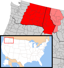
The Inland Northwest[1] or Inland Empire is a region adjacent to and just east of the Pacific Northwest centered on the Greater Spokane Area, that includes all of Eastern Washington and all of North Idaho. The region also contains the Tri-Cities. The portion of Montana west of the Continental Divide is sometimes included as part of the region. Included in the region are the counties of:
- Washington
- Adams, Asotin, Benton, Chelan, Columbia, Douglas, Ferry, Franklin, Garfield, Grant, Kittitas, Klickitat, Lincoln, Okanogan, Pend Oreille, Spokane, Stevens, Walla Walla, Whitman, and Yakima
- Idaho
- Benewah, Bonner, Boundary, Clearwater, Idaho, Kootenai, Latah, Lewis, Nez Perce, and Shoshone
Montana (sometimes included)
As of 2016 the U.S. Census Bureau estimated the region's population at 2,240,645, comparable to that of New Mexico. Its Canadian counterpart, north of the border, is the British Columbia Interior.
Geography
The region is bounded by the Cascade Mountains on the west and the Rocky Mountains (following the spine of the remote and rugged Cabinet Mountains) on the east, the Blue Mountains of Oregon and foothills of the Wallowa Mountains to the south, southeast, and encompasses the Columbia river basin (or Columbia Plateau). Between the three mountain ranges are large, sweeping areas of semi-arid steppe, part of which has been irrigated due to the Columbia Basin Project, resulting in expansive farmland in central Washington. The Palouse, original home of the Appaloosa, is another major agricultural region located in the gently rolling hills of southeastern Washington and extending into Idaho. In northern Idaho, the Silver Valley is a mineral-rich region of the Coeur d'Alene Mountains noted for its mining heritage, dating back to the 1880s.
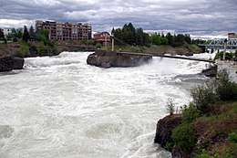
Spokane is the region's largest city, is located near where the arid, and largely unforested Columbia plateau meets the lush forests of the Selkirk Mountains. The urban area stretches east into Idaho along the I-90 corridor through the Spokane River valley across the border of Idaho to Post Falls and the city of Coeur d'Alene on the north bank of Lake Coeur d'Alene. The Northeastern Washington and Northern Idaho portion of the Inland Empire are mountainous and forested, and the crest of the Bitterroot Range of the Rocky Mountains forms part of the eastern boundary of the Inland Empire region, while the Columbia River forms a significant part of its southern boundary.
Gallery
 Spokane
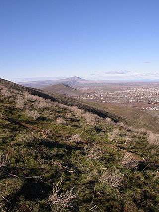 Hills near West Richland, Washington
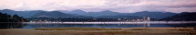
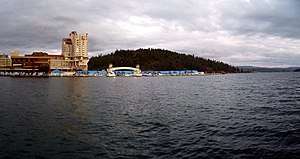 Coeur d'Alene
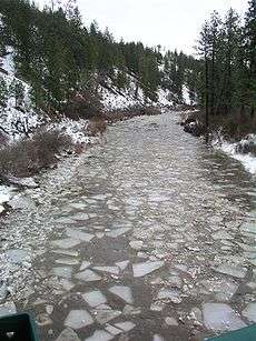 Hangman or Latah Creek, a historical site
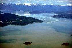 Lake Pend Oreille, 1,150 ft (350 m) deep
 View from north of Lewiston, Idaho and Clarkston, Washington
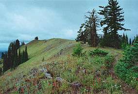 Oregon Butte in the Wenaha–Tucannon Wilderness
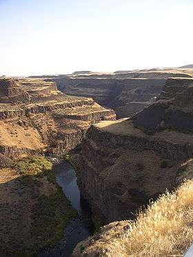 Palouse Canyon
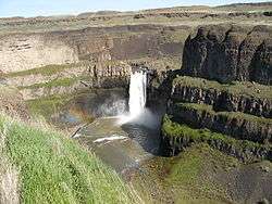


 The Palouse from Steptoe Butte
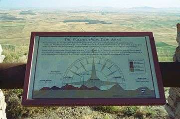 Interpretive sign on summit of Steptoe Butte
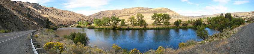
Climate
The Washington side is generally semi-arid, while the Idaho side experiences mostly a humid continental climate.
Largest cities by population
- Spokane, Washington (pop. 217,300)
- Spokane Valley, Washington (pop. 94,919)
- Yakima, Washington (pop. 93,701)
- Kennewick, Washington (pop. 80,280)
- Missoula, Montana (pop. 73,340)
- Pasco, Washington (pop. 71,680)
- Richland, Washington (pop. 54,150)
- Coeur d'Alene, Idaho (pop. 52,593)
- Post Falls, Idaho (pop. 34,371)
- Wenatchee, Washington (pop. 34,060)
- Walla Walla, Washington (pop. 33,840)
- Lewiston, Idaho (pop. 33,334)
- Pullman, Washington (pop. 32,280)
- Moscow, Idaho (pop. 25,984)
- Kalispell, Montana (pop. 23,212)
- Moses Lake, Washington (pop. 22,720)
- Ellensburg, Washington (pop. 19,550)
- Sunnyside, Washington (pop. 16,640)
- Hayden, Idaho (pop. 14,760)
- West Richland, Washington (pop. 14,660)
- East Wenatchee, Washington (pop. 13,600)
- Cheney, Washington (pop. 11,880)
- Grandview, Washington (pop. 11,170)
See also
References

Boise (capital) | ||
| Topics |
| |
| Society | ||
| Regions | ||
| Larger cities | ||
| Smaller cities | ||
| Counties |
| |