Nakop
| Nakop | |
|---|---|
 Nakop  Nakop Nakop (South Africa)  Nakop Nakop (Africa) | |
| Coordinates: 28°05′31″S 20°00′36″E / 28.0919°S 20.01°ECoordinates: 28°05′31″S 20°00′36″E / 28.0919°S 20.01°E | |
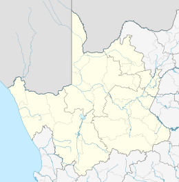
| Country | South Africa |
| Province | Northern Cape |
| District | ZF Mgcawu |
| Municipality | Kai !Garib |
| Area[1] | |
| • Total | 1.02 km2 (0.39 sq mi) |
| Population (2001)[1] | |
| • Total | 315 |
| • Density | 310/km2 (800/sq mi) |
| Racial makeup (2001)[1] | |
| • Coloured | 100.0% |
| First languages (2001)[1] | |
| • Afrikaans | 100% |
| Time zone | UTC+2 (SAST) |
| Area code | 054 |
Nakop is a small town and border post in northwestern South Africa on its border with Namibia. It lies ten kilometres north of the Orange River.
| South Africa | Namibia | |
|---|---|---|
| Region | Northern Cape | |
| Nearest town | Nakop | Ariamsvlei |
| Road | N10 | B3 |
| GPS Coordinates | 28°05′31″S 20°00′36″E / 28.0919°S 20.01°E | 28°05′31″S 20°00′36″E / 28.0919°S 20.01°E |
| Telephone number | +27 (0)54 571 0008 / 0077 | |
| Fax number | +27 (0)54 571 0009 | |
| Postal address | ||
| Business hours | 24 hours | 24 hours |
References
- 1 2 3 4 "Main Place Nakop". Census 2001.
- ↑ DHA Webpage - South African Ports of entry
Municipalities and communities of ZF Mgcawu District Municipality, Northern Cape | ||
|---|---|---|
District seat: Upington | ||
| Dawid Kruiper | .svg.png) | |
| Kai !Garib | ||
| Kgatelopele | ||
| !Kheis | ||
| Tsantsabane | ||
This article is issued from
Wikipedia.
The text is licensed under Creative Commons - Attribution - Sharealike.
Additional terms may apply for the media files.