Minonk Township, Woodford County, Illinois
| Minonk Township | |
|---|---|
| Township | |
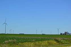 Wind farm along Illinois Route 116 | |
 Location in Woodford County | |
| Country | United States |
| State | Illinois |
| County | Woodford |
| Established | Unknown |
| Area | |
| • Total | 36.69 sq mi (95.0 km2) |
| • Land | 36.64 sq mi (94.9 km2) |
| • Water | 0.05 sq mi (0.1 km2) 0.14% |
| Population (2010) | |
| • Estimate (2016)[1] | 2,248 |
| • Density | 62.5/sq mi (24.1/km2) |
| Time zone | UTC-6 (CST) |
| • Summer (DST) | UTC-5 (CDT) |
| FIPS code | 17-203-49581 |
Minonk Township is located in Woodford County, Illinois at T28N, R2E. It includes within its boundaries the city of Minonk, Illinois. As of the 2010 census, its population was 2,292 and it contained 998 housing units.[2] Minonk Township and Panola Township (T27N, R2E) were originally the same township, but were separated on an unknown date.
Geography
According to the 2010 census, the township has a total area of 36.69 square miles (95.0 km2), of which 36.64 square miles (94.9 km2) (or 99.86%) is land and 0.05 square miles (0.13 km2) (or 0.14%) is water.[2]
Demographics
| Historical population | |||
|---|---|---|---|
| Census | Pop. | %± | |
| Est. 2016 | 2,248 | [1] | |
| U.S. Decennial Census[3] | |||
References
- 1 2 "Population and Housing Unit Estimates". Retrieved June 9, 2017.
- 1 2 "Population, Housing Units, Area, and Density: 2010 - County -- County Subdivision and Place -- 2010 Census Summary File 1". United States Census. Retrieved 2013-05-28.
- ↑ "Census of Population and Housing". Census.gov. Retrieved June 4, 2016.
External links
Municipalities and communities of Woodford County, Illinois, United States | ||
|---|---|---|
| Cities | ||
| Villages | ||
| Townships | ||
| Unincorporated communities | ||

Coordinates: 40°53′N 89°0′W / 40.883°N 89.000°W
This article is issued from
Wikipedia.
The text is licensed under Creative Commons - Attribution - Sharealike.
Additional terms may apply for the media files.