Cazenovia Township, Woodford County, Illinois
| Cazenovia Township | |
|---|---|
| Township | |
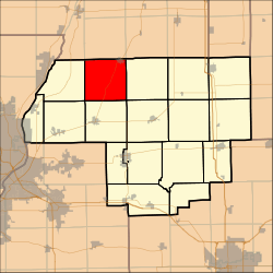 Location in Woodford County | |
| Country | United States |
| State | Illinois |
| County | Woodford |
| Established | November 7, 1854 |
| Area | |
| • Total | 36.16 sq mi (93.7 km2) |
| • Land | 36.15 sq mi (93.6 km2) |
| • Water | 0.01 sq mi (0.03 km2) 0.03% |
| Population (2010) | |
| • Estimate (2016)[1] | 1,751 |
| • Density | 48.9/sq mi (18.9/km2) |
| Time zone | UTC-6 (CST) |
| • Summer (DST) | UTC-5 (CDT) |
| FIPS code | 17-203-11878 |
Cazenovia Township, Township 28 North, Range 2 West, is located in Woodford County, Illinois. It includes most of the town of Washburn, Illinois and the villages of Cazenovia and Low Point, Illinois and is traversed by State Route 89. As of the 2010 census, its population was 1,768 and it contained 721 housing units.[2]
The township was named after the town of Cazenovia, New York.[3]
Geography
According to the 2010 census, the township has a total area of 36.16 square miles (93.7 km2), of which 36.15 square miles (93.6 km2) (or 99.97%) is land and 0.01 square miles (0.026 km2) (or 0.03%) is water.[2]
Demographics
| Historical population | |||
|---|---|---|---|
| Census | Pop. | %± | |
| Est. 2016 | 1,751 | [1] | |
| U.S. Decennial Census[4] | |||
References
- 1 2 "Population and Housing Unit Estimates". Retrieved June 9, 2017.
- 1 2 "Population, Housing Units, Area, and Density: 2010 - County -- County Subdivision and Place -- 2010 Census Summary File 1". United States Census. Retrieved 2013-05-28.
- ↑ Gannett, Henry (1905). The Origin of Certain Place Names in the United States. Govt. Print. Off. p. 73.
- ↑ "Census of Population and Housing". Census.gov. Retrieved June 4, 2016.
External links
Coordinates: 40°54′N 89°19′W / 40.900°N 89.317°W
Municipalities and communities of Woodford County, Illinois, United States | ||
|---|---|---|
| Cities | ||
| Villages | ||
| Townships | ||
| Unincorporated communities | ||

This article is issued from
Wikipedia.
The text is licensed under Creative Commons - Attribution - Sharealike.
Additional terms may apply for the media files.