El Paso Township, Woodford County, Illinois
| El Paso Township | |
|---|---|
| Township | |
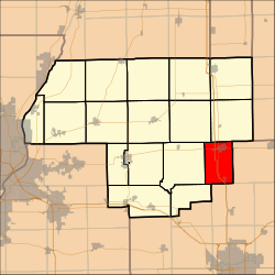 Location in Woodford County | |
| Country | United States |
| State | Illinois |
| County | Woodford |
| Established | September, 1861 |
| Government | |
| • Supervisor | Drew North |
| Area | |
| • Total | 24.23 sq mi (62.8 km2) |
| • Land | 24.22 sq mi (62.7 km2) |
| • Water | 0.01 sq mi (0.03 km2) 0.04% |
| Population (2010) | |
| • Estimate (2016)[1] | 3,439 |
| • Density | 142.8/sq mi (55.1/km2) |
| Time zone | UTC-6 (CST) |
| • Summer (DST) | UTC-5 (CDT) |
| FIPS code | 17-203-23750 |
El Paso Township is located in Woodford County, Illinois. As of the 2010 census, its population was 3,459 and it contained 1,387 housing units.[2] El Paso Township formed from Palestine Township in September, 1861. El Paso is located at 40°44'20" North, 89°0'58" West (40.738800, -89.016034).
The largest named community in El Paso Township is the city of El Paso, Illinois.
Geography
According to the 2010 census, the township has a total area of 24.23 square miles (62.8 km2), of which 24.22 square miles (62.7 km2) (or 99.96%) is land and 0.01 square miles (0.026 km2) (or 0.04%) is water.[2]
Demographics
| Historical population | |||
|---|---|---|---|
| Census | Pop. | %± | |
| Est. 2016 | 3,439 | [1] | |
| U.S. Decennial Census[3] | |||
References
- 1 2 "Population and Housing Unit Estimates". Retrieved June 9, 2017.
- 1 2 "Population, Housing Units, Area, and Density: 2010 - County -- County Subdivision and Place -- 2010 Census Summary File 1". United States Census. Retrieved 2013-05-28.
- ↑ "Census of Population and Housing". Census.gov. Retrieved June 4, 2016.
External links
Municipalities and communities of Woodford County, Illinois, United States | ||
|---|---|---|
| Cities | ||
| Villages | ||
| Townships | ||
| Unincorporated communities | ||

Coordinates: 40°42′41″N 89°01′07″W / 40.71139°N 89.01861°W
This article is issued from
Wikipedia.
The text is licensed under Creative Commons - Attribution - Sharealike.
Additional terms may apply for the media files.