Neuse River
| Neuse River | |
| River | |
 | |
| Country | United States |
|---|---|
| State | North Carolina |
| Region | South |
| Cities | Raleigh, North Carolina, Smithfield, North Carolina, Goldsboro, North Carolina, Kinston, North Carolina, New Bern, North Carolina |
| Source | Confluence of the Eno and Flat rivers |
| - location | Durham, North Carolina, United States |
| - elevation | 246 ft (75 m) |
| - coordinates | 36°05′42″N 78°48′49″W / 36.09500°N 78.81361°W |
| Mouth | Pamlico Sound |
| - location | Hobucken, North Carolina, United States |
| - elevation | −11 ft (−3 m) |
| - coordinates | 35°07′53″N 76°30′14″W / 35.13139°N 76.50389°WCoordinates: 35°07′53″N 76°30′14″W / 35.13139°N 76.50389°W |
| Length | 443 km (275 mi) |
| Basin | 14,600 km2 (5,637 sq mi) |
The Neuse River is a river rising in the Piedmont of North Carolina and emptying into Pamlico Sound below New Bern. Its total length is approximately 275 miles (443 km),[1] making it the longest river entirely contained in North Carolina. The Trent River joins the Neuse at New Bern. Its drainage basin, measuring 5,630 square miles (14,600 km2) in area, also lies entirely inside North Carolina. It is formed by the confluence of the Flat and Eno rivers prior to entering the manmade, artificial Falls Lake reservoir in northern Wake County. Its fall line shoals, known as the Falls of the Neuse, lie submerged under the waters of Falls Lake.
Geography

The Neuse begins at the confluence of the Flat and Eno rivers near Durham, North Carolina.[2][3][4] The river enters Pamlico Sound just east of Maw Point Shoal near Hobucken, North Carolina while en route to the Atlantic Ocean.[2][5]
Typical of rivers in the Coastal Plain of North Carolina, the Neuse enters a basin of chocolate intermittent bottomland swamp on its journey towards its outlet. One interesting exception is the "Cliffs of the Neuse" area near Goldsboro, where the river cuts a narrow 30 m (90 ft) gorge through limestone and sandstone bluffs. The Neuse is prone to extremes in its flow carriage, often escaping its banks during wet periods, then reducing to a trickle that can be forded on foot during prolonged drought conditions.
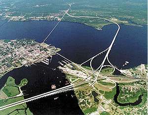
The Neuse flows through parts of seven counties. Major cities and towns in proximity to the Neuse are Durham; Neuse Township; Raleigh, the capital of North Carolina; Smithfield; Goldsboro; Kinston and New Bern.
History
For thousands of years before the Europeans arrived, different civilizations of indigenous peoples lived along the river. Many artifacts found along its banks have been traced to ancient prehistoric Native American settlements. Archaeological studies have shown waves of habitation.
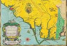
The river has one of the three oldest surviving English-applied placenames in the U.S.[6] Colonists named the Neuse River after its name by the American Indian tribe known as Neusiok, with whom the early Raleigh expeditions made contact. They also identified the region as the "Neusick". Two English captains, Arthur Barlowe and Phillip Armadas, were commissioned by Sir Walter Raleigh in 1584 to explore the New World. They landed on North Carolina’s coast July 2, 1584 to begin their research. In their 1585 report to Raleigh, they wrote favorably of the Indian population in "…the country Neusiok, situated upon a goodly river called Neuse…", as it was called by the local population.
In 1865 during the American Civil War, the Confederates burned one of the last ironclad warships which they had built, the Ram Neuse, to prevent its capture by Union troops. The level of the river had fallen so that it prevented the ship from passing downriver. Nearly a century later, during another period of historically low water, the remains of the ship were discovered. It was raised in 1963. Later the ship was installed beside the river at the Governor Caswell Memorial in Kinston.
The low-head Quaker Neck Dam was built in 1952 at Neuse River kilometer 225 to impound cooling water for a steam electric plant. A fish ladder was included. The dam was removed in May 1998, opening up access for anadromous fish to 127 kilometres (79 mi) of the mainstem Neuse River.[7]
Water quality
The Neuse has been plagued in recent years with environmental and public health problems related to municipal and agricultural waste water discharge, storm runoff, and other sources of pollution.[8] Pollution was particularly bad in the aftermath of hurricanes Fran and Floyd in the late 1990s.
The dinoflagellate Pfiesteria piscicida[9][10][11] is present in the river, and has a bloom in growth when nutrient levels are increased due to too much runoff. This organism may be connected to fish kills as well as adverse health effects in grapes.
Tributaries
See also
References
- ↑ "Neuse River" Archived 2009-06-09 at the Wayback Machine., The Columbia Gazetteer of North America
- 1 2 U.S. Geological Survey Geographic Names Information System: Neuse River
- ↑ U.S. Geological Survey Geographic Names Information System: Flat River
- ↑ Northeast Durham, North Carolina, 7.5 Minute Topographic Quadrangle, USGS, 1973 (1992 rev.)
- ↑ Jones Bay, NorthCarolina, 7.5 Minute Topographic Quadrangle, USGS, 1950 (1993 rev.)
- ↑ Stewart, George R. (1945) [1945]. Names on the Land: A Historical Account of Place-Naming in the United States (1st ed.). Random House. pp. 21, 22.
- ↑ Bowman, Stephan W. (15 March 2001), American Shad and Striped Bass Spawning Migration and Habitat Selection in the Neuse River, North Carolina (PDF), NCSU, p. 2, retrieved 2018-06-23
- ↑ "Neuse Issues and Facts", About the Neuse, Neuse River Foundation
- ↑ Pfiesteria Archived 2007-03-11 at the Wayback Machine., About the Neuse, Neuse River Foundation
- ↑ Pfiesteria, USDA
- ↑ Facts about Pfiesteria, NCDENR
External links
- Neuse Riverkeeper Foundation
- NCDENR: Neuse River Basin
- NCSU: Neuse River Basin
- USGS: Neuse River Current Conditions
- Upper Neuse River Basin Association
- Neuse River Compliance Association and Lower Neuse Basin Association
- The Neuse, River of Peace
- Events and Happening Along the Neuse River