Farmington, North Carolina
| Farmington, North Carolina | |
|---|---|
| Unincorporated community | |
 Farmington Location within the state of North Carolina | |
| Coordinates: 36°00′56″N 80°31′56″W / 36.01556°N 80.53222°WCoordinates: 36°00′56″N 80°31′56″W / 36.01556°N 80.53222°W | |
| Country | United States |
| State | North Carolina |
| County | Davie County |
| Elevation | 784 ft (239 m) |
| Time zone | UTC-5 (Eastern (EST)) |
| • Summer (DST) | UTC-4 (EDT) |
| ZIP code | 27028 |
| Area code(s) | 336 |
| GNIS feature ID | 1020220[1] |
Farmington is an unincorporated community in Davie County, North Carolina.[1] Located at the intersection NC 801 and Farmington Road (SR 1410), the area is a predominantly farming community. Located nearby is the Farmington Dragway.
References
- 1 2 "Farmington, North Carolina". Geographic Names Information System. United States Geological Survey. Retrieved October 31, 2014.
Municipalities and communities of Davie County, North Carolina, United States | ||
|---|---|---|
| Towns | 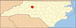 | |
| CDP | ||
| Unincorporated communities | ||
This article is issued from
Wikipedia.
The text is licensed under Creative Commons - Attribution - Sharealike.
Additional terms may apply for the media files.