Zanesville Township, Montgomery County, Illinois
| Zanesville Township | |
|---|---|
| Township | |
 | |
.svg.png) Location of Illinois in the United States | |
| Coordinates: 39°18′N 89°39′W / 39.300°N 89.650°WCoordinates: 39°18′N 89°39′W / 39.300°N 89.650°W | |
| Country | United States |
| State | Illinois |
| County | Montgomery |
| Settled | November 5, 1872 |
| Area | |
| • Total | 36.86 sq mi (95.5 km2) |
| • Land | 36.66 sq mi (94.9 km2) |
| • Water | 0.2 sq mi (0.5 km2) |
| Elevation | 653 ft (199 m) |
| Population (2010) | |
| • Estimate (2016)[1] | 470 |
| • Density | 13.4/sq mi (5.2/km2) |
| Time zone | UTC-6 (CST) |
| • Summer (DST) | UTC-5 (CDT) |
| FIPS code | 17-135-84129 |
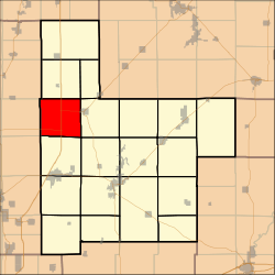
Zanesville Township (T10N R5W) is located in Montgomery County, Illinois. As of the 2010 census, its population was 491 and it contained 189 housing units.[2]
Geography
According to the 2010 census, the township has a total area of 36.86 square miles (95.5 km2), of which 36.66 square miles (94.9 km2) (or 99.46%) is land and 0.2 square miles (0.52 km2) (or 0.54%) is water.[2]
Demographics
| Historical population | |||
|---|---|---|---|
| Census | Pop. | %± | |
| Est. 2016 | 470 | [1] | |
| U.S. Decennial Census[3] | |||
Adjacent townships
- Pitman Township (north)
- Harvel Township (northeast)
- Raymond Township (east)
- Butler Grove Township (southeast)
- North Litchfield Township (south)
- Honey Point Township, Macoupin County (southwest)
- Shaws Point Township, Macoupin County (west)
- Nilwood Township, Macoupin County (northwest)
References
- 1 2 "Population and Housing Unit Estimates". Retrieved June 9, 2017.
- 1 2 "Population, Housing Units, Area, and Density: 2010 - County -- County Subdivision and Place -- 2010 Census Summary File 1". United States Census. Retrieved 2013-05-28.
- ↑ "Census of Population and Housing". Census.gov. Retrieved June 4, 2016.
External links
Municipalities and communities of Montgomery County, Illinois, United States | ||
|---|---|---|
| Cities | ||
| Villages | ||
| Townships | ||
| Unincorporated communities | ||
| Footnotes | ‡This populated place also has portions in an adjacent county or counties | |

This article is issued from
Wikipedia.
The text is licensed under Creative Commons - Attribution - Sharealike.
Additional terms may apply for the media files.