Scottville Township, Macoupin County, Illinois
| Scottville Township | |
|---|---|
| Township | |
 | |
.svg.png) Location of Illinois in the United States | |
| Coordinates: 39°29′N 90°6′W / 39.483°N 90.100°WCoordinates: 39°29′N 90°6′W / 39.483°N 90.100°W | |
| Country | United States |
| State | Illinois |
| County | Macoupin |
| Settled | November 1, 1870 |
| Area | |
| • Total | 36.73 sq mi (95.1 km2) |
| • Land | 36.71 sq mi (95.1 km2) |
| • Water | 0.02 sq mi (0.05 km2) |
| Elevation | 663 ft (202 m) |
| Population (2010) | |
| • Estimate (2016)[1] | 321 |
| • Density | 9.1/sq mi (3.5/km2) |
| Time zone | UTC-6 (CST) |
| • Summer (DST) | UTC-5 (CDT) |
| FIPS code | 17-117-68419 |
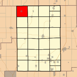
Scottville Township (T12N R9W) is located in Macoupin County, Illinois, United States. As of the 2010 census, its population was 333 and it contained 166 housing units.[2]
Geography
According to the 2010 census, the township has a total area of 36.73 square miles (95.1 km2), of which 36.71 square miles (95.1 km2) (or 99.95%) is land and 0.02 square miles (0.052 km2) (or 0.05%) is water.[2]
Demographics
| Historical population | |||
|---|---|---|---|
| Census | Pop. | %± | |
| Est. 2016 | 321 | [1] | |
| U.S. Decennial Census[3] | |||
Adjacent townships
- Road District No. 12, Morgan County, Illinois (north)
- North Palmyra Township (east)
- South Palmyra Township (southeast)
- Barr Township (south)
- Rubicon Township, Greene County (southwest)
- Athensville Township, Greene County (west)
- Road District No. 11, Morgan County, Illinois (northwest)
References
- 1 2 "Population and Housing Unit Estimates". Retrieved June 9, 2017.
- 1 2 "Population, Housing Units, Area, and Density: 2010 - County -- County Subdivision and Place -- 2010 Census Summary File 1". United States Census. Retrieved 2013-05-28.
- ↑ "Census of Population and Housing". Census.gov. Retrieved June 4, 2016.
External links
Municipalities and communities of Macoupin County, Illinois, United States | ||
|---|---|---|
| Cities | ||
| Town | ||
| Villages | ||
| Townships | ||
| Unincorporated communities | ||
| Footnotes | ‡This city also has portions in adjacent county or counties | |

This article is issued from
Wikipedia.
The text is licensed under Creative Commons - Attribution - Sharealike.
Additional terms may apply for the media files.