Palmyra, Illinois
| Palmyra | |
|---|---|
| Village | |
| Palmyra, Illinois | |
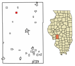 Location of Palmyra in Macoupin County, Illinois. | |
.svg.png) Location of Illinois in the United States | |
| Coordinates: 39°26′2″N 89°59′44″W / 39.43389°N 89.99556°WCoordinates: 39°26′2″N 89°59′44″W / 39.43389°N 89.99556°W | |
| Country | United States |
| State | Illinois |
| County | Macoupin |
| Area[1] | |
| • Total | 1.00 sq mi (2.59 km2) |
| • Land | 1.00 sq mi (2.59 km2) |
| • Water | 0.00 sq mi (0.00 km2) |
| Elevation | 671 ft (205 m) |
| Population (2010) | |
| • Total | 698 |
| • Estimate (2016)[2] | 672 |
| • Density | 672.67/sq mi (259.73/km2) |
| Time zone | UTC-6 (CST) |
| • Summer (DST) | UTC-5 (CDT) |
| ZIP Code(s) | 62674 |
| Area code(s) | 436 |
| FIPS code | 17-57329 |
| Wikimedia Commons | Palmyra, Illinois |
Palmyra is a village in Macoupin County, Illinois, United States. The population was 733 at the 2000 census.
History
The first home in the Palmyra area was a log cabin built in 1835 by William Owens.
The town originally was named Newburg, then changed to Cummington and finally was platted as Palmyra in 1855.[3]
Palmyra High School was established in 1892. It closed in 1948 as it combined with three other small towns.[4]
Landmarks
Palmyra Opera House
In November 1902, Clarence Grimett bought a half interest in land and building at the corner of Main and State streets in Palmyra, Illinois. Joseph Waters joined him later and they began operating general store. In 1905, they built a brick oven to cooks food. Next, they opened the second-floor as a theater, thus giving the name of the entire establishment the Palmyra Opera House.[5]
In November 1999, the Palmyra Opera House, was re-opened by Rick Creasy.[5]
Palmyra Castle
Palmyra Castle is a 40 acres, 9,000 square foot home designed to resemble a German castle.[6][7]
Geography
Palmyra is located at 39°26′2″N 89°59′44″W / 39.43389°N 89.99556°W (39.433980, -89.995424).[8]
According to the 2010 census, Palmyra has a total area of 1 square mile (2.59 km2), all land.[9]
Demographics
| Historical population | |||
|---|---|---|---|
| Census | Pop. | %± | |
| 1880 | 222 | — | |
| 1890 | 505 | 127.5% | |
| 1900 | 813 | 61.0% | |
| 1910 | 873 | 7.4% | |
| 1920 | 835 | −4.4% | |
| 1930 | 760 | −9.0% | |
| 1940 | 824 | 8.4% | |
| 1950 | 746 | −9.5% | |
| 1960 | 811 | 8.7% | |
| 1970 | 776 | −4.3% | |
| 1980 | 864 | 11.3% | |
| 1990 | 722 | −16.4% | |
| 2000 | 733 | 1.5% | |
| 2010 | 698 | −4.8% | |
| Est. 2016 | 672 | [2] | −3.7% |
| U.S. Decennial Census[10] | |||
As of the census[11] of 2000, there were 733 people, 334 households, and 223 families residing in the village. The population density was 732.9 people per square mile (283.0/km²). There were 361 housing units at an average density of 361.0 per square mile (139.4/km²). The racial makeup of the village was 98.77% White, 0.41% African American, 0.41% Native American, 0.14% Pacific Islander, and 0.27% from two or more races. Hispanic or Latino of any race were 0.55% of the population.
There were 334 households, of which 23.7% had children under the age of 18 living with them, 50.9% were married couples living together, 11.7% had a female householder with no husband present, and 33.2% were non-families. 28.4% of all households were made up of individuals and 18.9% had someone living alone who was 65 years of age or older. The average household size was 2.19 and the average family size was 2.63.
In the village, the population was spread out with 20.1% under the age of 18, 7.8% from 18 to 24, 24.0% from 25 to 44, 25.0% from 45 to 64, and 23.2% who were 65 years of age or older. The median age was 44 years. For every 100 females, there were 91.4 males. For every 100 females age 18 and over, there were 87.2 males.
The median income for a household in the village was $27,188, and the median income for a family was $36,250. Males had a median income of $29,583 versus $18,667 for females. The per capita income for the village was $14,801. About 10.1% of families and 14.7% of the population were below the poverty line, including 19.1% of those under age 18 and 12.1% of those age 65 or over.
Notable person
- Joe McManus, pitcher for the Cincinnati Reds
References
- ↑ "2016 U.S. Gazetteer Files". United States Census Bureau. Retrieved Jun 30, 2017.
- 1 2 "Population and Housing Unit Estimates". Retrieved June 9, 2017.
- ↑ Charles, Walter (1911). History of Macoupin County Illinois. Chicago: The S. J. Clarke Publishing Company. Retrieved 2018-09-21.
- ↑ "Palmyra, IL Landmarks". Retrieved 2018-09-21.
- 1 2 "Palmyra, IL Landmarks". Retrieved 2018-09-21.
- ↑ Crozier, Elizabeth (19 June 2017). "Spend The Night In Illinois' Most Majestic Castle For An Unforgettable Experience". Retrieved 2018-09-21.
- ↑ "PalmyraCastle". Retrieved 2018-09-21.
- ↑ "US Gazetteer files: 2010, 2000, and 1990". United States Census Bureau. 2011-02-12. Retrieved 2011-04-23.
- ↑ "G001 - Geographic Identifiers - 2010 Census Summary File 1". United States Census Bureau. Retrieved 2015-12-25.
- ↑ "Census of Population and Housing". Census.gov. Retrieved June 4, 2015.
- ↑ "American FactFinder". United States Census Bureau. Retrieved 2008-01-31.
External links
Municipalities and communities of Macoupin County, Illinois, United States | ||
|---|---|---|
| Cities | ||
| Town | ||
| Villages | ||
| Townships | ||
| Unincorporated communities | ||
| Footnotes | ‡This city also has portions in adjacent county or counties | |