Rockvale Township, Ogle County, Illinois
| Rockvale Township | |
|---|---|
| Township | |
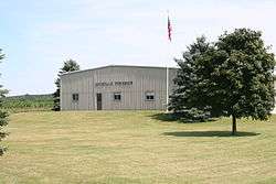 Rockvale Township building along Rt. 2 in Ogle County. | |
.svg.png) Location of Illinois in the United States | |
| Coordinates: 42°06′03″N 89°18′58″W / 42.10083°N 89.31611°WCoordinates: 42°06′03″N 89°18′58″W / 42.10083°N 89.31611°W | |
| Country | United States |
| State | Illinois |
| County | Ogle |
| Settled | November 6, 1849 |
| Government | |
| • Mayor | Jeff Tremble |
| Area | |
| • Total | 35.64 sq mi (92.3 km2) |
| • Land | 34.76 sq mi (90.0 km2) |
| • Water | 0.88 sq mi (2.3 km2) |
| Elevation | 748 ft (228 m) |
| Population (2010) | |
| • Estimate (2016)[1] | 1,705 |
| • Density | 50.9/sq mi (19.7/km2) |
| Time zone | UTC-6 (CST) |
| • Summer (DST) | UTC-5 (CDT) |
| FIPS code | 17-141-65182 |
Rockvale Township is located in Ogle County, Illinois. As of the 2010 census, its population was 1,770 and it contained 804 housing units.[2]
History
Rockvale Township was originally named Brooklyn Township, but changed its name on November 12, 1850.
Geography
According to the 2010 census, the township has a total area of 35.64 square miles (92.3 km2), of which 34.76 square miles (90.0 km2) (or 97.53%) is land and 0.88 square miles (2.3 km2) (or 2.47%) is water.[2]
Demographics
| Historical population | |||
|---|---|---|---|
| Census | Pop. | %± | |
| Est. 2016 | 1,705 | [1] | |
| U.S. Decennial Census[3] | |||
References
- 1 2 "Population and Housing Unit Estimates". Retrieved June 9, 2017.
- 1 2 "Population, Housing Units, Area, and Density: 2010 - County -- County Subdivision and Place -- 2010 Census Summary File 1". United States Census. Retrieved 2013-05-28.
- ↑ "Census of Population and Housing". Census.gov. Retrieved June 4, 2016.
External links
Municipalities and communities of Ogle County, Illinois, United States | ||
|---|---|---|
| Cities | ||
| Villages | ||
| Townships | ||
| CDPs | ||
| Other unincorporated communities | ||
| Footnotes | ‡This populated place also has portions in an adjacent county or counties | |

This article is issued from
Wikipedia.
The text is licensed under Creative Commons - Attribution - Sharealike.
Additional terms may apply for the media files.