Randolph Township, McLean County, Illinois
| Randolph Township | |
|---|---|
| Township | |
 Location in McLean County | |
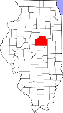 McLean County's location in Illinois | |
| Country | United States |
| State | Illinois |
| County | McLean |
| Established | November 3, 1857 |
| Area | |
| • Total | 49.62 sq mi (128.5 km2) |
| • Land | 49.48 sq mi (128.2 km2) |
| • Water | 0.14 sq mi (0.4 km2) 0.28% |
| Population (2010) | |
| • Estimate (2016)[1] | 4,413 |
| • Density | 88.4/sq mi (34.1/km2) |
| Time zone | UTC-6 (CST) |
| • Summer (DST) | UTC-5 (CDT) |
| FIPS code | 17-113-62692 |
Randolph Township is located in McLean County, Illinois. As of the 2010 census, its population was 4,375 and it contained 1,636 housing units.[2]
Randolph Township was named for Gardner Randolph, who settled in the area in January 1822, near a thick grove of trees later referred to as Randolph's Grove.[3] The village of Heyworth is part of the township.
Randolph Township was formed in 1858 and sent its first supervisor to Bloomington, the county seat, on May 17, 1858. It is Township 22 North, Range 2 East and part of Township 21 North, Range 2 East of the Third Principal Meridian. It has part of the north tier of sections in Township 2, which were taken by McLean County between 1844 and 1849, instead of giving them back to DeWitt County, when it was formed. It is 6x8 instead of 6x6. It is bounded by Downs Township on the east; Bloomington Township on the north; Funk’s Grove Township on the west; and Wapella Township, in DeWitt County, on the south.
In 2008, Randolph Township officials were:
- Donald O. Newby, supervisor
- Larry W. Mowery, town clerk
- Dennis L. Powell, highway commissioner
- Glenn H. Milton, assessor
- Town Trustees: Del Reinitz, Kevin Rustemeyer, Vernon Terrell, Rodger Zook
- Cemetery Trustees: Harold Necessary (president), Kurt Flora (secretary), Dan Billington
- Mark J. McGrath, township attorney[4]
Geography
According to the 2010 census, the township has a total area of 49.62 square miles (128.5 km2), of which 49.48 square miles (128.2 km2) (or 99.72%) is land and 0.14 square miles (0.36 km2) (or 0.28%) is water.[2]
Demographics
| Historical population | |||
|---|---|---|---|
| Census | Pop. | %± | |
| Est. 2016 | 4,413 | [1] | |
| U.S. Decennial Census[5] | |||
References
- 1 2 "Population and Housing Unit Estimates". Retrieved June 9, 2017.
- 1 2 "Population, Housing Units, Area, and Density: 2010 - County -- County Subdivision and Place -- 2010 Census Summary File 1". United States Census. Retrieved 2013-05-28.
- ↑ Henry Gannett (January 22, 2008). " "The Origin of Certain Place Names in the United States". US Geological Survey. Bowie, Md.: Heritage Books: 258. ISBN 0-7884-0579-9.
- ↑ "2008 Heyworth Community Guide". April 30, 2008: 16.
- ↑ "Census of Population and Housing". Census.gov. Retrieved June 4, 2016.
External links
- City-data.com
- Illinois State Archives
- Center School Collection - McLean County Museum of History archives
Municipalities and communities of McLean County, Illinois, United States | ||
|---|---|---|
| Cities | ||
| Town | ||
| Villages | ||
| Townships | ||
| CDP | ||
| Other unincorporated communities | ||
| Ghost towns | ||

Coordinates: 40°20′29″N 88°58′56″W / 40.34139°N 88.98222°W