Lawndale Township, McLean County, Illinois
| Lawndale Township | |
|---|---|
| Township | |
 Location in McLean County | |
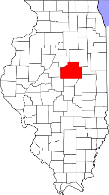 McLean County's location in Illinois | |
| Country | United States |
| State | Illinois |
| County | McLean |
| Established | November 3, 1857 |
| Area | |
| • Total | 39.75 sq mi (103.0 km2) |
| • Land | 39.74 sq mi (102.9 km2) |
| • Water | 0.01 sq mi (0.03 km2) 0.03% |
| Population (2010) | |
| • Estimate (2016)[1] | 156 |
| • Density | 4/sq mi (2/km2) |
| Time zone | UTC-6 (CST) |
| • Summer (DST) | UTC-5 (CDT) |
| FIPS code | 17-113-42353 |
Lawndale Township is located in McLean County, Illinois, east of Lexington, northwest of Colfax, and southeast of Chenoa. As of the 2010 census, its population was 158 and it contained 74 housing units.[2] Lawndale Cemetery is located on 2550 North Road. At least part of the township is within the area of the proposed Lexington Chenoa Wind Farm to be developed by Horizon Wind Energy.
Geography
According to the 2010 census, the township has a total area of 39.75 square miles (103.0 km2), of which 39.74 square miles (102.9 km2) (or 99.97%) is land and 0.01 square miles (0.026 km2) (or 0.03%) is water.[2]
Demographics
| Historical population | |||
|---|---|---|---|
| Census | Pop. | %± | |
| Est. 2016 | 156 | [1] | |
| U.S. Decennial Census[3] | |||
References
- 1 2 "Population and Housing Unit Estimates". Retrieved June 9, 2017.
- 1 2 "Population, Housing Units, Area, and Density: 2010 - County -- County Subdivision and Place -- 2010 Census Summary File 1". United States Census. Retrieved 2013-05-28.
- ↑ "Census of Population and Housing". Census.gov. Retrieved June 4, 2016.
External links
Municipalities and communities of McLean County, Illinois, United States | ||
|---|---|---|
| Cities | ||
| Town | ||
| Villages | ||
| Townships | ||
| CDP | ||
| Other unincorporated communities | ||
| Ghost towns | ||

Coordinates: 40°37′15″N 88°37′32″W / 40.62083°N 88.62556°W
This article is issued from
Wikipedia.
The text is licensed under Creative Commons - Attribution - Sharealike.
Additional terms may apply for the media files.