Durand Township, Winnebago County, Illinois
| Durand Township | |
|---|---|
| Township | |
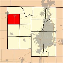 Location in Winnebago County | |
| Coordinates: 42°24′42″N 89°20′27″W / 42.41167°N 89.34083°WCoordinates: 42°24′42″N 89°20′27″W / 42.41167°N 89.34083°W | |
| Country | United States |
| State | Illinois |
| County | Winnebago |
| Established | November 6, 1849 |
| Government | |
| • Supervisor | Edward L. Mueller |
| Area | |
| • Total | 29.62 sq mi (76.7 km2) |
| • Land | 29.62 sq mi (76.7 km2) |
| • Water | 0.01 sq mi (0.03 km2) 0.03% |
| Elevation | 863 ft (263 m) |
| Population (2010) | |
| • Estimate (2016)[1] | 2,324 |
| • Density | 80.8/sq mi (31.2/km2) |
| Time zone | UTC-6 (CST) |
| • Summer (DST) | UTC-5 (CDT) |
| FIPS code | 17-201-21293 |
| [2][3] | |
Durand Township is located in Winnebago County, Illinois. As of the 2010 census, its population was 2,394 and it contained 1,035 housing units.[4]
Geography
According to the 2010 census, the township has a total area of 29.62 square miles (76.7 km2), of which 29.62 square miles (76.7 km2) (or 100%) is land and 0.01 square miles (0.026 km2) (or 0.03%) is water.[4]
Demographics
| Historical population | |||
|---|---|---|---|
| Census | Pop. | %± | |
| Est. 2016 | 2,324 | [1] | |
| U.S. Decennial Census[5] | |||
References
- 1 2 "Population and Housing Unit Estimates". Retrieved June 9, 2017.
- ↑ U.S. Geological Survey Geographic Names Information System: Township of Durand
- ↑ Illinois Regional Archives Depository System. "Name Index to Illinois Local Governments". Illinois State Archives. Illinois Secretary of State. Retrieved 19 September 2014.
- 1 2 "Population, Housing Units, Area, and Density: 2010 - County -- County Subdivision and Place -- 2010 Census Summary File 1". United States Census. Retrieved 2013-05-28.
- ↑ "Census of Population and Housing". Census.gov. Retrieved June 4, 2016.
External links
Municipalities and communities of Winnebago County, Illinois, United States | ||
|---|---|---|
| Cities | ||
| Villages | ||
| CDP | ||
| Townships | ||
| Unincorporated communities | ||
| Footnotes | ‡This populated place also has portions in an adjacent county or counties | |

This article is issued from
Wikipedia.
The text is licensed under Creative Commons - Attribution - Sharealike.
Additional terms may apply for the media files.