National Register of Historic Places listings in Richmond County, North Carolina
This list includes properties and districts listed on the National Register of Historic Places in Richmond County, North Carolina. Click the "Map of all coordinates" link to the right to view a Google map of all properties and districts with latitude and longitude coordinates in the table below.[1]
Current listings
- This National Park Service list is complete through NPS recent listings posted June 19, 2020.[2]
| [3] | Name on the Register | Image | Date listed[4] | Location | City or town | Description |
|---|---|---|---|---|---|---|
| 1 | Bank of Pee Dee Building | 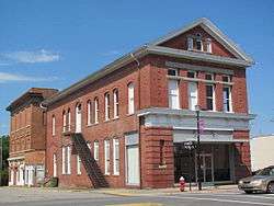 Bank of Pee Dee Building |
September 22, 1983 (#83001905) |
201 E. Washington St. 34°56′22″N 79°46′25″W |
Rockingham | |
| 2 | Bostick School | 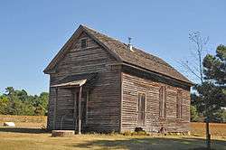 Bostick School |
April 20, 2005 (#05000327) |
604 Clayton Carriker Rd. 35°07′34″N 79°46′22″W |
Ellerbe | |
| 3 | Covington Plantation House | 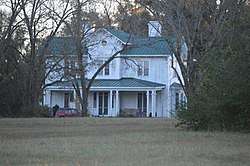 Covington Plantation House |
May 28, 1980 (#80002897) |
Southwest of Rockingham 34°53′49″N 79°48′12″W |
Rockingham | |
| 4 | Alfred Dockery House | 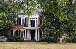 Alfred Dockery House |
November 20, 1986 (#86003350) |
E side SR 1005, 0.1 mile S of jct. with SR 1143 35°00′38″N 79°48′48″W |
Rockingham | |
| 5 | Ellerbe Springs Hotel | 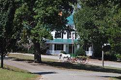 Ellerbe Springs Hotel |
June 4, 1980 (#80002896) |
N of Ellerbe 35°05′30″N 79°45′48″W |
Ellerbe | |
| 6 | Hannah Pickett Mill No. 1 | September 22, 1983 (#83001906) |
300 King Edward St. 34°55′02″N 79°45′40″W |
Rockingham | ||
| 7 | Liberty Hill School | 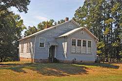 Liberty Hill School |
January 17, 2008 (#07001409) |
234 Covington Comm. Rd. 35°08′15″N 79°52′00″W |
Ellerbe | |
| 8 | John Phillips Little House | 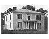 John Phillips Little House |
December 20, 1984 (#84000590) |
Off NC 73 35°09′11″N 79°55′12″W |
Little's Mill | |
| 9 | Main Street Commercial Historic District | 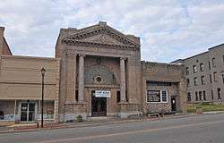 Main Street Commercial Historic District |
March 19, 1992 (#92000169) |
2-105 Main St. 34°53′03″N 79°41′59″W |
Hamlet | |
| 10 | Manufacturers Building | 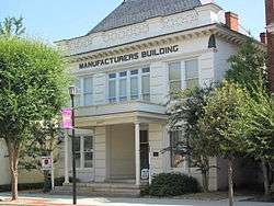 Manufacturers Building |
May 29, 1979 (#79003348) |
220 E. Washington St. 34°56′21″N 79°46′22″W |
Rockingham | |
| 11 | Mount Carmel Presbyterian Church and Cemetery | December 19, 2019 (#100004795) |
1367 Clayton Carriker Rd. 35°10′25″N 79°45′23″W |
Norman | Extends into Montgomery County | |
| 12 | Powell-Brookshire-Parker Farm | January 16, 2008 (#07001410) |
1881 E. NC 73 35°08′07″N 79°53′17″W |
Ellerbe | ||
| 13 | Richmond County Courthouse |  Richmond County Courthouse |
May 10, 1979 (#79001747) |
Franklin St. between Hancock and Lee Sts. 34°56′15″N 79°46′26″W |
Rockingham | |
| 14 | Roberdel Mill No. 1 Company Store | 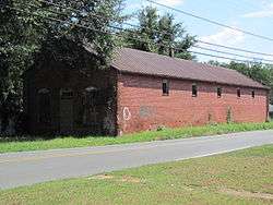 Roberdel Mill No. 1 Company Store |
September 22, 1983 (#83001907) |
1106 Roberdel Rd. 34°58′18″N 79°44′40″W |
Rockingham | |
| 15 | Rockingham Historic District | 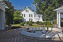 Rockingham Historic District |
November 21, 1983 (#83003981) |
Roughly bounded by LeGrand and Brookwood Aves., Leak and Ann Sts. 34°56′29″N 79°45′47″W |
Rockingham | |
| 16 | Seaboard Air Line Passenger Depot | 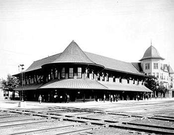 Seaboard Air Line Passenger Depot |
November 19, 1971 (#71000617) |
2 Main St. 34°53′01″N 79°41′58″W |
Hamlet | Continues in use as an Amtrak station. |
| 17 | U. S. Post Office and Federal Building |  U. S. Post Office and Federal Building |
September 22, 1983 (#83001908) |
125 S. Hancock St. 34°56′18″N 79°46′24″W |
Rockingham | |
| 18 | H. C. Watson House | 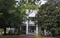 H. C. Watson House |
September 22, 1983 (#83001909) |
526 Caroline St. 34°55′50″N 79°46′39″W |
Rockingham |
Former listing
| [3] | Name on the Register | Image | Date listed | Date removed | Location | City or town | Summary |
|---|---|---|---|---|---|---|---|
| 1 | Great Falls Mill | .png) Great Falls Mill |
1971 (#71001069) | 1973 | W. Washington and Broad Aves. |
Rockingham | Destroyed by fire in 1972. Facade still standing. |
See also
| Wikimedia Commons has media related to National Register of Historic Places in Richmond County, North Carolina. |
References
- The latitude and longitude information provided in this table was derived originally from the National Register Information System, which has been found to be fairly accurate for about 99% of listings. Some locations in this table may have been corrected to current GPS standards.
- "National Register of Historic Places: Weekly List Actions". National Park Service, United States Department of the Interior. Retrieved on June 19, 2020.
- Numbers represent an ordering by significant words. Various colorings, defined here, differentiate National Historic Landmarks and historic districts from other NRHP buildings, structures, sites or objects.
- The eight-digit number below each date is the number assigned to each location in the National Register Information System database, which can be viewed by clicking the number.

| Topics | |
|---|---|
| Lists by state |
|
| Lists by insular areas | |
| Lists by associated state | |
| Other areas | |
| Related | |
| |
Municipalities and communities of Richmond County, North Carolina, United States | ||
|---|---|---|
| City | | |
| Towns | ||
| CDPs | ||
| Unincorporated communities | ||
This article is issued from Wikipedia. The text is licensed under Creative Commons - Attribution - Sharealike. Additional terms may apply for the media files.