Montgomery County, North Carolina
Montgomery County is a rural county located in the U.S. state of North Carolina. As of the 2010 census, the population was 27,798.[1] Its county seat is Troy.[2]
Montgomery County | |
|---|---|
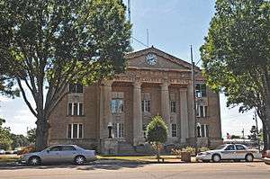 Montgomery County Courthouse | |
 Seal | |
| Motto(s): The Golden Opportunity | |
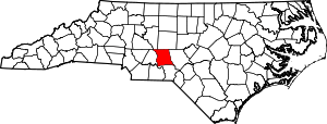 Location within the U.S. state of North Carolina | |
 North Carolina's location within the U.S. | |
| Coordinates: 35°20′N 79°54′W | |
| Country | |
| State | |
| Founded | 1779 |
| Named for | Richard Montgomery |
| Seat | Troy |
| Largest town | Troy |
| Area | |
| • Total | 502 sq mi (1,300 km2) |
| • Land | 492 sq mi (1,270 km2) |
| • Water | 10 sq mi (30 km2) 2.0%% |
| Population | |
| • Estimate (2018) | 27,271 |
| • Density | 57/sq mi (22/km2) |
| Time zone | UTC−5 (Eastern) |
| • Summer (DST) | UTC−4 (EDT) |
| Congressional district | 8th |
| Website | www |
Montgomery County's motto is "The Golden Opportunity".
History
The county was formed by an act of the North Carolina General Assembly of 1778 in January 1779 from Anson County. It was named in honor and respect of Richard Montgomery, an American Revolutionary War general killed in 1775 while attempting to capture Quebec City, Canada. The North Carolina General Assembly of 1779 named James Roper, James Allen, Cornelius Robeson, Samuel Person, and John Collier of Randolph County as the commissioners of Montgomery County and charged them with locating a county seat.[3]
In 1841 the part of Montgomery County west of the Pee Dee River became Stanly County
Geography
According to the U.S. Census Bureau, the county has a total area of 502 square miles (1,300 km2), of which 492 square miles (1,270 km2) is land and 10 square miles (26 km2) (2.0%) is water.[4] It is situated in the heart of the Uwharrie National Forest. There are also schools in Montgomery County such as Star Elementary, Mt. Gilead Elementary, Candor Elementary, Page Street Elementary, Green Ridge Elementary, West Montgomery Middle, East Montgomery Middle, East Montgomery High, West Montgomery High and Montgomery County Early College.
Adjacent counties
- Randolph County - northeast
- Moore County - east
- Richmond County - south
- Stanly County - west
- Davidson County - northwest
National protected area
- Uwharrie National Forest (part)
Demographics
| Historical population | |||
|---|---|---|---|
| Census | Pop. | %± | |
| 1790 | 5,039 | — | |
| 1800 | 7,677 | 52.4% | |
| 1810 | 8,430 | 9.8% | |
| 1820 | 8,693 | 3.1% | |
| 1830 | 10,919 | 25.6% | |
| 1840 | 10,780 | −1.3% | |
| 1850 | 6,872 | −36.3% | |
| 1860 | 7,649 | 11.3% | |
| 1870 | 7,487 | −2.1% | |
| 1880 | 9,374 | 25.2% | |
| 1890 | 11,239 | 19.9% | |
| 1900 | 14,197 | 26.3% | |
| 1910 | 14,967 | 5.4% | |
| 1920 | 14,607 | −2.4% | |
| 1930 | 16,218 | 11.0% | |
| 1940 | 16,280 | 0.4% | |
| 1950 | 17,260 | 6.0% | |
| 1960 | 18,408 | 6.7% | |
| 1970 | 19,267 | 4.7% | |
| 1980 | 22,469 | 16.6% | |
| 1990 | 23,346 | 3.9% | |
| 2000 | 26,822 | 14.9% | |
| 2010 | 27,798 | 3.6% | |
| Est. 2018 | 27,271 | [5] | −1.9% |
| U.S. Decennial Census[6] 1790-1960[7] 1900-1990[8] 1990-2000[9] 2010-2013[1] | |||
As of the census[10] of 2000, there were 26,822 people, 9,848 households, and 7,189 families residing in the county. The population density was 55 people per square mile (21/km²). There were 14,145 housing units at an average density of 29 per square mile (11/km²). The racial makeup of the county was 69.07% White, 21.84% Black or African American, 0.40% Native American, 1.61% Asian, 0.04% Pacific Islander, 5.75% from other races, and 1.29% from two or more races. 10.43% of the population were Hispanic or Latino of any race.
There were 9,848 households out of which 31.00% had children under the age of 18 living with them, 55.60% were married couples living together, 12.40% had a female householder with no husband present, and 27.00% were non-families. 24.10% of all households were made up of individuals and 10.70% had someone living alone who was 65 years of age or older. The average household size was 2.61 and the average family size was 3.080.
In the county, the population was spread out with 24.90% under the age of 18, 9.00% from 18 to 24, 28.50% from 25 to 44, 23.60% from 45 to 64, and 14.00% who were 65 years of age or older. The median age was 37 years. For every 100 females there were 102.60 males. For every 100 females age 18 and over, there were 100.60 males.
The median income for a household in the county was $32,903, and the median income for a family was $39,616. Males had a median income of $27,832 versus $21,063 for females. The per capita income for the county was $16,505. About 10.90% of families and 15.40% of the population were below the poverty line, including 19.50% of those under age 18 and 17.80% of those age 65 or over.
Law and government
Montgomery County is a sustaining member of the regional Piedmont Triad Council of Governments.
As of the 2000 Census, Montgomery County is located entirely in North Carolina's 8th congressional district, which is currently represented in the 115th United States Congress by Richard Hudson (R).
| Year | Republican | Democratic | Third parties |
|---|---|---|---|
| 2016 | 61.8% 7,130 | 36.0% 4,150 | 2.3% 260 |
| 2012 | 57.0% 6,404 | 41.9% 4,706 | 1.1% 121 |
| 2008 | 54.9% 6,155 | 43.9% 4,926 | 1.2% 129 |
| 2004 | 57.0% 5,745 | 42.8% 4,313 | 0.2% 22 |
| 2000 | 55.1% 4,946 | 44.3% 3,979 | 0.6% 49 |
| 1996 | 43.1% 3,379 | 49.2% 3,856 | 7.7% 603 |
| 1992 | 38.7% 3,543 | 48.3% 4,422 | 13.1% 1,196 |
| 1988 | 52.8% 4,504 | 46.8% 3,995 | 0.4% 31 |
| 1984 | 57.1% 5,109 | 42.8% 3,831 | 0.1% 12 |
| 1980 | 45.7% 3,587 | 52.7% 4,129 | 1.6% 126 |
| 1976 | 39.8% 2,872 | 59.7% 4,308 | 0.4% 31 |
| 1972 | 65.7% 4,417 | 32.3% 2,175 | 2.0% 134 |
| 1968 | 39.7% 3,070 | 31.1% 2,410 | 29.2% 2,259 |
| 1964 | 46.3% 3,385 | 53.7% 3,933 | |
| 1960 | 52.5% 3,649 | 47.5% 3,297 | |
| 1956 | 52.1% 3,359 | 47.9% 3,088 | |
| 1952 | 50.0% 3,181 | 50.0% 3,176 | |
| 1948 | 43.3% 1,975 | 47.5% 2,165 | 9.2% 418 |
| 1944 | 42.4% 1,963 | 57.6% 2,665 | |
| 1940 | 37.3% 1,789 | 62.7% 3,007 | |
| 1936 | 41.8% 2,506 | 58.2% 3,484 | |
| 1932 | 42.2% 2,153 | 57.4% 2,927 | 0.4% 18 |
| 1928 | 56.8% 2,653 | 43.2% 2,016 | |
| 1924 | 45.5% 2,077 | 54.4% 2,483 | 0.1% 5 |
| 1920 | 49.8% 2,304 | 50.2% 2,321 | |
| 1916 | 49.5% 1,196 | 50.5% 1,222 | |
| 1912 | 7.2% 144 | 50.6% 1,012 | 42.3% 846 |
Communities

Towns
- Biscoe
- Candor
- Mount Gilead
- Star
- Troy (county seat)
Townships
- Biscoe
- Cheek Creek
- Eldorado
- Little River
- Mount Gilead
- Ophir
- Pee Dee
- Rocky Springs
- Star
- Troy
- Uwharrie
References
- "State & County QuickFacts". United States Census Bureau. Archived from the original on June 6, 2011. Retrieved October 27, 2013.
- "Find a County". National Association of Counties. Retrieved 2011-06-07.
- "Laws of North Carolina 1779, Chapter 28" (PDF). Carolana.com. Retrieved November 11, 2019.
- "2010 Census Gazetteer Files". United States Census Bureau. August 22, 2012. Archived from the original on January 12, 2015. Retrieved January 18, 2015.
- "Population and Housing Unit Estimates". Retrieved July 22, 2019.
- "U.S. Decennial Census". United States Census Bureau. Retrieved January 18, 2015.
- "Historical Census Browser". University of Virginia Library. Retrieved January 18, 2015.
- Forstall, Richard L., ed. (March 27, 1995). "Population of Counties by Decennial Census: 1900 to 1990". United States Census Bureau. Retrieved January 18, 2015.
- "Census 2000 PHC-T-4. Ranking Tables for Counties: 1990 and 2000" (PDF). United States Census Bureau. April 2, 2001. Retrieved January 18, 2015.
- "U.S. Census website". United States Census Bureau. Retrieved 2008-01-31.
- Leip, David. "Dave Leip's Atlas of U.S. Presidential Elections". uselectionatlas.org. Retrieved 2018-03-16.
External links
| Wikivoyage has a travel guide for Rural Montgomery County. |
- Official website
- NCGenWeb Montgomery County - free genealogy resources for the county
Places adjacent to Montgomery County, North Carolina | ||||||||||
|---|---|---|---|---|---|---|---|---|---|---|
| ||||||||||
Municipalities and communities of Montgomery County, North Carolina, United States | ||
|---|---|---|
| Towns |  Montgomery County map | |
| Unincorporated communities | ||


| Authority control |
|
|---|