National Register of Historic Places listings in Warren County, North Carolina
This list includes properties and districts listed on the National Register of Historic Places in Warren County, North Carolina. Click the "Map of all coordinates" link to the right to view a Google map of all properties and districts with latitude and longitude coordinates in the table below.[1]
Current listings
- This National Park Service list is complete through NPS recent listings posted June 26, 2020.[2]
| [3] | Name on the Register[4] | Image | Date listed[5] | Location | City or town | Description |
|---|---|---|---|---|---|---|
| 1 | Mary Ann Browne House | July 24, 1986 (#86001912) |
NC 1530 36°24′51″N 77°59′13″W |
Vaughan | ||
| 2 | Buck Spring Plantation | October 15, 1970 (#70000480) |
N of Vaughan on SR 1348 36°28′50″N 77°59′52″W |
Vaughan | ||
| 3 | Buxton Place | April 22, 1993 (#93000323) |
NC 58 W side, 0.2 miles N of jct. with NC 1628 36°14′30″N 78°06′22″W |
Inez | ||
| 4 | Chapel of the Good Shepherd | 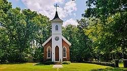 Chapel of the Good Shepherd |
September 16, 1977 (#77001013) |
E of Ridgeway 36°26′10″N 78°13′22″W |
Ridgeway | |
| 5 | Cherry Hill | November 5, 1974 (#74001384) |
SE of Warrenton on NC 58 36°16′08″N 78°05′42″W |
Inez | ||
| 6 | Coleman-White House | October 25, 1973 (#73001380) |
Halifax and Hall Sts. 36°23′36″N 78°09′13″W |
Warrenton | ||
| 7 | Dalkeith | December 16, 1974 (#74001382) |
SW of Arcola off NC 43 36°16′47″N 77°59′12″W |
Arcola | ||
| 8 | Green Duke House | August 7, 1974 (#74001383) |
SE of Manson off SR 1100 36°24′52″N 78°13′51″W |
Manson | ||
| 9 | Elgin | .jpg) Elgin |
February 6, 1973 (#73001381) |
SE of Warrenton on SR 1509 36°23′06″N 78°06′09″W |
Warrenton | |
| 10 | William J. Hawkins House | 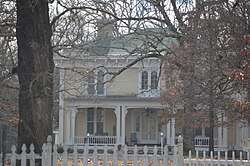 William J. Hawkins House |
May 22, 1978 (#78001982) |
West of Norlina on SR 1103 36°25′45″N 78°14′41″W |
Ridgeway | |
| 11 | Hebron Methodist Church |  Hebron Methodist Church |
April 19, 1984 (#84002547) |
SR 1306 36°30′31″N 78°05′02″W |
Oakville | |
| 12 | Lake O'Woods | January 19, 1979 (#79001760) |
S of Inez of SR 1512 36°18′11″N 78°05′10″W |
Inez | ||
| 13 | Liberia School | May 18, 2005 (#05000438) |
4.5 miles S of Warrenton, Sw side of NC 58 36°21′42″N 78°06′03″W |
Warrenton | ||
| 14 | Little Manor | April 24, 1973 (#73001378) |
Belle Shearin Rd., south of Littleton[6] 36°25′09″N 77°54′54″W |
Littleton | ||
| 15 | Reedy Rill | December 3, 1974 (#74001385) |
S of Warrenton off SR 1600 36°20′47″N 78°09′29″W |
Warrenton | ||
| 16 | Shady Oaks | March 15, 1976 (#76001346) |
SE of Warrenton on SR 1600 36°22′49″N 78°08′32″W |
Warrenton | ||
| 17 | Dr. Charles and Susan Skinner House and Outbuildings | October 6, 2000 (#00001186) |
NC 1528, 0.25 miles SW of NC 158 36°25′37″N 77°56′16″W |
Littleton | ||
| 18 | Sledge-Hayley House |  Sledge-Hayley House |
April 17, 1980 (#80002904) |
Frankin and Hayley Sts. 36°23′52″N 78°09′39″W |
Warrenton | |
| 19 | Mansfield Thornton House |  Mansfield Thornton House |
December 2, 1977 (#77001014) |
SE of Warrenton 36°23′12″N 78°08′46″W |
Warrenton | |
| 20 | Tusculum | October 23, 1974 (#74001386) |
SE of Warrenton off SR 1635 36°17′04″N 78°01′07″W |
Arcola | ||
| 21 | Warren County Fire Tower | March 3, 2000 (#00000164) |
4.5 miles S of Warrenton on NC 58 S 36°21′39″N 78°04′52″W |
Liberia | ||
| 22 | Warren County Training School | April 19, 2006 (#06000294) |
East side of NC 1300, 0.8 N of NC 1372 36°30′56″N 78°09′59″W |
Wise | ||
| 23 | Warrenton Historic District | .jpg) Warrenton Historic District |
August 11, 1976 (#76001347) |
U.S. 401 36°23′42″N 78°09′18″W |
Warrenton | |
| 24 | John Watson House | December 28, 1990 (#90001954) |
Petway Burwell Rd., 1/4 miles W of NC 401 36°21′50″N 78°10′58″W |
Warrenton | ||
| 25 | Solomon and Kate Williams Jr. House | September 25, 2003 (#03000968) |
Jct. of NC 58 and NC 1626 36°16′28″N 78°05′41″W |
Inez |
See also
| Wikimedia Commons has media related to National Register of Historic Places in Warren County, North Carolina. |
References
- The latitude and longitude information provided in this table was derived originally from the National Register Information System, which has been found to be fairly accurate for about 99% of listings. Some locations in this table may have been corrected to current GPS standards.
- "National Register of Historic Places: Weekly List Actions". National Park Service, United States Department of the Interior. Retrieved on June 26, 2020.
- Numbers represent an ordering by significant words. Various colorings, defined here, differentiate National Historic Landmarks and historic districts from other NRHP buildings, structures, sites or objects.
- "National Register Information System". National Register of Historic Places. National Park Service. April 24, 2008.
- The eight-digit number below each date is the number assigned to each location in the National Register Information System database, which can be viewed by clicking the number.
- Location derived from coordinates; the NRIS provides coordinates but lists the property as "Address Restricted"

| Topics | |
|---|---|
| Lists by state |
|
| Lists by insular areas | |
| Lists by associated state | |
| Other areas | |
| Related | |
| |
Municipalities and communities of Warren County, North Carolina, United States | ||
|---|---|---|
| Towns | | |
| Unincorporated communities | ||
This article is issued from Wikipedia. The text is licensed under Creative Commons - Attribution - Sharealike. Additional terms may apply for the media files.